The Duchy of Lancaster is the private estate of the British sovereign as Duke of Lancaster. The principal purpose of the estate is to provide a source of independent income to the sovereign. The estate consists of a portfolio of lands, properties and assets held in trust for the sovereign and is administered separately from the Crown Estate. The duchy consists of 18,433 ha of land holdings, urban developments, historic buildings and some commercial properties across England and Wales, particularly in Cheshire, Staffordshire, Derbyshire, Lincolnshire, Yorkshire, Lancashire and the Savoy Estate in London. The Duchy of Lancaster is one of two royal duchies: the other is the Duchy of Cornwall, which provides income to the Duke of Cornwall, a title which is traditionally held by the Prince of Wales.

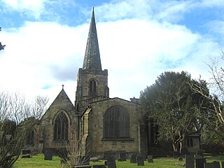
Wirksworth is a market town in the Derbyshire Dales district of Derbyshire, England. Its population of 5,038 in the 2011 census was estimated at 5,180 in 2019. Wirksworth contains the source of the River Ecclesbourne. The town was granted a market charter by Edward I in 1306 and still holds a market on Tuesdays in the Memorial Gardens. The parish church of St Mary's is thought to date from 653. The town developed as a centre for lead mining and stone quarrying. Many lead mines were owned by the Gell family of nearby Hopton Hall.

Monyash is a village and civil parish in the Peak District, Derbyshire, England, 5 miles (8.0 km) west of the market town Bakewell. It is centred on a village green 265 metres (869 ft) above sea level at the head of Lathkill Dale in the limestone area known as the White Peak. At the 2011 census, it had a population of 314. Tourism and farming are the predominant activities of the village. The area was once an important meeting place, a watering point for drovers’ animals at the intersection of several trade routes, and industrial centre supporting the local lead mining industry.
Duffield is a village in the Amber Valley district of Derbyshire, 5 miles (8.0 km) north of Derby. It is centred on the western bank of the River Derwent at the mouth of the River Ecclesbourne. It is within the Derwent Valley Mills World Heritage Area and the southern foothills of the Pennines.

Stannary law is the body of English law that governs tin mining in Cornwall and Devon; although no longer of much practical relevance, the stannary law remains part of the law of the United Kingdom and is arguably the oldest law incorporated into the English legal system.

This article details some of the history of lead mining in Derbyshire, England.

Brassington is a village and civil parish in the Derbyshire Dales district of Derbyshire, 16 miles north west of Derby. The parish had a population of 573 at the 2011 census.

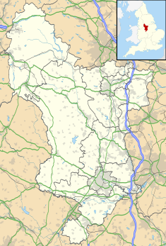
The history of Derbyshire can be traced back to human settlement since the last Ice Age, over 10,000 years ago. The county of Derbyshire in England dates back to the 11th century.
Duffield Frith was, in medieval times, an area of Derbyshire in England, part of that bestowed upon Henry de Ferrers by King William, controlled from his seat at Duffield Castle. From 1266 it became part of the Duchy of Lancaster and from 1285 it was a Royal Forest with its own Forest Courts.
A barmote court is a court held in the lead mining districts of Derbyshire, England, for the purpose of determining the customs peculiar to the industry and also for the settlements of any disputes which may arise in connection with it.

The Gell Baronetcy of Hopton in the County of Derby, was a title in the Baronetage of England. It was created on 29 January 1642 for John Gell, Hopton Hall, Derbyshire, chief barmaster in the wapentake of Wirksworth from 1638–1644. The family gained importance and wealth through lead mining interests near Wirksworth. Sir John Gell, 1st Baronet received the baronetcy on the eve of the English Civil War, but fought for the Parliamentary side.

Newbold is a village north of Chesterfield, Derbyshire, England, which in 2001 had a population of just under 8,000.

Bolehill is an area of Wirksworth, Derbyshire, England. It is located in the north of the town and has connections to the lead mining industry. Originally a village in its own right, Bolehill became part of the outskirts of Wirksworth upon the town's expansion during the 19th and 20th centuries. Bolehill is adjacent to Black Rocks, a local landmark and a short walk from the High Peak Trail at Middleton incline.

Alport is a hamlet in the White Peak area of Derbyshire, England. It lies east of Youlgreave, at the confluence of the River Bradford and the River Lathkill. The oldest house in the hamlet is Monks Hall. There also used to be a pub, which was demolished thanks the construction of a main road, which leads to the A6 and towards Buxton.

Callow is a village and a civil parish in the Derbyshire Dales District, in the English county of Derbyshire. At the 2011 Census the population of the civil parish was less than 100. Details are included in the civil parish of Kirk Ireton. It is near the small town of Wirksworth and the reservoir Carsington Water.

The Church of St John the Divine is in Burnley Road, Holme Chapel, a village in the civil parish of Cliviger, near Burnley, Lancashire, England. It is an active Anglican parish church in the diocese of Blackburn, and the church is recorded in the National Heritage List for England as a designated Grade II listed building. It was built between 1788 and 1794, replacing a small chapel, and is in simple Classical style. Above the west front is a bell turret with an octagonal cupola, and inside the church are carved oak stalls, moved from a demolished church, which include a poppyhead and misericords.

Philip Eyre Gell (1723–1795) of Hopton Hall near Wirksworth, Derbyshire, was a wealthy lead-mining aristocrat.

Ivonbrook Grange is a civil parish within the Derbyshire Dales district, in the county of Derbyshire, England. Largely rural, Ivonbrook Grange's population is reported with the population of neighbouring parishes for a total of 180 residents in 2011. It is 130 miles (210 km) north west of London, 15 miles (24 km) north west of the county city of Derby, and 3+1⁄2 miles (5.6 km) south west of the nearest market town of Matlock. Ivonbrook Grange is wholly within the Peak District national park on its southern edge, and shares a border with the parishes of Aldwark, Bonsall, Brassington, Ible as well as Winster. There is one listed structure in Ivonbrook Grange.

Wirksworth Town Hall is a municipal building in Coldwell Street, Wirksworth, Derbyshire, England. The town hall, which was the headquarters of Wirksworth Urban District Council, now accommodates the local public library.

Matlock Town Hall is a municipal building in Bank Road, Matlock, Derbyshire, England. The building is now used as the offices of Derbyshire Dales District Council.