
Abbottabad District is a district of the Pakistani province of Khyber Pakhtunkhwa. It is part of Hazara Division and covers an area of 1,969 km2, with the city of Abbottabad being the principal town. Neighbouring districts are Mansehra to the north, Muzaffarabad to the east, Haripur to the west, and Rawalpindi to the south.

Sheikhul Bandi is one of the 51 union councils (sub-divisions) of Abbottabad District in Khyber-Pakhtunkhwa province of Pakistan. The Union council takes its name from a neighbourhood which is 3 km from the city of Abbottabad. It is in the valley toward the north-west of the Sarban Hills. It is located at 34° 8' 60N, 73° 13' 60E
Nawan Shehr is a town in Abbottabad District in Khyber Pakthunkhwa of Pakistan. Nawan Shehr's most famous place is Ilyasi Masjid which is the oldest and largest mosque of Abbottabad, there is also a small hill with walking tracks just behind the masjid. The weather is pleasant in summer, so people from other parts of country come to visit Abbottabad and Nawan Shehr. Board of Intermediate and Secondary Education of Abbottabad is also in Nawan Shehr. Nawan Shehr has its own old bazaar which is famous for its Chapli Kebab.
Bal Dheri is one of the 51 union councils of Abbottabad District in Khyber-Pakhtunkhwa province of Pakistan, the union council of Baldheri is named after the main village of the area. The population of Baldheri Union Council is 14,796.
Palak is one of the 51 union councils of Abbottabad District in the Khyber Pakhtunkhwa Province of Pakistan.
Bakot is a union council and town of Abbottabad District in Khyber-Pakhtunkhwa province of Pakistan. According to the 2017 Census of Pakistan, the population is 17,466.
Chamhad is one of the 51 Union Councils (subdivisions) of Abbottabad District in the Khyber Pakhtunkhwa province of Pakistan.
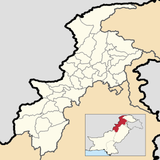
Namal is one of the 51 union councils of Abbottabad district in the Khyber Pakhtunkhwa province of Pakistan.
Jhangi is one of the 51 union councils of Abbottabad District in Khyber-Pakhtunkhwa province of Pakistan.
Phal Kot(Sehana) is one of the 51 union councils of Abbottabad District in Khyber-Pakhtunkhwa province of Pakistan. It is situated in Abbottabad, N.W.F.P., Pakistan, its geographical coordinates are 34° 9' 0" North, 73° 23' 0" East. Its original name is Phal Kot.
Pind Kargoo Khan is one of the 51 union councils of Abbottabad District in Khyber-Pakhtunkhwa province of Pakistan. It is located 30 km from Abbottabad city.
Bagh is a union council of Abbottabad District in Khyber-Pakhtunkhwa province of Pakistan, it has two high schools GHS Bagh and GMS Kehial The main tribe of this area are the Jadun and the Dhund Abbasis.there are 5 village in union council 1 bagh 2 serian 3 jagain kolian 4 dari keyal 5 bogre
Mir Pur is one of the 51 union councils of Abbottabad District in the Khyber Pakhtunkhwa Province of Pakistan. It is located at an altitude of 1251 metres and lies in the west of the district. The population of the union council Mirpur was 46,206 in the 2017 census. Now the government have established this union council into three village councils. These are VC1,VC2 and VC3. Majority of the residents of Mirpur are Jadoon, Awan, Tanoli and Gujjars.

Abbottabad Tehsil is an administrative subdivision (tehsil) of Abbottabad District in Khyber Pakhtunkhwa province of Pakistan.
Havelian Tehsil is an administrative subdivision (tehsil) of Abbottabad District in the Khyber Pakhtunkhwa province of Pakistan.
Jaggian Kohalian is an area of Bagh Union Council, Abbottabad Tehsil, Abbottabad District, Khyber Pakhtunkhwa, Pakistan. According to the 2017 Census of Pakistan, the population of Jaggian Kohalian is 2,773. village bagh have tow main parts on is serian and second is bagh):)
Kakol is one of the 51 union councils of Abbottabad District in Khyber-Pakhtunkhwa province of Pakistan. According to the 2017 Census of Pakistan, the population is 14,924.
Qasba Abbatabad is a union council of Abbottabad District in Khyber-Pakhtunkhwa province of Pakistan. According to the 2017 Census of Pakistan, the population is 3,189.
Bagan is a union council of Abbottabad District in Khyber-Pakhtunkhwa province of Pakistan. According to the 2017 Census of Pakistan, the population is 11,512.
Seri Sher Shah is a patwar circle within the Pind Kargoo Khan Union Council, Abbottabad District in Khyber-Pakhtunkhwa province of Pakistan. According to the 2017 Census of Pakistan, the population is 4,433.