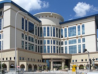
Torrance County is a county located in the center of the U.S. state of New Mexico. As of the 2020 census, the population was 15,045. The county seat is Estancia.

Santa Fe County is located in the U.S. state of New Mexico. As of the 2020 census, the population was 154,823, making it New Mexico's third-most populous county, after Bernalillo County and Doña Ana County. Its county seat is Santa Fe, the state capital.

Sandoval County is located in the U.S. state of New Mexico. As of the 2020 census, the population was 148,834, making it the fourth-most populous county in New Mexico. The county seat is Bernalillo.

Bernalillo County is the most populous county in the U.S. state of New Mexico. As of the 2020 census, the population was 676,444. The county seat, Albuquerque, is the most populous city in New Mexico.

Kewa Pueblo is a federally-recognized tribe of Native American Pueblo people in northern New Mexico, in Sandoval County southwest of Santa Fe. The pueblo is recorded as the Santo Domingo Pueblo census-designated place by the U.S. Census Bureau, with a population of 2,456 at the 2010 census.

Edgewood is a town in Santa Fe County, New Mexico, United States. Through annexations, its town boundaries now extend into Bernalillo and Sandoval counties. It is part of the Albuquerque–Santa Fe–Las Vegas combined statistical area.

Moriarty is a town in Torrance County, New Mexico, United States. The population was 1,946 at the 2020 Census. It is part of the Albuquerque Metropolitan Statistical Area.

The Albuquerque–Santa Fe–Las Vegas combined statistical area is made up of eight counties in north central New Mexico. The combined statistical area consists of the Albuquerque and Santa Fe metropolitan statistical areas, and the Las Vegas, Los Alamos, and Española micropolitan statistical areas. The 2013 delineations included the Grants micropolitan statistical area, but it was removed in the 2018 revisions. As of the 2020 census, the CSA had a population of 1,162,523. Roughly 56% of New Mexico's residents live in this area. Prior to the 2013 redefinitions, the CSA consisted only of the Santa Fe metropolitan statistical area and the Española micropolitan statistical area. The total land area of the Albuquerque–Santa Fe–Las Vegas combined statistical area in the 2013 definition is 26,421 sq mi (68,430 km2).

The Albuquerque Metropolitan Statistical Area, sometimes referred to as Tiguex, is a metropolitan area in central New Mexico centered on the city of Albuquerque. The metro comprises four counties: Bernalillo, Sandoval, Torrance, and Valencia. As of the 2010 United States Census, the MSA had a population of 887,077. The population is estimated to be 923,630 as of July 1, 2020, making Greater Albuquerque the 61st-largest MSA in the nation. The Albuquerque MSA forms a part of the larger Albuquerque–Santa Fe–Las Vegas combined statistical area with a 2020 estimated population of 1,165,181, ranked 49th-largest in the country.

Pojoaque Valley High School is a public high school in unincorporated Santa Fe County, New Mexico. It is located on the Jacona Campus, which is outside of the Jacona census-designated place. It serves the Pojoaque Valley in New Mexico and its colors are kelly green and white. Their mascot is the Elk.
Española Public School District #55 (EPSD) or Española Public Schools (EPS) is a school district based in Española, New Mexico, USA. It includes sections of Rio Arriba County and Santa Fe County.
Santa Fe Public Schools (SFPS) is a school district based in Santa Fe, New Mexico. Santa Fe Public Schools serves the city of Santa Fe, the communities of Tesuque and Eldorado, and the historic neighborhood of Agua Fria, and other communities with a total area of 1,016 square miles (2,630 km2). The school district has a total of 31 schools: three high schools, three combined high/middle schools, three middle schools, and 21 elementary schools.
Stanley is an unincorporated community in Santa Fe County, New Mexico. The ZIP code is 87056.
McIntosh is a census-designated place in Torrance County, New Mexico, United States. Its population was 1,484 as of the 2010 census. McIntosh has a post office with ZIP code 87032, which opened on August 28, 1906. New Mexico State Road 41 passes through the community.
Manzano Springs is a census-designated place (CDP) in Torrance and Bernalillo counties, New Mexico, United States. The population was 137 at the 2010 census. It is part of the Albuquerque Metropolitan Statistical Area.

U.S. Route 366 or US 366 was the designation of two child routes of the former U.S. Route 66 in New Mexico and Texas during the late 1920s and 1930s. Both alignments of US 366 were original U.S. Routes created in 1927. The first alignment was a route from El Paso, Texas to Amarillo, Texas crossing through New Mexico that existed until 1932. The second was a route from Albuquerque to Willard that was previously designated U.S. Route 470 before 1932. That alignment was canceled in 1939.
Indian Hills is an unincorporated community and census-designated place in Torrance County, New Mexico, United States. Its population was 892 as of the 2010 census.
San Pedro is an unincorporated community and census-designated place in Santa Fe County, New Mexico, United States. Its population was 184 as of the 2010 census. New Mexico State Road 344 passes through the community.
Barton is a census-designated place (CDP) in Bernalillo and Santa Fe counties, New Mexico, United States. It was first listed as a CDP prior to the 2020 census.
Thunder Mountain is an unincorporated community and census-designated place (CDP) in Santa Fe County, New Mexico, United States. It was first listed as a CDP prior to the 2020 census.


