Torrance County, New Mexico

Last updated

Torrance County
Torrance County New Mexico Court House.jpg
Torrance County Courthouse in Estancia
Flag of Torrance County, New Mexico.svg
Torrance County nm seal.png
Map of New Mexico highlighting Torrance County.svg
Location within the U.S. state of New Mexico
New Mexico in United States.svg
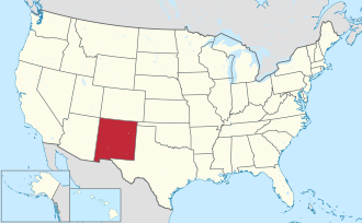
New Mexico's location within the U.S.
Coordinates: 34°38′N105°51′W / 34.64°N 105.85°W / 34.64; -105.85
CountryFlag of the United States.svg United States
StateFlag of New Mexico.svg  New Mexico
FoundedMarch 16, 1903
Seat Estancia
Largest city Moriarty
Area
  Total3,346 sq mi (8,670 km2)
  Land3,345 sq mi (8,660 km2)
  Water0.9 sq mi (2 km2)  0.03%
Population
 (2020)
  Total15,045
  Density4.5/sq mi (1.7/km2)
Time zone UTC−7 (Mountain)
  Summer (DST) UTC−6 (MDT)
Congressional district 1st
Website www.torrancecountynm.org

This article is about the county in New Mexico. For the city in California, see Torrance, California.

Contents

Torrance County is a county located in the center of the U.S. state of New Mexico. As of the 2020 census, the population was 15,045. [1] The county seat is Estancia. [2]

The geographic center of New Mexico is located in Torrance County, southwest of the Village of Willard, [3] [ circular reference ] and in 2010, the center of population of New Mexico was located in Torrance County, near Manzano. [4] Torrance County is included in the Albuquerque, NM Metropolitan Statistical Area.

Geography

According to the U.S. Census Bureau, the county has a total area of 3,346 square miles (8,670 km2), of which 0.9 square miles (2.3 km2) (0.03%) is covered by water. [5] Most of the county is gently rolling grassland ranging from 6000 to 6200 feet in elevation. The Manzano Mountains rising to 10,098 feet on the western edge of the county provide it with its only significant topographic relief. The Manzano Wilderness area includes the highest part of the mountains. The other notable geographic feature of the county is the series of playas and seasonal lakes centering on Laguna del Perro southeast of Estancia.

Adjacent counties

National protected areas

Government

County Commissioners [6]

United States presidential election results for Torrance County, New Mexico [7]
Year Republican Democratic Third party
No.%No.%No.%
2020 4,77265.54%2,34432.19%1652.27%
2016 3,71458.73%1,78528.23%82513.05%
2012 3,52955.12%2,42837.93%4456.95%
2008 3,73553.81%3,08744.47%1191.71%
2004 4,02661.87%2,38636.67%951.46%
2000 2,89158.29%1,86837.66%2014.05%
1996 2,15446.27%2,07244.51%4299.22%
1992 1,66740.00%1,66239.88%83820.11%
1988 2,25257.19%1,61841.09%681.73%
1984 2,32664.02%1,27435.07%330.91%
1980 1,90757.42%1,26137.97%1534.61%
1976 1,46248.54%1,52650.66%240.80%
1972 1,75864.54%90833.33%582.13%
1968 1,31652.98%97439.21%1947.81%
1964 1,18344.90%1,44654.88%60.23%
1960 1,55453.88%1,30845.35%220.76%
1956 1,56756.23%1,20143.09%190.68%
1952 1,74754.99%1,42244.76%80.25%
1948 1,70950.09%1,69649.71%70.21%
1944 2,01458.28%1,43841.61%40.12%
1940 2,50956.52%1,92143.28%90.20%
1936 1,84343.60%2,34655.50%380.90%
1932 1,80344.29%2,20254.09%661.62%
1928 1,95864.54%1,07035.27%60.20%
1924 1,66651.18%1,26938.99%3209.83%
1920 1,75160.28%1,12538.73%291.00%
1916 94855.83%67939.99%714.18%
1912 52039.54%39029.66%40530.80%

Demographics

Historical population
CensusPop.Note
1910 10,119
1920 9,731−3.8%
1930 9,269−4.7%
1940 11,02619.0%
1950 8,012−27.3%
1960 6,497−18.9%
1970 5,290−18.6%
1980 7,49141.6%
1990 10,28537.3%
2000 16,91164.4%
2010 16,383−3.1%
2020 15,045−8.2%
U.S. Decennial Census [8]
1790-1960 [9] 1900-1990 [10]
1990-2000 [11] 2010 [12]

2000 census

As of the 2000 census, [13] there were 16,911 people, 6,024 households, and 4,391 families residing in the county. The population density was 5 people per square mile (1.9 people/km2). There were 7,257 housing units at an average density of 2 per square mile (0.77/km2). The racial makeup of the county was 43.89% White, 31.66% Black or African American, 2.09% Native American, 0.32% Asian, 0.13% Pacific Islander, 17.95% from other races, and 3.97% from two or more races. 37.15% of the population were Hispanic or Latino of any race.

There were 6,024 households, out of which 37.80% had children under the age of 18 living with them, 55.40% were married couples living together, 12.30% had a female householder with no husband present, and 27.10% were non-families. 23.20% of all households were made up of individuals, and 7.90% had someone living alone who was 65 years of age or older. The average household size was 2.72 and the average family size was 3.20.

In the county, the population was spread out, with 30.40% under the age of 18, 7.50% from 18 to 24, 29.20% from 25 to 44, 23.20% from 45 to 64, and 9.70% who were 65 years of age or older. The median age was 35 years. For every 100 females there were 105.50 males. For every 100 females age 18 and over, there were 106.20 males.

The median income for a household in the county was $30,446, and the median income for a family was $34,461. Males had a median income of $29,403 versus $21,833 for females. The per capita income for the county was $14,134. About 15.20% of families and 19.00% of the population were below the poverty line, including 24.50% of those under age 18 and 12.00% of those age 65 or over.

2010 census

As of the 2010 census, there were 16,383 people, 6,264 households, and 4,192 families residing in the county. [14] The population density was 4.9 inhabitants per square mile (1.9/km2). There were 7,798 housing units at an average density of 2.3 per square mile (0.89/km2). [15] The racial makeup of the county was 36.1% white, 2.3% American Indian, 41.3% black or African American, 0.4% Asian, 15.5% from other races, and 4.3% from two or more races. Those of Hispanic or Latino origin made up 39.1% of the population. [14] In terms of ancestry, 17.5% were German, 12.2% were Irish, 10.0% were English, and 2.3% were American. [16]

Of the 6,264 households, 31.8% had children under the age of 18 living with them, 48.5% were married couples living together, 12.0% had a female householder with no husband present, 33.1% were non-families, and 27.6% of all households were made up of individuals. The average household size was 2.52 and the average family size was 3.06. The median age was 41.6 years. [14]

The median income for a household in the county was $37,117 and the median income for a family was $43,914. Males had a median income of $37,545 versus $28,826 for females. The per capita income for the county was $17,278. About 13.5% of families and 19.4% of the population were below the poverty line, including 30.7% of those under age 18 and 11.5% of those age 65 or over. [17]

Communities

City

Towns

Villages

Census-designated places

Unincorporated communities

Education

School districts include: [18]

See also

Related Research Articles

<span class="mw-page-title-main">Valencia County, New Mexico</span> County in New Mexico, United States

Valencia County is a county in the U.S. state of New Mexico. As of the 2020 census, the population was 76,205. The county seat is Los Lunas.

<span class="mw-page-title-main">Santa Fe County, New Mexico</span> County in New Mexico, United States

Santa Fe County is located in the U.S. state of New Mexico. As of the 2020 census, the population was 154,823, making it New Mexico's third-most populous county, after Bernalillo County and Doña Ana County. Its county seat is Santa Fe, the state capital.

<span class="mw-page-title-main">San Miguel County, New Mexico</span> County in New Mexico, United States

San Miguel County is a county in the U.S. state of New Mexico. As of the 2020 census, the population was 27,201. Its county seat is Las Vegas.

<span class="mw-page-title-main">Luna County, New Mexico</span> County in New Mexico, United States

Luna County(Spanish: Condado de Luna) is a county located in the U.S. state of New Mexico. As of the 2020 census, the population was 25,427. Its county seat is Deming. This county abuts the Mexican border. Luna County comprises the Deming, NM Micropolitan Statistical Area.

<span class="mw-page-title-main">Lincoln County, New Mexico</span> County in New Mexico, United States

Lincoln County is a county in the U.S. state of New Mexico. As of the 2020 census, the population was 20,269. Its county seat is Carrizozo, while its largest community is Ruidoso.

<span class="mw-page-title-main">Hidalgo County, New Mexico</span> County in New Mexico, United States

Hidalgo County is the southernmost county of the U.S. state of New Mexico. As of the 2020 census, the population was 4,178. The county seat and largest city is Lordsburg. A bill creating Hidalgo from the southern part of Grant County was passed on February 25, 1919, taking effect at the beginning of 1920. The county was named for the town north of Mexico City where the Treaty of Guadalupe Hidalgo was signed, which in turn was named for Miguel Hidalgo y Costilla, the priest who is known as the "Father of Mexican Independence." The county is located on the Mexico–United States border.

<span class="mw-page-title-main">Guadalupe County, New Mexico</span> County in New Mexico, United States

Guadalupe County is a county in the U.S. state of New Mexico. As of the 2020 census, the population was 4,452. Its county seat is Santa Rosa.

<span class="mw-page-title-main">Grant County, New Mexico</span> County in New Mexico, United States

Grant County is a county located in the U.S. state of New Mexico. At the 2020 census, the population was 28,185. Its county seat is Silver City. The county was founded in 1868 and named for Ulysses S. Grant, the 18th President of the United States.

<span class="mw-page-title-main">Chaves County, New Mexico</span> County in New Mexico, United States

Chaves County is a county in New Mexico, United States. As of the 2020 census, the population was 65,157. Its county seat is Roswell. Chaves County was named for Colonel Jose Francisco Chaves, a military leader there during the Civil War and later in Navajo campaigns. The county was created by the New Mexico Territorial Legislature on February 25, 1889, out of land from Lincoln County.

<span class="mw-page-title-main">Bernalillo County, New Mexico</span> County in New Mexico, United States

Bernalillo County is the most populous county in the U.S. state of New Mexico. As of the 2020 census, the population was 676,444. The county seat, Albuquerque, is the most populous city in New Mexico.

<span class="mw-page-title-main">Mesita, New Mexico</span> Census-designated place in New Mexico, United States

Mesita is a census-designated place (CDP) in Cibola County, New Mexico, United States. The population was 804 at the 2010 census.

<span class="mw-page-title-main">Alcalde, New Mexico</span> CDP in New Mexico, United States

Alcalde is a census-designated place (CDP) in Rio Arriba County, New Mexico, United States. The population was 285 at the 2010 census.

<span class="mw-page-title-main">Edgewood, New Mexico</span> Town in New Mexico, United States

Edgewood is a town in Santa Fe County, New Mexico, United States. Through annexations, its town boundaries now extend into Bernalillo and Sandoval counties. It is part of the Albuquerque–Santa Fe–Las Vegas combined statistical area.

<span class="mw-page-title-main">Encino, New Mexico</span> Village in New Mexico, United States

Encino is a village in Torrance County, New Mexico, United States. The population was 82 at the 2010 census. It is part of the Albuquerque Metropolitan Statistical Area.

<span class="mw-page-title-main">Estancia, New Mexico</span> Town in New Mexico, United States

Estancia is a town in Torrance County, New Mexico, United States. As of the 2020 census, the town population was 1,242. It is the county seat of Torrance County.

<span class="mw-page-title-main">Manzano, New Mexico</span> CDP in New Mexico, United States

Manzano is a census-designated place (CDP) in Torrance County, New Mexico, United States. The population was 54 at the 2000 census. The Quarai Ruins of Salinas Pueblo Missions National Monument are located near the town. The center of population of New Mexico is located in Manzano.

<span class="mw-page-title-main">Torreon, Torrance County, New Mexico</span> Census-designated place in Torrance County, New Mexico, United States

Torreon is a farming community and census-designated place (CDP) in Torrance County, New Mexico, United States. The population was 244 at the 2000 census. It is part of the Albuquerque Metropolitan Statistical Area.

<span class="mw-page-title-main">Willard, New Mexico</span> Village in New Mexico, United States

Willard is a village in Torrance County, New Mexico, United States. The population was 253 at the 2010 census. It is part of the Albuquerque Metropolitan Statistical Area. The village is not experiencing the same extreme growth that towns farther north in the state are. A wind farm has recently been constructed upon the mesa just south of the town. It provides power for about 25,000 homes in Arizona.

<span class="mw-page-title-main">Mountainair, New Mexico</span> Town in New Mexico, United States

Mountainair is a town in Torrance County, New Mexico, United States. It was founded in 1902 by John Corbett, Colonel E. C. Manning, and Elias S. Stover. The population was 884 at the 2020 census. It is part of the Albuquerque Metropolitan Statistical Area. The main visitor center for Salinas Pueblo Missions National Monument is located within the town.

<span class="mw-page-title-main">De Baca County, New Mexico</span> County in New Mexico, United States

De Baca County is a county in the U.S. state of New Mexico. As of the 2020 census, the population was 1,698, making it New Mexico's second-least populous county. Its county seat is Fort Sumner. The county is named for Ezequiel Cabeza De Baca, the second elected Governor of New Mexico.

References

  1. "Torrance County, New Mexico". United States Census Bureau . Retrieved July 3, 2023.
  2. "Find a County". National Association of Counties. Retrieved June 7, 2011.
  3. List of geographic centers of the United States
  4. "Centers of Population by State: 2010". United States Census Bureau. Retrieved April 3, 2014.
  5. "2010 Census Gazetteer Files". United States Census Bureau. August 22, 2012. Archived from the original on January 1, 2015. Retrieved January 2, 2015.
  6. "Torrance County, New Mexico - County Commission". www.torrancecountynm.org. Retrieved April 2, 2018.
  7. Leip, David. "Dave Leip's Atlas of U.S. Presidential Elections". uselectionatlas.org. Retrieved April 2, 2018.
  8. "U.S. Decennial Census". United States Census Bureau. Retrieved January 2, 2015.
  9. "Historical Census Browser". University of Virginia Library. Retrieved January 2, 2015.
  10. "Population of Counties by Decennial Census: 1900 to 1990". United States Census Bureau. Retrieved January 2, 2015.
  11. "Census 2000 PHC-T-4. Ranking Tables for Counties: 1990 and 2000" (PDF). United States Census Bureau. Archived (PDF) from the original on March 27, 2010. Retrieved January 2, 2015.
  12. "State & County QuickFacts". United States Census Bureau. Retrieved September 30, 2013.
  13. "U.S. Census website". United States Census Bureau . Retrieved January 31, 2008.
  14. 1 2 3 "DP-1 Profile of General Population and Housing Characteristics: 2010 Demographic Profile Data". United States Census Bureau. Archived from the original on February 13, 2020. Retrieved January 24, 2016.
  15. "Population, Housing Units, Area, and Density: 2010 - County". United States Census Bureau. Archived from the original on February 13, 2020. Retrieved January 24, 2016.
  16. "DP02 SELECTED SOCIAL CHARACTERISTICS IN THE UNITED STATES – 2006-2010 American Community Survey 5-Year Estimates". United States Census Bureau. Archived from the original on February 13, 2020. Retrieved January 24, 2016.
  17. "DP03 SELECTED ECONOMIC CHARACTERISTICS – 2006-2010 American Community Survey 5-Year Estimates". United States Census Bureau. Archived from the original on February 13, 2020. Retrieved January 24, 2016.
  18. "2020 CENSUS - SCHOOL DISTRICT REFERENCE MAP: Torrance County, NM" (PDF). U.S. Census Bureau. Archived (PDF) from the original on September 2, 2022. Retrieved September 1, 2022. - Text list

34°38′N105°51′W / 34.64°N 105.85°W / 34.64; -105.85