
Santa Fe County is a county located in the U.S. state of New Mexico. As of the 2020 census, the population was 154,823, making it New Mexico's third-most populous county, after Bernalillo County and Doña Ana County. Its county seat is Santa Fe, the state capital.

Sandoval County is a county located in the U.S. state of New Mexico. As of the 2020 census, the population was 148,834, making it the fourth-most populous county in New Mexico. The county seat is Bernalillo.

Rio Arriba County is a county in the U.S. state of New Mexico. As of the 2020 census, the population was 40,363. Its county seat is Tierra Amarilla. Its northern border is the Colorado state line.

Chimayo is a census-designated place (CDP) in Rio Arriba and Santa Fe counties in the U.S. state of New Mexico. The name is derived from a Tewa name for a local landmark, the hill of Tsi Mayoh. The town is unincorporated and includes many neighborhoods, called plazas or placitas, each with its own name, including El Potrero de Chimayó and the Plaza del Cerro. The cluster of plazas called Chimayo lies near Santa Cruz, approximately 25 miles north of Santa Fe. The population was 3,177 at the 2010 census.

Española is a city primarily in Rio Arriba County, New Mexico, United States. A portion of the central and eastern section of the city is in Santa Fe County. Founded as a railroad village some distance from the old Indian town of San Juan de los Caballeros, it was named Española and officially incorporated in 1925. It has been called the first capital city in the United States. At the time of the 2010 census, the city had a total population of 10,495. Española is within the Albuquerque–Santa Fe–Los Alamos combined statistical area.
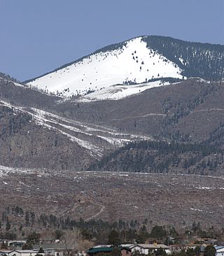
The Jemez Mountains are a group of mountains in Rio Arriba, Sandoval, and Los Alamos counties, New Mexico, United States.

This is a list of properties and districts in New Mexico that are on the National Register of Historic Places. There are more than 1,100 listings. Of these, 46 are National Historic Landmarks. There are listings in each of the state's 33 counties.
Ohkay Owingeh, known by its Spanish name as San Juan Pueblo from 1589 to 2005, is a pueblo in Rio Arriba County, New Mexico. For statistical purposes, the United States Census Bureau has defined that community as a census-designated place (CDP). Ohkay Owingeh is also the federally recognized tribe of Pueblo people inhabiting the town.
The Santa Fe National Forest is a protected national forest in northern New Mexico in the Southwestern United States. It was established in 1915 and covers 1,558,452 acres (6,306.83 km2). Elevations range from 5,300 feet (1600 m) to 13,103 feet (4000 m) at the summit of Truchas Peak, located within the Pecos Wilderness. The Jemez, Coyote, and Cuba districts are located in the Jemez Mountains; the Pecos/Las Vegas district is located in the Sangre de Cristo Mountains; and the Española district is located in both mountain ranges. In descending order of land area the forest lies in parts of Rio Arriba, San Miguel, Sandoval, Santa Fe, Mora, and Los Alamos counties. Forest headquarters are located in the city of Santa Fe.

The Santa Clara Pueblo is an Indian reservation in north-central New Mexico, United States. It is the homeland of a branch of the Pueblo people (Tewa) of Native Americans. The reservation lies on 76.73 sq mi (198.729 km²) of southern Rio Arriba, northeastern Sandoval, and northern Santa Fe Counties. It includes the community of Santa Clara Pueblo, as well as parts of three other communities. The total population living on Santa Clara Pueblo land as of the 2000 census was 10,658 persons. Most of the population lives in the northeastern corner of the reservation. The largest community on reservation land is the city of Española, although a part of the city is not on reservation territory.

The Albuquerque–Santa Fe–Los Alamos combined statistical area is made up of eight counties in north central New Mexico. The combined statistical area consists of the Albuquerque and Santa Fe metropolitan statistical areas, and the Las Vegas, Los Alamos, and Española micropolitan statistical areas. The 2013 delineations included the Grants micropolitan statistical area, but it was removed in the 2018 revisions. As of the 2020 census, the CSA had a population of 1,162,523. Roughly 56% of New Mexico's residents live in this area. Prior to the 2013 redefinitions, the CSA consisted only of the Santa Fe metropolitan statistical area and the Española micropolitan statistical area. The total land area of the Albuquerque–Santa Fe–Las Vegas combined statistical area in the 2013 definition is 26,421 sq mi (68,430 km2).

Española Valley High School (EVHS) is a Title-1 public senior high school of the Española Public Schools District, located in Española, New Mexico. Nearly 97% of the student body is made up of minority enrollment.

The Rio Grande Trail is a proposed long distance trail along the Rio Grande in the U.S. state of New Mexico. The river extends over 1,800 total miles, some 700 miles (1,100 km) of which pass through the heart of New Mexico. It is the state's primary drainage feature and most valuable natural and cultural resource. The river and its bosque provide a wide variety of recreation, including hunting and fishing, birdwatching, river rafting, hiking, biking, and horseback riding. The river also flows through or beside numerous spectacular and geologically interesting landforms, the result of extensive volcanism and erosion of the valley within the Rio Grande Rift. Although some trail advocates would like to see the trail extended the full distance through New Mexico, from the Colorado border to the United States–Mexico border, the portion proposed for initial development extends 300 miles (480 km), from Bernalillo south to Las Cruces.

Caja del Rio is a dissected plateau, of volcanic origin, which covers approximately 84,000 acres of land in northern Santa Fe County, New Mexico, United States. The region is also known as the Caja, Caja del Rio Plateau, and Cerros del Rio. The center of the area is approximately 15 miles (23 km) west of Santa Fe, New Mexico. Most of the Caja is owned by the United States Forest Service and managed by the Santa Fe National Forest. Access is through New Mexico Highway 599, Santa Fe County Road 62, and Forest Service Road 24.

Under the provisions of the Kearny Code as promulgated in 1846, the first legislature of New Mexico commenced its session on December 6, 1847. The Council consisted of seven members, with Antonio Sandoval, of Bernalillo County, as president, and the House of twenty-one members, with W. Z. Angney as speaker.

The Hispanos of New Mexico, also known as Neomexicanos or Nuevomexicanos, are Hispanic residents originating in the historical region of Santa Fe de Nuevo México, today the US state of New Mexico, southern Colorado, and other parts of the Southwestern United States including Arizona, Nevada, Texas, and Utah. They are descended from Oasisamerica groups and the settlers of the Viceroyalty of New Spain, the First Mexican Empire and Republic, the Centralist Republic of Mexico, and the New Mexico Territory.

Northern Rio Grande National Heritage Area is a federally designated National Heritage Area in the U.S. state of New Mexico. The national heritage area includes a section of the upper Rio Grande Valley that has been inhabited by the Puebloan peoples since the early Pre-Columbian era.
Medanales is an unincorporated community located in Rio Arriba County, New Mexico, United States. The community is located on the Chama River near U.S. Route 84, 14 miles (23 km) north-northwest of Española. Medanales has a post office with ZIP code 87548, which opened on March 10, 1945.


