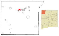
Kirtland, New Mexico

Last updated
Kirtland, New Mexico
San Juan County New Mexico Incorporated and Unincorporated areas Kirtland Highlighted.svg
Location of former Kirtland, New Mexico CDP
Usa edcp location map.svg
Red pog.svg
Kirtland, New Mexico
Location in the United States
Coordinates: 36°44′36″N108°21′30″W / 36.74333°N 108.35833°W / 36.74333; -108.35833
Country United States
State New Mexico
County San Juan
Area
[1]
  Total1.76 sq mi (4.57 km2)
  Land1.72 sq mi (4.46 km2)
  Water0.04 sq mi (0.11 km2)
Elevation
[2]
5,233 ft (1,595 m)
Population
 (2020) [3]
  Total585
  Density339.72/sq mi (131.18/km2)
Time zone UTC-7 (Mountain (MST))
  Summer (DST) UTC-6 (MDT)
ZIP code
87417
Area code 505
FIPS code 35-36230
GNIS feature ID2783911 [2]
Website kirtlandnm.org

Kirtland is a town, made up of part of the former census-designated place (CDP) of the same name in San Juan County, New Mexico, United States. The population of the former CDP was 6,190 at the 2000 census. It is part of the Farmington Metropolitan Statistical Area.

Contents

History

Kirtland was founded in the early 1880s by Mormon settlers, who named it after Kirtland, Ohio. (Reflecting its history and principal demographic, the city's principal thoroughfare is Brigham Street, with a Mormon meetinghouse on the street and a release-time seminary building across the street from Kirtland Central High School.) There had been a few Mormons who had settled in Fruitland as early as 1878. As of 2000, Fruitland was designated as part of Kirtland for census purposes. Another Mormon settlement of these early days was Waterflow, just west of Fruitland, which appears on maps to this day. [4] [5] A Mormon meetinghouse was dedicated in Kirtland by Heber J. Grant in 1928. [6]

The town incorporated in January 2015, after an 80–40 vote in favor of doing so. [7]

Geography

According to the United States Census Bureau, the town has a total area of 0.670 square miles (1.74 km2), all land.

Demographics

Historical population
CensusPop.Note
2020 585
U.S. Decennial Census [8] [3]

As of the census [9] of 2000, there were 6,190 people, 1,822 households, and 1,517 families residing in the CDP. The population density was 530.5 inhabitants per square mile (204.8/km2). There were 1,994 housing units at an average density of 170.9 per square mile (66.0/km2). The racial makeup of the CDP was 48.93% Native American, 43.38% White, 0.24% Asian, 0.19% African American, 0.02% Pacific Islander, 4.26% from other races, and 2.97% from two or more races. Hispanic or Latino of any race were 9.45% of the population.

There were 1,822 households, out of which 50.5% had children under the age of 18 living with them, 61.6% were married couples living together, 14.9% had a female householder with no husband present, and 16.7% were non-families. 13.7% of all households were made up of individuals, and 4.7% had someone living alone who was 65 years of age or older. The average household size was 3.40 and the average family size was 3.71.

In the CDP, the population was spread out, with 36.4% under the age of 18, 11.2% from 18 to 24, 27.4% from 25 to 44, 18.9% from 45 to 64, and 6.1% who were 65 years of age or older. The median age was 27 years. For every 100 females, there were 98.0 males. For every 100 females age 18 and over, there were 93.3 males.

The median income for a household in the CDP was $45,000, and the median income for a family was $45,491. Males had a median income of $41,014 versus $21,146 for females. The per capita income for the CDP was $14,053. About 12.5% of families and 14.8% of the population were below the poverty line, including 19.6% of those under age 18 and 9.607% of those age 65 or over.

Education

Central Consolidated Schools serves Kirtland as well as other communities in western San Juan County. [10]

Related Research Articles

<span class="mw-page-title-main">San Juan County, New Mexico</span> County in New Mexico, United States

San Juan County is located in the U.S. state of New Mexico. As of the 2020 census, the population was 121,661 making it the fifth-most populous county in New Mexico. Its county seat is Aztec. The county was created in 1887.

<span class="mw-page-title-main">Conning Towers Nautilus Park, Connecticut</span> Census-designated place in Connecticut, United States

Conning Towers Nautilus Park is a census-designated place (CDP) in the town of Groton in New London County, Connecticut, United States. The population was 9,828 at the 2010 census. The statistical area consists of the portion of the town in the vicinity of Route 12 and includes Naval Submarine Base New London.

<span class="mw-page-title-main">Mattapoisett Center, Massachusetts</span> Census-designated place in Massachusetts, United States

Mattapoisett Center is a census-designated place (CDP) in the town of Mattapoisett in Plymouth County, Massachusetts. The population was 2,915 at the 2010 census.

<span class="mw-page-title-main">San Juan, New Mexico</span> CDP in New Mexico, United States

San Juan is a census-designated place (CDP) in Rio Arriba County, New Mexico, United States. The population was 592 at the 2000 census.

<span class="mw-page-title-main">Beclabito, New Mexico</span> Census-designated place in San Juan County, New Mexico, United States

Beclabito is a census-designated place (CDP) in San Juan County, New Mexico, United States. The population was 317 at the 2010 census. It is part of the Farmington Metropolitan Statistical Area.

<span class="mw-page-title-main">Flora Vista, New Mexico</span> CDP in New Mexico, United States

Flora Vista is a census-designated place (CDP) in San Juan County, New Mexico, United States. The population was 1,383 at the 2000 census. It is part of the Farmington Metropolitan Statistical Area. Flora Vista was founded in 1877 by settlers from Colorado who built cabins along the Animas River. A post office was established the following year. The name derived from the view of wildflowers in the valley.

<span class="mw-page-title-main">Huerfano, New Mexico</span> CDP in New Mexico, United States

Huerfano is a census-designated place (CDP) in San Juan County, New Mexico, United States. The population was 104 at the 2000 census. It is part of the Farmington Metropolitan Statistical Area. Huerfano is named after El Huerfano Mountain, located a mile to the northeast.

<span class="mw-page-title-main">Nageezi, New Mexico</span> CDP in New Mexico, United States

Nageezi is a census-designated place (CDP) in San Juan County, New Mexico, United States. The population was 296 at the 2000 census. It is part of the Farmington Metropolitan Statistical Area. A post office was established in 1941. Nageezi's name in Navajo means "squash."

Napi Headquarters is a census-designated place (CDP) in San Juan County, New Mexico, United States. The population was 706 at the 2000 census.

<span class="mw-page-title-main">Naschitti, New Mexico</span> CDP in New Mexico, United States

Naschitti is a census-designated place (CDP) in San Juan County, New Mexico, United States. The population was 360 at the 2000 census. It is part of the Farmington Metropolitan Statistical Area. The town was established in 1886, when Tom Bryan set up a trading post east of the Chuska Mountains. With a Navajo name, Naschitti means "badger springs."

<span class="mw-page-title-main">Nenahnezad, New Mexico</span> CDP in New Mexico, United States

Nenahnezad is a census-designated place (CDP) in San Juan County, New Mexico, United States. The population was 726 at the 2000 census. Nenahnezad is a Chapter community just to the south of Fruitland, between the towns of Farmington and Shiprock. It is part of the Farmington Metropolitan Statistical Area.

<span class="mw-page-title-main">Newcomb, New Mexico</span> CDP in New Mexico, United States

Newcomb is a census-designated place (CDP) in San Juan County, New Mexico, United States. The population was 387 at the 2000 census. It is part of the Farmington Metropolitan Statistical Area.

<span class="mw-page-title-main">Ojo Amarillo, New Mexico</span> CDP in New Mexico, United States

Ojo Amarillo is a census-designated place (CDP) in San Juan County, New Mexico, United States. The population was 829 at the 2000 census. It is part of the Farmington Metropolitan Statistical Area.

<span class="mw-page-title-main">Sanostee, New Mexico</span> CDP in New Mexico, United States

Sanostee is a census-designated place (CDP) in San Juan County, New Mexico, United States. The population was 429 at the 2000 census. It is part of the Farmington Metropolitan Statistical Area.

<span class="mw-page-title-main">Sheep Springs, New Mexico</span> CDP in New Mexico, United States

Sheep Springs is a census-designated place (CDP) in San Juan County, New Mexico, United States. The population was 237 at the 2000 census. It is part of the Farmington Metropolitan Statistical Area.

<span class="mw-page-title-main">Upper Fruitland, New Mexico</span> CDP in New Mexico, United States

Upper Fruitland is a census-designated place (CDP) in San Juan County, New Mexico, United States. The population was 1,664 at the 2000 census. It is part of the Farmington Metropolitan Statistical Area.

<span class="mw-page-title-main">Curtisville, Pennsylvania</span> Census-designated place in Pennsylvania, United States

Curtisville is a census-designated place (CDP) in Allegheny County, Pennsylvania, United States. The population was 1,097 at the 2020 census.

Flying Hills is a census-designated place (CDP) in Cumru Township, Berks County, Pennsylvania. The population was 2,568 as of the 2010 census.

<span class="mw-page-title-main">Newfane (CDP), New York</span> CDP in New York, United States

Newfane is a census-designated place (CDP) in the town of Newfane in Niagara County, New York, United States, along State Route 78. The population was 3,822 at the 2010 census. It is part of the Buffalo–Niagara Falls Metropolitan Statistical Area.

<span class="mw-page-title-main">Warner (CDP), New Hampshire</span> Census-designated place in New Hampshire, United States

Warner is a census-designated place (CDP) and the main village in the town of Warner in Merrimack County, New Hampshire, United States. The population of the CDP was 453 at the 2020 census, out of 2,937 in the entire town.

References

  1. "ArcGIS REST Services Directory". United States Census Bureau. Retrieved October 12, 2022.
  2. 1 2 U.S. Geological Survey Geographic Names Information System: Kirtland, New Mexico
  3. 1 2 "Census Population API". United States Census Bureau. Retrieved Oct 12, 2022.
  4. Jensen, Richard L. "Pioneer Settlements in New Mexico" in Ludlow, Daniel H., ed., Selections from the Encyclopedia of Mormonism. (Salt Lake City: Deseret Book, 1995) p. 386
  5. Hammond's Complete World Atlas (New York: C. S. Hammond and Co., 1951) p. 210
  6. Conference Report, October 1928, p. 4
  7. "Census of Population and Housing". Census.gov. Retrieved June 4, 2016.
  8. "U.S. Census website". United States Census Bureau . Retrieved 2008-01-31.
  9. "2020 CENSUS - SCHOOL DISTRICT REFERENCE MAP: San Juan County, NM" (PDF). U.S. Census Bureau . Retrieved 2021-07-31.

Commons-logo.svg Media related to Kirtland, New Mexico at Wikimedia Commons