
San Juan County is a county in the southeastern portion of the U.S. state of Utah. As of the 2020 United States Census, the population was 14,518. Its county seat is Monticello, while its most populous city is Blanding. The Utah State Legislature named the county for the San Juan River, itself named by Spanish explorers.

Imperial County is a county located on the southeast border of the U.S. state of California. As of the 2020 census, the population was 179,702, making it the least populous county in Southern California. The county seat and largest city is El Centro. Imperial is the most recent California county to be established, as it was created in 1907 out of portions of San Diego County.

San Bernardino County, officially the County of San Bernardino and sometimes abbreviated as S.B. County, is a county located in the southern portion of the U.S. state of California, and is located within the Inland Empire area. As of the 2020 U.S. Census, the population was 2,181,654, making it the fifth-most populous county in California and the 14th-most populous in the United States. The county seat is San Bernardino.

Madera County, officially the County of Madera, is a county located at the geographic center of the U.S. state of California. It features a varied landscape, encompassing the eastern San Joaquin Valley and the central Sierra Nevada, with Madera serving as the county seat. Established in 1893 from part of Fresno County, Madera County reported a population of 156,255 in the 2020 census.

Mendocino County is a county located on the North Coast of the U.S. state of California. As of the 2020 census, the population was 91,601. The county seat is Ukiah.

Napa County is a county north of San Pablo Bay located in the northern portion of the U.S. state of California. As of the 2020 census, the population was 138,019. The county seat is the City of Napa. Napa County was one of the original counties of California, created in 1850 at the time of statehood. Parts of the county's territory were given to Lake County in 1861.
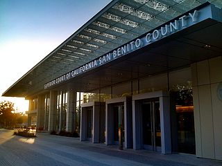
San Benito County, officially the County of San Benito, is a county located in the Coast Range Mountains of the U.S. state of California. As of the 2020 census, the population was 64,209. The county seat is Hollister.
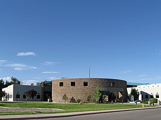
San Juan County is a county located in the U.S. state of New Mexico. As of the 2020 census, the population was 121,661 making it the fifth-most populous county in New Mexico. Its county seat is Aztec. The county was created in 1887.

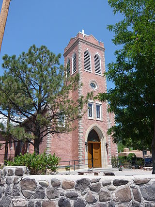
Rio Arriba County is a county in the U.S. state of New Mexico. As of the 2020 census, the population was 40,363. Its county seat is Tierra Amarilla. Its northern border is the Colorado state line.

Farmington is a city in San Juan County in the U.S. state of New Mexico. As of the 2020 census, the city had a population of 46,624 people. Farmington makes up one of the four metropolitan statistical areas (MSAs) in New Mexico.
Ohkay Owingeh, known by its Spanish name as San Juan Pueblo from 1589 to 2005, is a pueblo in Rio Arriba County, New Mexico. For statistical purposes, the United States Census Bureau has defined that community as a census-designated place (CDP). Ohkay Owingeh is also the federally recognized tribe of Pueblo people inhabiting the town.
Polvadera is an unincorporated community and census-designated place in Socorro County in central New Mexico, United States. It is located on the west bank of the Rio Grande, near the mouth of the Rio Salado, and on the western spur of El Camino Real de Tierra Adentro.

Riverside County is a county located in the southern portion of the U.S. state of California. As of the 2020 census, the population was 2,418,185, making it the fourth-most populous county in California and the 10th-most populous in the United States. The name was derived from the city of Riverside, which is the county seat.

San Diego County, officially the County of San Diego, is a county in the southwestern corner of the U.S. state of California. As of the 2020 census, the population was 3,298,634, making it California's second-most populous county and the fifth-most populous in the United States. Its county seat is San Diego, the second-most populous city in California and the eighth-most populous city in the United States. It is the southwesternmost county in the 48 contiguous United States, and is a border county. It is also home to 18 Native American tribal reservations, the most of any county in the United States.

Waterflow is an unincorporated community and census-designated place in San Juan County, New Mexico, United States on the north side of the San Juan River. It is immediately west of Fruitland and north across the river from the Navajo Nation. It is east of Shiprock.
Cedar Hill is an unincorporated community and census-designated place in San Juan County, New Mexico, United States. Its population was 847 as of the 2010 census. The community is located on U.S. Route 550, near the Colorado border. Cedar Hill was originally known as Cox's Crossing. The name was chosen during a Literacy Society meeting by picking names out of a hat. A post office operated from 1892 to 1966.
North Light Plant is an unincorporated community and census-designated place in San Juan County, New Mexico, United States. Its population was 414 as of the 2010 census. New Mexico State Road 574 passes through the community.
The state of Utah has an increasingly diverse population, home to hundreds of thousands of Hispanic/Latino people who share ancestry from Latin American countries. It is estimated that there are roughly 383,400 residents of Hispanic/Latino descent currently living in Utah.
Center Point is an unincorporated community and census-designated place (CDP) in San Juan County, New Mexico, United States. It was first listed as a CDP prior to the 2020 census.
La Boca is an unincorporated community and census-designated place (CDP) in San Juan County, New Mexico, United States. It was first listed as a CDP prior to the 2020 census.

