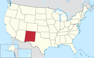
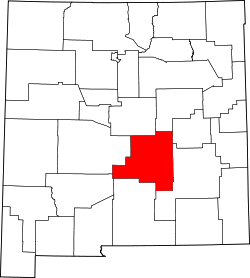
Lincoln County, New Mexico

Last updated

Lincoln County
LincolnNM Jail and Courthouse.jpg
Old Lincoln County courthouse in Lincoln
Seal of Lincoln County, New Mexico.png
Map of New Mexico highlighting Lincoln County.svg
Location within the U.S. state of New Mexico
New Mexico in United States.svg
New Mexico's location within the U.S.
Coordinates: 33°44′N105°28′W / 33.74°N 105.46°W / 33.74; -105.46
CountryFlag of the United States.svg United States
StateFlag of New Mexico.svg  New Mexico
Founded1869
Named for Abraham Lincoln [1]
Seat Carrizozo
Largest village Ruidoso
Area
  Total4,831 sq mi (12,510 km2)
  Land4,831 sq mi (12,510 km2)
  Water0.2 sq mi (0.5 km2)  0.0%%
Population
 (2020)
  Total20,269
  Density4.2/sq mi (1.6/km2)
Time zone UTC−7 (Mountain)
  Summer (DST) UTC−6 (MDT)
Congressional district 2nd
Website www.lincolncountynm.gov

Lincoln County is a county in the U.S. state of New Mexico. As of the 2020 census, the population was 20,269. [2] Its county seat is Carrizozo, [3] while its largest community is Ruidoso.

Contents

History

Lincoln County was named in honor of President Abraham Lincoln. It was once the largest county in the United States. In the late 1870s, the Lincoln County War began between ranchers and the owners of the county's largest general store. William Bonney, better known as Billy the Kid, became involved on the side of the ranchers after his friend and employer was killed. In the end, Bonney killed the county sheriff, a deputy, and the deputy that killed his friend. Several other people were slain in the conflict, which included the other leader of the rancher faction. His death ended the conflict. In 1878, the new territorial governor, retired Union General Lew Wallace, offered amnesty to the combatants to bring a long-lasting truce between the factions.

Most of the population is in the Greater Ruidoso Area. The town of Carrizozo serves as the county seat and is in the Tularosa Basin northwest of Ruidoso. Ruidoso boasts several small suburbs and neighbor communities including Ruidoso Downs, Hollywood, Mescalero, and Alto which contribute to the Ruidoso Micropolitan Statistical Area's population of 21,224. Ruidoso serves as the second largest city in south central New Mexico behind Alamogordo which is 46 miles southwest of the village. Ruidoso Downs on the southern end of the county and southeast of Ruidoso operates the Ruidoso Downs Racetrack and Casino. The track hosts both thoroughbred and quarter horse racing, notably the All American Futurity, the richest in quarter horse racing. Historical figures from Lincoln County include Billy the Kid and Smokey Bear, whose names help drive the tourism trade that is heavily popularized within the county.

Geography

According to the U.S. Census Bureau, the county has a total area of 4,831 square miles (12,510 km2), virtually all of which is land. [4]

Adjacent counties

National protected areas

Demographics

Historical population
CensusPop.Note
1910 7,822
1920 7,8230.0%
1930 7,198−8.0%
1940 8,55718.9%
1950 7,409−13.4%
1960 7,7444.5%
1970 7,560−2.4%
1980 10,99745.5%
1990 12,21911.1%
2000 19,41158.9%
2010 20,4975.6%
2020 20,269−1.1%
U.S. Decennial Census [5]
1790–1960 [6] 1900–1990 [7]
1990–2000 [8] 2010 [9]

2000 census

As of the 2000 census, [10] there were 19,411 people, 8,202 households, and 5,634 families living in the county. The population density was 4 people per square mile (1.5 people/km2). There were 15,298 housing units at an average density of 3 units per square mile (1.2/km2). The racial makeup of the county was 83.60% White, 0.35% Black or African American, 1.95% Native American, 0.27% Asian, 0.06% Pacific Islander, 11.28% from other races, and 2.48% from two or more races. 25.63% of the population were Hispanic or Latino of any race.

There were 8,202 households, out of which 26.20% had children under the age of 18 living with them, 55.60% were married couples living together, 9.30% had a female householder with no husband present, and 31.30% were non-families. 26.70% of all households were made up of individuals, and 10.00% had someone living alone who was 65 years of age or older. The average household size was 2.34 and the average family size was 2.80.

In the county, the population was spread out, with 22.70% under the age of 18, 6.00% from 18 to 24, 23.20% from 25 to 44, 30.20% from 45 to 64, and 17.90% who were 65 years of age or older. The median age was 44 years. For every 100 females there were 95.90 males. For every 100 females age 18 and over, there were 93.30 males.

The median income for a household in the county was $33,886, and the median income for a family was $40,035. Males had a median income of $27,323 versus $19,923 for females. The per capita income for the county was $19,338. About 10.80% of families and 14.90% of the population were below the poverty line, including 24.70% of those under age 18 and 8.70% of those age 65 or over.

2010 census

As of the 2010 census, there were 20,497 people, 9,219 households, and 5,859 families living in the county. [11] The population density was 4.2 inhabitants per square mile (1.6/km2). There were 17,519 housing units at an average density of 3.6 units per square mile (1.4 units/km2). [12] The racial makeup of the county was 85.1% white, 2.4% American Indian, 0.5% black or African American, 0.4% Asian, 9.2% from other races, and 2.5% from two or more races. Those of Hispanic or Latino origin made up 29.8% of the population. [11] In terms of ancestry, 17.0% were Irish, 15.6% were German, 12.3% were English, and 4.8% were American. [13]

Of the 9,219 households, 23.3% had children under the age of 18 living with them, 49.5% were married couples living together, 9.8% had a female householder with no husband present, 36.4% were non-families, and 30.5% of all households were made up of individuals. The average household size was 2.21 and the average family size was 2.72. The median age was 49.4 years. [11]

The median income for a household in the county was $43,750 and the median income for a family was $53,871. Males had a median income of $34,306 versus $29,836 for females. The per capita income for the county was $24,290. About 8.1% of families and 12.9% of the population were below the poverty line, including 20.7% of those under age 18 and 7.8% of those age 65 or over. [14]

Communities

City

Town

Villages

Census-designated place

Other communities

Ghost towns

Politics

Lincoln County is overwhelmingly Republican, voting Democratic in just 3 elections since New Mexico's founding (1912, 1932, 1936). It was one of only three counties in the state to support Barry Goldwater of neighboring Arizona in 1964, which is also the last time a Democrat managed even 40 percent of the county's vote.

United States presidential election results for Lincoln County, New Mexico [17]
Year Republican Democratic Third party
No.%No.%No.%
2020 6,94267.36%3,19430.99%1701.65%
2016 5,89666.23%2,33126.19%6757.58%
2012 5,96164.50%2,94231.83%3393.67%
2008 6,00161.89%3,53536.46%1601.65%
2004 6,07067.34%2,82231.31%1221.35%
2000 4,45865.83%2,02729.93%2874.24%
1996 3,39652.97%2,20934.46%80612.57%
1992 2,66945.57%1,73029.54%1,45824.89%
1988 3,51166.40%1,69031.96%871.65%
1984 3,99277.04%1,13421.88%561.08%
1980 3,00968.79%1,12725.77%2385.44%
1976 2,32061.64%1,41537.59%290.77%
1972 2,52877.07%69621.22%561.71%
1968 2,00464.52%80225.82%3009.66%
1964 1,76152.55%1,56546.70%250.75%
1960 2,04258.29%1,45941.65%20.06%
1956 1,95664.77%1,05935.07%50.17%
1952 2,00464.52%1,09535.25%70.23%
1948 1,57552.41%1,40646.79%240.80%
1944 1,45551.95%1,34247.91%40.14%
1940 1,79450.25%1,76349.38%130.36%
1936 1,57943.37%2,02155.51%411.13%
1932 1,17234.29%2,22565.10%210.61%
1928 1,48964.32%82135.46%50.22%
1924 1,08749.05%83737.77%29213.18%
1920 1,45657.32%1,04741.22%371.46%
1916 88949.50%86348.05%442.45%
1912 45240.11%46140.91%21418.99%

Education

School districts include: [18]

See also

Related Research Articles

<span class="mw-page-title-main">Torrance County, New Mexico</span> County in New Mexico, United States

Torrance County is a county located in the center of the U.S. state of New Mexico. As of the 2020 census, the population was 15,045. The county seat is Estancia.

<span class="mw-page-title-main">Taos County, New Mexico</span> County in New Mexico, United States

Taos County is a county in the U.S. state of New Mexico. As of the 2020 census, the population was 34,489. Its county seat is Taos. The county was formed in 1852 as one of the original nine counties in New Mexico Territory.

<span class="mw-page-title-main">Sierra County, New Mexico</span> County in New Mexico, United States

Sierra County is a county located in the U.S. state of New Mexico. As of the 2020 Census, the population was 11,576. Its county seat is Truth or Consequences.

<span class="mw-page-title-main">Roosevelt County, New Mexico</span> County in New Mexico, United States

Roosevelt County is a county located in the U.S. state of New Mexico. As of the 2020 census, the population was 19,191. Its county seat is Portales. The county was created in 1903 from Chaves and Guadalupe counties and named for the then-current President of the United States, Theodore Roosevelt. The county's eastern border is the Texas state line.

<span class="mw-page-title-main">Quay County, New Mexico</span> County in New Mexico, United States

Quay County is a county in the state of New Mexico. As of the 2020 U.S. census, the population was 8,746. Its county seat is Tucumcari. The county was named for Pennsylvania senator Matthew Quay, who supported statehood for New Mexico. Its eastern border is the Texas state line, approximately 103.04 degrees west longitude.

<span class="mw-page-title-main">Otero County, New Mexico</span> County in New Mexico, United States

Otero County is a county located in the U.S. state of New Mexico. As of the 2020 census, the population was 67,839. Its county seat is Alamogordo. Its southern boundary is the Texas state line. It is named for Miguel Antonio Otero, the territorial governor when the county was created.

<span class="mw-page-title-main">Luna County, New Mexico</span> County in New Mexico, United States

Luna County is a county located in the U.S. state of New Mexico. As of the 2010 census, the population was 25,095. Its county seat is Deming. This county abuts the Mexican border. Luna County comprises the Deming, NM Micropolitan Statistical Area.

<span class="mw-page-title-main">Lea County, New Mexico</span> County in New Mexico, United States

<span class="mw-page-title-main">Grant County, New Mexico</span> County in New Mexico, United States

Grant County is a county located in the U.S. state of New Mexico. At the 2020 census, the population was 28,185. Its county seat is Silver City. The county was founded in 1868 and named for Ulysses S. Grant, the 18th President of the United States.

<span class="mw-page-title-main">Curry County, New Mexico</span> County in New Mexico, United States

Curry County is a county located in the U.S. state of New Mexico. As of the 2020 census, its population was 48,430. Its county seat is Clovis. The county is named in honor of George Curry, territorial governor of New Mexico from 1907 to 1910.

<span class="mw-page-title-main">Chaves County, New Mexico</span> County in New Mexico, United States

Chaves County is a county in New Mexico, United States. As of the 2020 census, the population was 65,157. Its county seat is Roswell. Chaves County was named for Colonel Jose Francisco Chaves, a military leader there during the Civil War and later in Navajo campaigns. The county was created by the New Mexico Territorial Legislature on February 25, 1889, out of land from Lincoln County.

<span class="mw-page-title-main">Bernalillo County, New Mexico</span> County in New Mexico, United States

Bernalillo County is the most populous county in the U.S. state of New Mexico. As of the 2020 census, the population was 676,444. The county seat, Albuquerque, is the most populous city in New Mexico.

<span class="mw-page-title-main">St. James, Minnesota</span> City in Minnesota, United States

St. James or Saint James is a city in and the county seat of Watonwan County, Minnesota, United States. The population was 4,793 at the 2020 census.

<span class="mw-page-title-main">Ruidoso, New Mexico</span> City in New Mexico, United States

Ruidoso is a village in Lincoln County, New Mexico, United States, adjacent to the Lincoln National Forest. The population was 8,029 at the 2010 census. The city of Ruidoso Downs and the unincorporated area of Alto are suburbs of Ruidoso, and contribute to the Ruidoso Micropolitan Statistical Area's population of 21,223.

<span class="mw-page-title-main">Ruidoso Downs, New Mexico</span> City in New Mexico, United States

Ruidoso Downs is a city in Lincoln County, New Mexico, United States, located within the Lincoln National Forest. The population was 1,824 at the 2000 census and 2,815 at the 2010 census. Originally incorporated as a village, it became a city in May 2002. Known locally as "the Downs", Ruidoso Downs is a suburb of adjacent Ruidoso and is a part of the Ruidoso Micropolitan Statistical Area. The city, located along U.S. Route 70, is named after the Ruidoso Downs Race Track, which is located in the city along with the Billy the Kid Casino and the Hubbard Museum of the American West.

<span class="mw-page-title-main">Mescalero, New Mexico</span> Census-designated place in New Mexico, United States

Mescalero is a census-designated place (CDP) in Otero County, New Mexico, United States, located on the Mescalero Apache Reservation. The population was 1,338 at the 2010 census.

<span class="mw-page-title-main">Ranchos de Taos, New Mexico</span> Census-designated place in Taos County, New Mexico, United States

Ranchos de Taos is a census-designated place (CDP) in Taos County, New Mexico. The population was 2,390 at the time of the 2000 census.

<span class="mw-page-title-main">Capitan, New Mexico</span> Village in New Mexico, United States

Capitan is a village in Lincoln County, New Mexico, United States, located north of the Lincoln National Forest between the Capitan and Sacramento Mountains at an elevation of 6,350 feet. The population was 1,489 at the 2010 census. Capitan was founded in the 1890s and incorporated in 1941.

<span class="mw-page-title-main">De Baca County, New Mexico</span> County in New Mexico, United States

De Baca County is a county in the U.S. state of New Mexico. As of the 2020 census, the population was 1,698, making it New Mexico's second-least populous county. Its county seat is Fort Sumner. The county is named for Ezequiel Cabeza De Baca, the second elected Governor of New Mexico.

Glencoe is an unincorporated community in Lincoln County, New Mexico, United States. Its ZIP code is 88324.

References

  1. Gannett, Henry (1905). The Origin of Certain Place Names in the United States. U.S. Government Printing Office. p. 187.
  2. "Lincoln County, New Mexico". United States Census Bureau . Retrieved July 3, 2023.
  3. "Find a County". National Association of Counties. Retrieved June 7, 2011.
  4. "2010 Census Gazetteer Files". United States Census Bureau. August 22, 2012. Archived from the original on January 1, 2015. Retrieved January 2, 2015.
  5. "U.S. Decennial Census". United States Census Bureau. Retrieved January 2, 2015.
  6. "Historical Census Browser". University of Virginia Library. Retrieved January 2, 2015.
  7. "Population of Counties by Decennial Census: 1900 to 1990". United States Census Bureau. Retrieved January 2, 2015.
  8. "Census 2000 PHC-T-4. Ranking Tables for Counties: 1990 and 2000" (PDF). United States Census Bureau. Archived (PDF) from the original on March 27, 2010. Retrieved January 2, 2015.
  9. "State & County QuickFacts". United States Census Bureau. Archived from the original on June 6, 2011. Retrieved September 29, 2013.
  10. "U.S. Census website". United States Census Bureau . Retrieved January 31, 2008.
  11. 1 2 3 "DP-1 Profile of General Population and Housing Characteristics: 2010 Demographic Profile Data". United States Census Bureau. Archived from the original on February 13, 2020. Retrieved January 24, 2016.
  12. "Population, Housing Units, Area, and Density: 2010 – County". United States Census Bureau. Archived from the original on February 13, 2020. Retrieved January 24, 2016.
  13. "DP02 Selected Social Characteristics in the United States – 2006–2010 American Community Survey 5-Year Estimates". United States Census Bureau. Archived from the original on February 13, 2020. Retrieved January 24, 2016.
  14. "DP03 Selected Economic Characteristics in the United States – 2006–2010 American Community Survey 5-Year Estimates". United States Census Bureau. Archived from the original on February 13, 2020. Retrieved January 24, 2016.
  15. "Ruidoso-NM.gov | Municipal Website of the Village of Ruidoso, NM". Ruidoso-NM.gov | Municipal Website of the Village of Ruidoso, NM.
  16. "Alto".
  17. Leip, David. "Dave Leip's Atlas of U.S. Presidential Elections". uselectionatlas.org. Retrieved April 1, 2018.
  18. "2020 CENSUS - SCHOOL DISTRICT REFERENCE MAP: Lincoln County, NM" (PDF). U.S. Census Bureau. Archived (PDF) from the original on September 5, 2022. Retrieved September 5, 2022. - Text list

33°44′N105°28′W / 33.74°N 105.46°W / 33.74; -105.46