Carrizozo, New Mexico

Last updated

Carrizozo, New Mexico
Carrizozo 06.jpg
Downtown Carrizozo
Nickname: 
'Zozo
Lincoln County New Mexico Incorporated and Unincorporated areas Carrizozo Highlighted.svg
Location of Carrizozo, New Mexico
Usa edcp location map.svg
Red pog.svg
Carrizozo, New Mexico
Location in the United States
Coordinates: 33°38′38″N105°52′39″W / 33.64389°N 105.87750°W / 33.64389; -105.87750
Country United States
State New Mexico
County Lincoln
Area
[1]
  Total8.36 sq mi (21.66 km2)
  Land8.36 sq mi (21.66 km2)
  Water0.00 sq mi (0.00 km2)
Elevation
5,429 ft (1,657 m)
Population
 (2020) [2]
  Total972
  Density116.25/sq mi (44.88/km2)
Time zone UTC−7 (Mountain (MST))
  Summer (DST) UTC−6 (MDT)
ZIP Code
88301
Area code 575
FIPS code 35-12500
GNIS feature ID0918425
Website www.carrizozonm.us

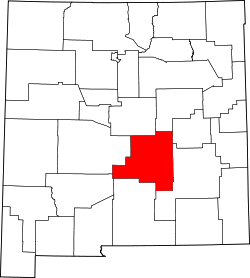
Carrizozo is a town in Lincoln County, New Mexico, United States. It is the county seat, with a population of 996 at the 2010 census. [3] Founded in 1899, the town provided the main railroad access for Lincoln County, and the town experienced significant population growth in the early decades of the 1900s. However, with declining relevance of the railroad, the population of the town has gradually declined. The town is located at the intersection of U.S. Routes 54 and 380.

Contents

Name

The name of the town is derived from the Spanish vernacular for reed grass ( Carrizo ), which grew significantly in the area and provided excellent feed for ranch cattle. The additional "zo" at the end of the town name was added to indicate abundance of Carrizo grass. [4] The town is now often referred to colloquially as "Zozo". [5]

History

Official scenic historical marker at eastern town limit Carrizozo.JPG
Official scenic historical marker at eastern town limit

Prior to 1899, the area was primarily a few ranches and a stagecoach crossing with limited permanent settlement. [6] Lawrence Murphy, a merchant active in the Lincoln County War (1878), owned a major ranch in the area. [7] [8] The location of Carrizozo was selected as the site for a station on the El Paso and Northeastern Railway (EP&NE) main line in 1899. Carrizozo was chosen over the nearby booming mine town of White Oaks, resulting in large-scale migration from White Oaks to Carrizozo. [9]

The railroad brought businesses, growing population, and increased importance to the town of Carrizozo. As a result, a county referendum in 1909 moved the seat of Lincoln County from the town of Lincoln to Carrizozo. [6] This decision resulted in a four-year legal battle that was eventually resolved in favor of Carrizozo by the Supreme Court of the United States in the case of Gray v. Taylor. [10] The result was a boom in which railroad access and political importance combined to lead to significant population growth in Carrizozo. The population reached around 2,000 by 1920. [4]

During this time, Albert B. Fall, a U.S. Senator from New Mexico and later Secretary of the Interior, owned the Three Rivers Ranch just south of Carrizozo, but had to sell it to settle legal debts as a result of his involvement in the Teapot Dome scandal (1922–1923). [11] During the same time, journalist Quentin Reynolds visited the town and wrote a piece on it for Collier's . Later, he wrote in The Wounded Don't Cry that "I used to agree with Bugs that once you left New York, you were strictly on the horse and buggy circuit. But of late years I've had to modify that. Since then I've discovered New Orleans, San Francisco and a little place called Carrizozo, New Mexico, where I want to go when I die. I want to go there and gang around the drug store and sneak behind the prescription counter with Art Rolland and have a nip of what he calls Old Granddaddy then type out his prescriptions for him." [12]

Carrizozo is about 35 miles (56 km) east of the Trinity Site, where the first nuclear bomb was detonated on July 16, 1945. Residents reported tremors like an earthquake and, as the first major downwind settlement, the town received a significant part of the remnants of the mushroom cloud resulting in nuclear fallout of the area, which caused radioactive contamination. [13] [ page needed ] Bonito Lake which also lies within the estimated radioactive fallout zone of the 1945 Trinity test, was a water source for Carrizozo. [14]

With the rise of the automobile, Carrizozo's proximity to the railroad became less important starting in the 1950s, and the last passenger train passed through in 1968. [6] The result was a decrease in economic opportunity in Carrizozo, and the population fell back to about 1,200 people for much of the end of the 20th century. [15] Recently, the town has seen increasing focus on tourism, and cherry cider produced in the town is known nationally. [16] [4]

Geography

The Carrizozo Malpais is the long dark streak across the bottom half of the image. The red arrowhead marks the location of Trinity site. Credit: NASA Astronaut photograph ISS008-E-5604, taken at an altitude of 198 miles. TrinitySiteISS008-E-5604.jpg
The Carrizozo Malpais is the long dark streak across the bottom half of the image. The red arrowhead marks the location of Trinity site. Credit: NASA Astronaut photograph ISS008-E-5604, taken at an altitude of 198 miles.

Carrizozo is located at the northern end of the Tularosa Basin, which extends southward to the New Mexico–Texas border. The town itself is located in a flat area known prior to the founding of the town as the Corrizo flats, with typical Chihuahuan desert scrub and desert grasslands. [16] [17]

To the west of the town is the Carrizozo Malpais, a 40-mile-long (64 km) lava flow that is about 1,500 years old and accessible through the Valley of Fires Recreation Area. [18] To the northeast is Carrizo Mountain, a 9,600-foot (2,900 m) peak within the Sacramento Mountains, and to the southeast are the Sierra Blanca mountain range.

Climate

Carrizozo, New Mexico
Climate chart (explanation)
JFMAMJJASOND
 
 
0.6
 
 
55
25
 
 
0.7
 
 
56
26
 
 
0.7
 
 
63
30
 
 
0.5
 
 
72
37
 
 
0.7
 
 
85
47
 
 
1.1
 
 
96
59
 
 
2.1
 
 
95
55
 
 
2.4
 
 
87
54
 
 
1.5
 
 
82
51
 
 
1.4
 
 
72
40
 
 
0.6
 
 
60
28
 
 
0.9
 
 
55
25

Average max. and min. temperatures in °F

Precipitation totals in inches

Metric conversion
JFMAMJJASOND
 
 
16
 
 
13
4
 
 
17
 
 
13
3
 
 
18
 
 
17
1
 
 
14
 
 
22
3
 
 
17
 
 
29
8
 
 
28
 
 
36
15
 
 
53
 
 
35
13
 
 
60
 
 
31
12
 
 
39
 
 
28
11
 
 
37
 
 
22
4
 
 
15
 
 
16
2
 
 
23
 
 
13
4

Average max. and min. temperatures in °C

Precipitation totals in mm

Demographics

Historical population
CensusPop.Note
1920 1,301
1930 1,171−10.0%
1940 1,45724.4%
1950 1,389−4.7%
1960 1,54611.3%
1970 1,123−27.4%
1980 1,2228.8%
1990 1,075−12.0%
2000 1,036−3.6%
2010 996−3.9%
2020 972−2.4%
U.S. Decennial Census [19] [2]

As of the 2010 census, [20] there were 996 people living in the town. The racial makeup of the town was 78.71% White, 0.70% African American, 2.61% American Indian, 14.16% Other, and 3.82% identified as two or more. Hispanics of any race were 43.57% of the population. Of the population, 54.72% were men and 45.28% were women. Of these, 15.96% were under the age of 18, 24.50% were over 65, and 59.54% were between 18 and 65.

Transportation

Carrizozo is located at the intersection of U.S. Routes 54 and 380.

Railroad freight traffic is provided by Union Pacific.

For general aviation, the town is served by Carrizozo Municipal Airport.

Education

Carrizozo Municipal Schools is the local school district. [21]

Points of interest

The Carrizozo Women's Club Carrizozo New Mexico Woman's Club building.jpg
The Carrizozo Women's Club

Film and television

A number of movies have been filmed in Carrizozo. Movies which have been filmed at least partially in Carrizozo include: [23]

Notable people

Related Research Articles

<span class="mw-page-title-main">Roswell, New Mexico</span> City in New Mexico, United States

Roswell is a city in and the seat of Chaves County, New Mexico, United States. As of the 2020 census it had a population of 48,422, making it the fifth-most populous city in New Mexico. It is home of the New Mexico Military Institute (NMMI), founded in 1891. The city is also the location of an Eastern New Mexico University campus. Bitter Lake National Wildlife Refuge is located a few miles northeast of the city on the Pecos River. Bottomless Lakes State Park is located 12 miles (19 km) east of Roswell on US 380. Chaves County forms the entirety of the Roswell micropolitan area.

<span class="mw-page-title-main">Albuquerque, New Mexico</span> City in New Mexico, United States

Albuquerque, also known as ABQ, Burque, and the Duke City, is the most populous city in the U.S. state of New Mexico. Founded in 1706 as La Villa de Alburquerque by Santa Fe de Nuevo México governor Francisco Cuervo y Valdés, and named in honor of Francisco Fernández de la Cueva, 10th Duke of Alburquerque and Viceroy of New Spain, it served as an outpost on El Camino Real linking Mexico City to the northernmost territories of New Spain.

<span class="mw-page-title-main">Lincoln County, New Mexico</span> County in New Mexico, United States

Lincoln County is a county in the U.S. state of New Mexico. As of the 2020 census, the population was 20,269. Its county seat is Carrizozo, while its largest community is Ruidoso.

<span class="mw-page-title-main">Santa Rosa, New Mexico</span> City in New Mexico, United States

Santa Rosa is a city in and the county seat of Guadalupe County, New Mexico, United States. The population was 2,848 at the 2010 census. It lies between Albuquerque and Tucumcari, situated on the Pecos River at the intersection of Interstate 40 and U.S. Route 54 and 84. The city is located on the western edge of the Llano Estacado or "staked plains" of eastern New Mexico and west Texas.

<span class="mw-page-title-main">Ruidoso, New Mexico</span> City in New Mexico, United States

Ruidoso is a village in Lincoln County, New Mexico, United States, adjacent to the Lincoln National Forest. The population was 8,029 at the 2010 census. The city of Ruidoso Downs and the unincorporated area of Alto are suburbs of Ruidoso, and contribute to the Ruidoso Micropolitan Statistical Area's population of 21,223.

<span class="mw-page-title-main">Ruidoso Downs, New Mexico</span> City in New Mexico, United States

Ruidoso Downs is a city in Lincoln County, New Mexico, United States, located within the Lincoln National Forest. The population was 1,824 at the 2000 census and 2,815 at the 2010 census. Originally incorporated as a village, it became a city in May 2002. Known locally as "the Downs", Ruidoso Downs is a suburb of adjacent Ruidoso and is a part of the Ruidoso Micropolitan Statistical Area. The city, located along U.S. Route 70, is named after the Ruidoso Downs Race Track, which is located in the city along with the Billy the Kid Casino and the Hubbard Museum of the American West.

<span class="mw-page-title-main">Farmington, New Mexico</span> City in New Mexico, United States

Farmington is a city in San Juan County in the U.S. state of New Mexico. As of the 2020 census, the city had a population of 46,624 people. Farmington makes up one of the four metropolitan statistical areas (MSAs) in New Mexico.

<span class="mw-page-title-main">Edgewood, New Mexico</span> Town in New Mexico, United States

Edgewood is a town in Santa Fe County, New Mexico, United States. Through annexations, its town boundaries now extend into Bernalillo and Sandoval counties. It is part of the Albuquerque–Santa Fe–Las Vegas combined statistical area.

<span class="mw-page-title-main">Clayton, New Mexico</span> Town in New Mexico, United States

Clayton is a town and county seat of Union County, New Mexico, United States. As of the 2010 census, the city population was 2,980.

<span class="mw-page-title-main">Carrizo Springs, Texas</span> City in Texas, United States

Carrizo Springs is the largest city in and the county seat of Dimmit County, Texas, United States. The population was 5,368 at the 2010 census..

<span class="mw-page-title-main">San Antonio, New Mexico</span>

San Antonio is a census-designated place in Socorro County, New Mexico, United States, roughly in the center of the state, on the Rio Grande. The entire population of the county is approximately 18,000.

<span class="mw-page-title-main">Rio Rancho, New Mexico</span> City in New Mexico, United States

Rio Rancho is the largest and most populous city in Sandoval County, part of the expansive Albuquerque metropolitan area, in the U.S. state of New Mexico. A small portion of the city extends into northern Bernalillo County.

<span class="mw-page-title-main">Lincoln National Forest</span> National forest in New Mexico, United States

Lincoln National Forest is a unit of the U.S. Forest Service located in southern New Mexico. The Lincoln National Forest covers an extensive 1.1 million acres in southeastern New Mexico. Established by Presidential Proclamation in 1902 as the Lincoln Forest Reserve, the 1,103,897 acres (4,467.31 km2) forest begins near the Texas border and contains lands in parts of Chaves, Eddy, Lincoln, and Otero counties. The Lincoln National Forest is home to three major mountain ranges: Sacramento, Guadalupe and Capitan. The three Ranger Districts within the forest contain all or part of a total of four mountain ranges, and include a variety of different environmental areas, from desert to heavily forested mountains and sub-alpine grasslands. Clean air, water, and soil are necessary elements that the National Forests contribute to the environment. Established to balance conservation, resource management, and recreation, the lands of the Lincoln National Forest include important local timber resources, protected wilderness areas, and popular recreation and winter sports areas. The forest headquarters is located in Alamogordo, N.M. with local offices in Carlsbad, Cloudcroft, and Ruidoso.

State Road 37 (NM 37) is a 14.162-mile-long (22.792 km) state road that runs north-south through the Sacramento Mountains, which are part of the Lincoln National Forest in Lincoln County, in the U.S. state of New Mexico. Its southern terminus is at NM 48 several miles north of the town of Ruidoso and its northern terminus is at U.S. Route 380 (US 380) several miles west of the Town of Capitan.

San Patricio is a very small community in Lincoln County, in the U.S. state of New Mexico. It is located on the Rio Ruidoso and U.S. Highway 70, between the communities of Hondo and Glencoe. It is just east of the Lincoln National Forest.

Hondo is an unincorporated community in Lincoln County, New Mexico, United States. It is located about thirty-five miles downstream (east) from Ruidoso Downs, where the Rio Bonito and Rio Ruidoso rivers join together to form the Rio Hondo. It is located at the point where U.S. Route 70 is joined by U.S. Route 380, which conjoined route continues eastward. It has had a post office since 1900.

<span class="mw-page-title-main">Nutt, New Mexico</span> Unincorporated community in New Mexico, United States

Nutt is an unincorporated community in Luna County, southern New Mexico, in the American Southwest. It is located nineteen miles southwest of Hatch on NM 26 at the intersection with NM 27.

Nogal is a census-designated place and unincorporated community in Lincoln County, New Mexico, United States. Its population was 96 as of the 2010 census. Nogal has a post office with ZIP code 88341, which opened on November 9, 1880.

Glencoe is an unincorporated community in Lincoln County, New Mexico, United States. Its ZIP code is 88324.

Carrizozo Municipal School District is a school district headquartered in Carrizozo, New Mexico. It operates three schools: Carrizozo Elementary School, Carrizozo Middle School, and Carrizozo High School.

References

  1. "ArcGIS REST Services Directory". United States Census Bureau. Retrieved October 12, 2022.
  2. 1 2 "Census Population API". United States Census Bureau. Retrieved October 12, 2022.
  3. "Total Population: 2010 Census DEC Summary File 1 (P1), Carrizozo town, New Mexico". data.census.gov. U.S. Census Bureau. Retrieved May 13, 2020.
  4. 1 2 3 Banks, Phyllis Eileen. "Carrizozo – named for reed grass". Southern New Mexico. Archived from the original on January 20, 2012. Retrieved September 1, 2012.
  5. LeDuc, Eric (August 23, 2012). "Cowboy Days, 'Zozo Fair Returns for Labor Day". Ruidoso News. Archived from the original on November 4, 2014.
  6. 1 2 3 Cosentino, Stew (2010). History of New Mexico: Land of the Brave, Land of the Slaves. Bloomington, IN: iUniverse.
  7. Drago, Harry Sinclair (1970). The Great Range Wars: Violence on the Plains. New York: Dodd & Mead. ISBN   0803265638.
  8. Mullin, Robert N. (1966). "The Life and Death of John Henry Tunstall". Journal of the Southwest. 8 (2): 181.
  9. Dietrich, Bruce M. "Carrizozo". New Mexico Office of the State Historian. Archived from the original on October 7, 2010. Retrieved September 1, 2012.
  10. Gray v. Taylor.
  11. Pike, David (2004). Roadside New Mexico: A Guide to Historical Markers. Albuquerque, NM: University of New Mexico Press.
  12. Reynolds, Quentin (1941). The Wounded Don't Cry. p. 103. ISBN   9781419159640.
  13. Szasz, Ferenc Morton (1984). The Day the Sun Rose Twice . Albuquerque, NM: University of New Mexico Press. The Day the Sun Rose Twice.
  14. "U.S. lawmakers move urgently to recognize survivors of the first atomic bomb test". National Geographic. September 21, 2021. Archived from the original on September 21, 2021. Retrieved August 2, 2023.
  15. "Lincoln County Comprehensive Plan" (PDF). Lincoln County. Retrieved September 5, 2012.
  16. 1 2 Heim, Michael (2007). Exploring New Mexico Highways. Wabasha, MN: Travel Organization Network Organization. ISBN   9780974435817.
  17. Dick-Peddie, William (1993). New Mexico Vegetation: Past, Present, and Future. University of New Mexico Press: Albuquerque, NM.
  18. "Valley of Fires Recreation Area, Carrizozo, New Mexico" Retrieved January 30, 2010.
  19. "Census of Population and Housing". Census.gov. Archived from the original on March 2, 2013. Retrieved June 4, 2015.
  20. U.S. Census Bureau. "2010 Population Finder" . Retrieved September 3, 2012.
  21. "2020 CENSUS - SCHOOL DISTRICT REFERENCE MAP: Lincoln County, NM" (PDF). U.S. Census Bureau . Retrieved September 5, 2022.
  22. Carrizozo Women's Club
  23. "Film Carrizozo". Carrizozo Chamber of Commerce. Archived from the original on October 21, 2012. Retrieved September 4, 2012.
  24. Simmons, Marc (2005). New Mexico Maverics. Santa Fe, New Mexico: Sunstone Press. ISBN   9780865345003.
  25. Maue, Lisa (August 10, 2016). "Artist profile: A graphic journey with cartoonist, illustrator and author Rick Geary". Ruidoso News .