Mosquero, New Mexico

Last updated

Mosquero, New Mexico
Mosquero Water Tower.JPG
Harding County New Mexico Incorporated and Unincorporated areas Mosquero Highlighted.svg
Location of Mosquero, New Mexico
Usa edcp relief location map.png
Red pog.svg
Mosquero, New Mexico
Location in the United States
Coordinates: 35°46′28″N103°57′16″W / 35.77444°N 103.95444°W / 35.77444; -103.95444
Country United States
State New Mexico
Counties Harding, San Miguel
Area
[1]
  Total1.00 sq mi (2.58 km2)
  Land1.00 sq mi (2.58 km2)
  Water0.00 sq mi (0.00 km2)
Elevation
[2]
5,584 ft (1,702 m)
Population
 (2020) [3]
  Total98
  Density98.20/sq mi (37.92/km2)
Time zone UTC-7 (Mountain (MST))
  Summer (DST) UTC-6 (MDT)
ZIP code
87733
Area code 575
FIPS code 35-50300
GNIS feature ID2413574 [2]
Websitewww.villageofmosquero.com/

Mosquero is a village in Harding and San Miguel counties in the U.S. state of New Mexico. The population was 93 at the 2010 census, [4] down from 120 in 2000. It is the county seat of Harding County; [5] only a small portion of the village extends into San Miguel County.

Contents

Geography

New Mexico State Road 39 passes through the village, leading southeast 50 miles (80 km) to Logan and northwest 18 miles (29 km) to Roy.

According to the United States Census Bureau, the village has a total area of 1.0 square mile (2.6 km2), all land. [4]

History

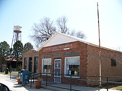
The site was a water stop along the Dawson Railway, built in 1902 from Tucumcari to Dawson. [6] The name in Spanish translates as "swarm of flies", reputedly from the flies that were drawn to carcasses of bison hunted by local native tribes. The village was founded in 1908 by Benjamin Brown, and a post office was established here in that year. [7]

The community developed as a farming and stock-raising and shipping point, with a dry ice plant, using carbon dioxide from local wells drilled into the Bravo Dome carbon dioxide gas field, which lies beneath Harding and Union counties. The railroad, absorbed into the Southern Pacific, was removed in 1950 and the population dwindled after the dry ice plant was destroyed. [8]

Demographics

Historical population
CensusPop.Note
1930 401
1940 74285.0%
1950 583−21.4%
1960 310−46.8%
1970 244−21.3%
1980 197−19.3%
1990 164−16.8%
2000 120−26.8%
2010 93−22.5%
2020 985.4%
U.S. Decennial Census [9] [3]

As of the census [10] of 2000, there were 120 people, 60 households, and 33 families residing in the village. The population density was 120.8 people per square mile (46.6 people/km2). There were 86 housing units at an average density of 86.5 per square mile (33.4/km2). The racial makeup of the village was 70.00% White, 25.83% from other races, and 4.17% from two or more races. Hispanic or Latino of any race were 77.50% of the population.

There were 60 households, out of which 16.7% had children under the age of 18 living with them, 45.0% were married couples living together, 8.3% had a female householder with no husband present, and 45.0% were non-families. 41.7% of all households were made up of individuals, and 23.3% had someone living alone who was 65 years of age or older. The average household size was 2.00 and the average family size was 2.76.

In the village, the population was spread out, with 17.5% under the age of 18, 4.2% from 18 to 24, 20.0% from 25 to 44, 31.7% from 45 to 64, and 26.7% who were 65 years of age or older. The median age was 51 years. For every 100 females, there were 114.3 males. For every 100 females age 18 and over, there were 110.6 males.

The median income for a household in the village was $25,000, and the median income for a family was $32,917. Males had a median income of $19,167 versus $16,250 for females. The per capita income for the village was $11,915. There were 14.6% of families and 21.6% of the population living below the poverty line, including 41.4% of under eighteens and 22.2% of those over 64.

Notable person

See also

Flag of New Mexico.svg New Mexicoportal

Related Research Articles

<span class="mw-page-title-main">Union County, New Mexico</span> County in New Mexico, United States

Union County is the easternmost county in the U.S. state of New Mexico. As of the 2020 census, the population was 4,079, making it the fourth-least populous county in New Mexico. Its county seat is Clayton. The county was formed in 1894. Union County borders Colorado to the north, and Oklahoma and Texas to the east.

<span class="mw-page-title-main">San Miguel County, New Mexico</span> County in New Mexico, United States

San Miguel County is a county in the U.S. state of New Mexico. As of the 2020 census, the population was 27,201. Its county seat is Las Vegas.

<span class="mw-page-title-main">Mora County, New Mexico</span> County in New Mexico, United States

Mora County is a county in the U.S. state of New Mexico. As of the 2020 census, the population was 4,189. Its county seat is the census-designated place (CDP) Mora. The county has another CDP, Watrous, a village, Wagon Mound, and 12 smaller unincorporated settlements. Mora became a formal county in the US, in what was then the New Mexico Territory, on February 1, 1860. Ecclesiastically, the county is within the Roman Catholic Archdiocese of Santa Fe. County population peaked at approximately 14,000 circa 1920, declining to about 4,000 to 5,000 since the 1970s; the 2018 estimate was 4,506.

<span class="mw-page-title-main">Harding County, New Mexico</span> County in New Mexico, United States

Harding County is a county in the U.S. state of New Mexico. As of the 2020 census, the population was 657, making it the least populous county in the state, and the 13th-smallest county by population in the United States. Its county seat is Mosquero. The county is named for United States President Warren G. Harding, and was created on the day of his inauguration as president on March 4, 1921, making him the most recent president to have a county in any state named after him.

<span class="mw-page-title-main">Grant County, New Mexico</span> County in New Mexico, United States

Grant County is a county located in the U.S. state of New Mexico. At the 2020 census, the population was 28,185. Its county seat is Silver City. The county was founded in 1868 and named for Ulysses S. Grant, the 18th President of the United States.

<span class="mw-page-title-main">Colfax County, New Mexico</span> County in New Mexico, United States

Colfax County is a county in the U.S. state of New Mexico. As of the 2020 census, the population was 12,387. Its county seat is Raton. It is south from the Colorado state line. This county was named for Schuyler Colfax (1823–1885), seventeenth Vice President of the United States under U.S. President Ulysses S. Grant.

<span class="mw-page-title-main">Westwood, Missouri</span> Village in Missouri, United States

Westwood is a village in west St. Louis County, Missouri, United States. The population was 316 at the 2020 census.

<span class="mw-page-title-main">Dawson, Nebraska</span> Village in Richardson County, Nebraska, United States

Dawson is a village in Richardson County, Nebraska, United States. The population was 148 at the 2020 census.

<span class="mw-page-title-main">Milan, New Mexico</span> Village in New Mexico, United States

Milan is a village in Cibola County, New Mexico, United States. The population was 3,245 at the 2010 census.

<span class="mw-page-title-main">Maxwell, New Mexico</span> Village in New Mexico, United States

Maxwell is a village in Colfax County, New Mexico, United States. The population was 254 at the 2010 census, down from 274 in 2000. Maxwell was established in 1879 as a railroad town on the Atchison, Topeka and Santa Fe Railway. It was named in honor of Lucien Maxwell, who provided the land for the original townsite from his Maxwell Land Grant.

<span class="mw-page-title-main">Springer, New Mexico</span> Town in New Mexico, United States

Springer is a town in Colfax County, New Mexico, United States. Its population was 1,047 at the 2010 census.

<span class="mw-page-title-main">Fort Sumner, New Mexico</span> Village and county seat in De Baca County, New Mexico, United States

Fort Sumner is a village in and the county seat of De Baca County, New Mexico, United States. The population was 1,031 at the 2010 U.S. Census, down from the figure of 1,249 recorded in 2000. Fort Sumner is the spring and fall home of the Columbia Scientific Balloon Facility.

<span class="mw-page-title-main">Hope, New Mexico</span> Village in New Mexico, United States

Hope is a village in Eddy County, New Mexico, United States. It is located approximately 20 miles (32 km) west of Artesia on U.S. Route 82. It has had a post office since 1890. As of the 2010 census, the village's population was 105.

<span class="mw-page-title-main">Roy, New Mexico</span> Village in New Mexico, United States

Roy is a village in Harding County, New Mexico, United States. The population was 192 in the 2020 census.

<span class="mw-page-title-main">Cloudcroft, New Mexico</span> Village in Otero County, New Mexico, United States

Cloudcroft is a village in Otero County, New Mexico, United States, and is located within the Lincoln National Forest. The population was 750 at the 2020 census.

<span class="mw-page-title-main">Chama, New Mexico</span> Village in New Mexico, United States

Chama is a village in Rio Arriba County, New Mexico, United States. The population was 917 at the 2020 census. The village is located in the Rocky Mountains about 7 miles (11 km) south of the Colorado-New Mexico border.

<span class="mw-page-title-main">Dulce, New Mexico</span> Census-designated place in New Mexico, United States

Dulce is a census-designated place (CDP) in Rio Arriba County, New Mexico, United States. The population was 2,743 at the 2010 census, almost entirely Native American. It is the largest community and tribal headquarters of the Jicarilla Apache Reservation.

<span class="mw-page-title-main">Cuyamungue, New Mexico</span> Census-designated place in New Mexico, United States

Cuyamungue is a census-designated place (CDP) in Santa Fe County, New Mexico, United States. It is part of the Santa Fe, New Mexico Metropolitan Statistical Area. The population was 479 at the 2010 census.

<span class="mw-page-title-main">New London, Ohio</span> Village in Ohio, United States

New London is a village in Huron County, Ohio, United States. The population was 2,416 at the 2020 census.

<span class="mw-page-title-main">Dawson, Pennsylvania</span> Borough in Pennsylvania, United States

Dawson is a borough in Fayette County, Pennsylvania, United States. The population was 352 at the 2020 census, a decline from the figure of 367 tabulated in 2010.

References

  1. "ArcGIS REST Services Directory". United States Census Bureau. Retrieved October 12, 2022.
  2. 1 2 U.S. Geological Survey Geographic Names Information System: Mosquero, New Mexico
  3. 1 2 "Census Population API". United States Census Bureau. Retrieved October 12, 2022.
  4. 1 2 "Geographic Identifiers: 2010 Census Summary File 1 (G001): Mosquero village, New Mexico". American Factfinder. U.S. Census Bureau. Archived from the original on February 13, 2020. Retrieved August 24, 2017.
  5. "Find a County". National Association of Counties. Retrieved June 7, 2011.
  6. Myrick, David, ‘’New Mexico’s Railroads, A Historic Survey’’, University of New Mexico Press 1990. ISBN   0-8263-1185-7
  7. Pearce, T.M., editor, New Mexico Place Names, A Geographical Dictionary, University of New Mexico Press 1965. ISBN   0-8263-0082-0
  8. https://www.villageofmosquero.com/ [ bare URL ]
  9. "Census of Population and Housing". Census.gov. Retrieved June 4, 2015.
  10. "U.S. Census website". United States Census Bureau . Retrieved January 31, 2008.

Commons-logo.svg Media related to Mosquero, New Mexico at Wikimedia Commons