Conchas Dam, New Mexico

Last updated

Conchas Dam, New Mexico
Conchas Dam CDP April 2022.jpg
Aerial view of Conchas Dam
USA New Mexico location map.svg
Red pog.svg
Conchas Dam, New Mexico
Coordinates: 35°22′10″N104°12′12″W / 35.36944°N 104.20333°W / 35.36944; -104.20333
Country United States
State New Mexico
County San Miguel
Area
[1]
  Total10.10 sq mi (26.15 km2)
  Land8.32 sq mi (21.56 km2)
  Water1.77 sq mi (4.59 km2)
Elevation
[2]
4,229 ft (1,289 m)
Population
 (2020) [3]
  Total194
  Density23.30/sq mi (9.00/km2)
Time zone UTC-7 (Mountain (MST))
  Summer (DST) UTC-6 (MDT)
ZIP code
88416 [4]
Area code 575
GNIS feature ID2629107 [2]

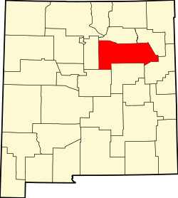
Conchas Dam is a census-designated place in San Miguel County, New Mexico, United States. As of the 2010 census, its population was 186. [5]

It includes the Conchas Dam Historic District, which is listed on the National Register of Historic Places. It is on the Canadian River.

Demographics

Historical population
CensusPop.Note
2020 194
U.S. Decennial Census [6] [3]

Related Research Articles

<span class="mw-page-title-main">Zapata County, Texas</span> County in Texas, United States

Zapata County is a county located in the U.S. state of Texas. As of the 2020 census, its population was 13,889. Its county seat is Zapata. The county is east of the Mexico–United States border and is named for Colonel José Antonio de Zapata, a rancher in the area who rebelled against Mexico.

<span class="mw-page-title-main">San Miguel County, New Mexico</span> County in New Mexico, United States

San Miguel County is a county in the U.S. state of New Mexico. As of the 2020 census, the population was 27,201. Its county seat is Las Vegas.

<span class="mw-page-title-main">Isleta Village Proper, New Mexico</span> Census-designated place in New Mexico, United States

Isleta Village Proper or Isleta is a census-designated place (CDP) in Bernalillo County, New Mexico, United States. The population was 491 at the 2010 census. It is part of the Albuquerque Metropolitan Statistical Area.

<span class="mw-page-title-main">Cochiti, New Mexico</span> CDP in New Mexico, United States

Cochiti is a census-designated place (CDP) in Sandoval County, New Mexico, United States. A historic pueblo of the Cochiti people, one of the Keresan Nations, it is part of the Albuquerque Metropolitan Statistical Area. The population was 528 at the 2010 census. Located 22 miles (35 km) southwest of Santa Fe, the community is listed as a historic district on the National Register of Historic Places.

<span class="mw-page-title-main">Zia Pueblo, New Mexico</span> CDP in New Mexico, United States

Zia Pueblo is a census-designated place (CDP) in Sandoval County, New Mexico, United States. The population was 646 at the 2000 census, with 310 males and 336 females. The pueblo after which the CDP is named is included within the CDP; it is listed on the National Register of Historic Places.

<span class="mw-page-title-main">North Charleroi, Pennsylvania</span> Borough in Pennsylvania, United States

North Charleroi is a borough in Washington County, Pennsylvania, United States. The population was 1,302 at the 2020 census.

<span class="mw-page-title-main">Concho, Arizona</span> CDP in Apache County, Arizona

Concho is an unincorporated community and census-designated place (CDP) in Apache County, Arizona, United States. Concho is located on Arizona State Route 61, 14 miles (23 km) west of St. Johns. Concho was the original site for the state capital, due to its prosperous farming. As of the 2010 census, the Concho CDP had a population of 38.

Bluewater Village is a census-designated place in Cibola County, New Mexico, United States. Its population in 2010 was 628.

Faywood is a census-designated place in Grant County, New Mexico, United States. Its population was 33 as of the 2010 census. Faywood has a post office with ZIP code 88034. It is located 3 miles (4.8 km) north of US 180 on NM 61.

<span class="mw-page-title-main">San Fidel, New Mexico</span> Census-designated place in New Mexico, United States

San Fidel is a census-designated place in Cibola County, New Mexico, United States. Its population was 138 as of the 2010 census. San Fidel has a post office with ZIP code 87049, which opened on December 24, 1910. New Mexico State Road 124, the original Route 66, also known as the "Old Road," passes through the community.

Lumberton is a census-designated place in Rio Arriba County, New Mexico, United States. Its population was 73 as of the 2010 census. U.S. Route 64 passes through the community.

Canjilon is a census-designated place in Rio Arriba County, New Mexico, United States. Its population was 256 as of the 2010 census. Canjilon has a post office with ZIP code 87515. The community is located along New Mexico State Road 115. Canjilon was first settled in 1870, and by 1880, 35 families lived here.

<span class="mw-page-title-main">Newkirk, New Mexico</span> Census-designated place in New Mexico, United States

Newkirk is a village in Guadalupe County, New Mexico, United States. The community is located at the junction of Interstate 40 and New Mexico State Road 129; historic U.S. Route 66 also passes through the community. Its population was 7 as of the 2010 census. Newkirk has a post office serving ZIP Code 88431, and a service station. It is part of the Newkirk Census Designated Place (CDP).

Navajo Dam is a census-designated place in San Juan County, New Mexico, United States. Its population was 253 as of the 2020 census. Navajo Dam has a post office with ZIP code 87419. The community is located in the vicinity of Navajo Dam.

<span class="mw-page-title-main">Whites City, New Mexico</span> Census-designated place in New Mexico, United States

Whites City also spelled White's City, is a census-designated place and unincorporated community in Eddy County, New Mexico, United States. Whites City has a post office with ZIP code 88268.

Caballo is a census-designated place in Sierra County, New Mexico, United States. Its population was 112 as of the 2010 census. Caballo has a post office with ZIP code 87931. The community is located along New Mexico State Road 187, north and south of Exit 63 on Interstate 25.

Anzac Village is a census-designated place (CDP) in Cibola County, New Mexico, United States. The population was 54 at the 2010 census.

Brazos is an unincorporated community and census-designated place in Rio Arriba County, New Mexico, United States. Its population was 44 as of the 2010 census. U.S. Route 64 passes through the community.

Los Luceros is an unincorporated community and census-designated place in Rio Arriba County, New Mexico, United States. Its population was 906 as of the 2010 census.

La Boca is an unincorporated community and census-designated place (CDP) in San Juan County, New Mexico, United States. It was first listed as a CDP prior to the 2020 census.

References

  1. "ArcGIS REST Services Directory". United States Census Bureau. Retrieved October 12, 2022.
  2. 1 2 U.S. Geological Survey Geographic Names Information System: Conchas Dam, New Mexico
  3. 1 2 "Census Population API". United States Census Bureau. Retrieved October 12, 2022.
  4. United States Postal Service (2012). "USPS - Look Up a ZIP Code" . Retrieved February 15, 2012.
  5. "U.S. Census website". United States Census Bureau . Retrieved May 14, 2011.
  6. "Census of Population and Housing". Census.gov. Retrieved June 4, 2016.