San Jose, San Miguel County, New Mexico

Last updated

San Jose, New Mexico
Census-designated place
USA New Mexico location map.svg
Red pog.svg
San Jose, New Mexico
Coordinates: 35°23′44″N105°28′33″W / 35.39556°N 105.47583°W / 35.39556; -105.47583
Country United States
State New Mexico
County San Miguel
Area
[1]
  Total0.265 sq mi (0.69 km2)
  Land0.265 sq mi (0.69 km2)
  Water0 sq mi (0 km2)
Elevation
[2]
6,135 ft (1,870 m)
Population
 (2010) [3]
  Total137
  Density520/sq mi (200/km2)
Time zone UTC-7 (Mountain (MST))
  Summer (DST) UTC-6 (MDT)
ZIP code
87565
Area code 505
GNIS feature ID2629125 [2]

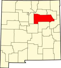
San Jose is a census-designated place in San Miguel County, New Mexico, United States. Its population was 137 as of the 2010 census. [3] San Jose has a post office, with ZIP code 87565. [4] [5] Exit 319 of Interstate 25 serves the community.

Contents

History

San Jose was founded in 1803 when allotments of land were made to 45 men and two women by the Spanish government of New Mexico. [6] The purpose of the settlement, and others in the Pecos River valley, was to defend the eastern flanks of the New Mexican settlements from Indian attacks, especially by the Apaches. Many of the early settlers were landless genizaros. Many of the comancheros and ciboleros who traded with the Comanche and hunted bison on the Great Plains came from San Jose and other Pecos Valley settlements. [7]

Geography

According to the U.S. Census Bureau, the community has an area of 0.265 square miles (0.69 km2), all land. [1]

Education

It is in the West Las Vegas Schools school district. [8] West Las Vegas High School is the area high school.

See also

Related Research Articles

<span class="mw-page-title-main">Tierra Amarilla, New Mexico</span> Census-designated place in New Mexico, United States

Tierra Amarilla is a census-designated place in and the county seat of Rio Arriba County, New Mexico, United States.

<span class="mw-page-title-main">San Miguel County, New Mexico</span> County in New Mexico, United States

San Miguel County is a county in the U.S. state of New Mexico. As of the 2020 census, the population was 27,201. Its county seat is Las Vegas.

<span class="mw-page-title-main">Mora County, New Mexico</span> County in New Mexico, United States

Mora County is a county in the U.S. state of New Mexico. As of the 2020 census, the population was 4,189. Its county seat is the census-designated place (CDP) Mora. The county has another CDP, Watrous, a village, Wagon Mound, and 12 smaller unincorporated settlements. Mora became a formal county in the US, in what was then the New Mexico Territory, on February 1, 1860. Ecclesiastically, the county is within the Roman Catholic Archdiocese of Santa Fe. County population peaked at approximately 14,000 circa 1920, declining to about 4,000 to 5,000 since the 1970s; the 2018 estimate was 4,506.

<span class="mw-page-title-main">Vado, New Mexico</span> Place and community in the United States

Vado is an unincorporated community and census-designated place (CDP) in Doña Ana County, New Mexico, United States. The population was 3,194 at the 2010 census. The ZIP code for Vado is 88072, its area code is 575, and it is part of the Las Cruces Metropolitan Statistical Area.

<span class="mw-page-title-main">Pecos, New Mexico</span> Village in New Mexico, United States

Pecos is a village in San Miguel County, New Mexico, United States. The population was 1,392 at the 2010 census, shrinking slower than other parts of San Miguel County, partly because Pecos is within commuting distance of Santa Fe. The village is built along the Pecos River, which flows from the north out of the Santa Fe National Forest. Notable locations nearby include Pecos National Historical Park, Glorieta Pass, and Pecos Benedictine Monastery. It is also an entry point for hunting, fishing, hiking and camping in the Pecos Wilderness. The closest metropolitan area is the Santa Fe metropolitan area, approximately 26 miles (42 km) to the west.

Villanueva is an unincorporated community and census-designated place in San Miguel County, New Mexico, United States. Known as La Cuesta until 1890, it is located along the Pecos River and New Mexico State Road 3. Villanueva has the ZIP code 87583. The 87583 ZIP Code Tabulation Area had a population of 234 in the 2010 United States census, compared to 267 in 2000. A total of 211 residents of Villanueva in 2010 identified themselves as Hispanic.

<span class="mw-page-title-main">Ribera, New Mexico</span> CDP in New Mexico, United States

Ribera is an unincorporated community and census-designated place in San Miguel County, New Mexico. Located in the northern part of the state, it is at the foot of Rowe Mesa and along the Pecos River, 50 miles (80 km) southeast of Santa Fe.

<span class="mw-page-title-main">Villanueva State Park</span>

Villanueva State Park is a state park of New Mexico, United States, located on the banks of the Pecos River. The park features red and yellow sandstone cliffs, cottonwood trees, and other native plants. Villanueva State Park's elevation is 6,110 feet above sea level. The park sits in the shift from The Rocky Mountains and The Great Plains. The park is located southwest of the town of Las Vegas, 35 miles (56 km) New Mexico. While on the lookout trails of Villanueva State Park, one would be able to view the Pecos River. Water in the Pecos River south headed to Villanueva State Park, there are showed signs of base metals and mercury. Elevated levels of copper, lead, and zinc.

<span class="mw-page-title-main">José Guadalupe Gallegos</span>

José Guadalupe Gallegos was a native New Mexican military leader, county sheriff, rancher and politician. In 1854 he served as brigadier general in the volunteer Mounted Militia of New Mexico (Territory) formed for the purpose of protecting communities against Native American attacks. Prior to the Battle of Glorieta Pass, he was a Union field and staff Colonel in the Civil War, serving as commander of the 3rd New Mexico Volunteer Infantry and as commander of the Hatch's Ranch military post. He represented San Miguel County in four of the six Assemblies of the Territorial Legislature between 1855-1861 and served as House Speaker and as Council President. José was one of the founding members of the Historical Society of New Mexico and was a founding associate in the incorporation of the Montezuma Copper Mining Company of Santa Fé, New Mexico the New Mexican Railway Company and the New Mexico Wool Manufacturing Company.

<span class="mw-page-title-main">San Miguel del Vado, New Mexico</span> Unincorporated community in New Mexico, United States

San Miguel del Vado is an unincorporated community in San Miguel County, New Mexico, United States.

<span class="mw-page-title-main">San Miguel del Vado Land Grant</span>

The San Miguel del Vado Land Grant is one of the Spanish land grants in New Mexico. On November 24, 1794, 53 men submitted a petition for land and were granted temporary possession on November 24, 1794, pending satisfaction of prescribed criteria. A second grant was obtained by 58 men and their respective families on March 12, 1803. Two days later, the procedure was repeated at San José del Vado, 6 kilometres (3.7 mi) north of San Miguel del Vado, distributing farm land to an additional 47 heads of household, including two women.

Watrous is a census-designated place in Mora County, New Mexico, United States. Its population was 135 as of the 2010 census. Watrous has a post office with ZIP code 87753, which opened on April 14, 1868. The community is located along Interstate 25. It was named after merchant and landowner Samuel Watrous, who moved to New Mexico from Vermont in 1835.

<span class="mw-page-title-main">El Cerrito, New Mexico</span> Village in New Mexico, United States

El Cerrito is a village in San Miguel County, New Mexico, United States. The village is located in the upper Pecos River valley and was founded in 1824 by settlers from Villanueva, 5 kilometres (3.1 mi) upstream. The majority of the population is Hispanic.

<span class="mw-page-title-main">Costilla, New Mexico</span> Census-designated place in New Mexico, United States

Costilla is a census-designated place in Taos County, New Mexico, United States. Its population was 205 as of the 2010 census. Costilla has a post office with ZIP code 87524. State roads 196 and 522 intersect in the community.

Anton Chico, or Anton Chico Abajo or Anton Chico de Abajo, is a census-designated place in Guadalupe County, New Mexico, United States. Its population was 188 as of the 2010 census, of which 167 were Hispanic in origin. Anton Chico has a post office with ZIP code 87711. New Mexico State Road 386 passes through the community. Anton Chico is listed in the National Register of Historic Places.

Ojo Sarco is an unincorporated community located in Rio Arriba County, New Mexico, United States. Ojo Sarco is located in the Sangre de Cristo Mountains, 1 mile (1.6 km) from New Mexico State Road 76 and 1.5 miles (2.4 km) west-southwest of Las Trampas. Ojo Sarco had its own post office until June 8, 1996. Ojo Sarco was founded by settlers on the Las Trampas Land Grant which dates back to 1751.

San Miguel is a census-designated place in Doña Ana County, New Mexico, United States. Its population was 1,153 as of the 2010 census. San Miguel has a post office with ZIP code 88058. The community is located at the junction of state routes 28 and 192.

Monticello is an unincorporated community located in Sierra County, New Mexico, United States. Monticello is located on Alamosa Creek, 22 miles (35 km) northwest of Truth or Consequences. Monticello has a post office with ZIP code 87939.

Sena is an unincorporated community and census-designated place in San Miguel County, New Mexico, United States. It is located along the Pecos River and New Mexico State Highway 3.

Llano del Medio is an unincorporated community and census-designated place in Guadalupe County, New Mexico, United States. Its population was 118 as of the 2010 census, of which 111 people were Hispanic in origin. New Mexico State Road 119 passes through the community.

References

  1. 1 2 "2010 Census Gazetteer Files: Places: New Mexico". U.S. Census Bureau. Archived from the original on July 14, 2014. Retrieved July 11, 2014.
  2. 1 2 U.S. Geological Survey Geographic Names Information System: San Jose, San Miguel County, New Mexico
  3. 1 2 "U.S. Census website". United States Census Bureau . Retrieved May 14, 2011.
  4. "Postmaster Finder - Post Offices by ZIP Code". United States Postal Service . Retrieved July 11, 2014.
  5. United States Postal Service (2012). "USPS - Look Up a ZIP Code" . Retrieved February 15, 2012.
  6. Jenks, Kelly L. (2011), "Vecinos en la Frontera: Early History and Recent Archaeology of San Miguel del Vado, New Mexico", pp. 15-17, , accessed 13 Mar 2019
  7. "San Miguel del Vado", Department of Anthropology, New Mexico State University, , accessed 13 Mar 2019
  8. "2020 CENSUS - SCHOOL DISTRICT REFERENCE MAP: San Miguel County, NM" (PDF). U.S. Census Bureau . Retrieved July 12, 2022.