Rociada, New Mexico | |
---|---|
![]() | |
Coordinates: 35°49′56″N105°25′15″W / 35.83222°N 105.42083°W | |
Country | United States |
State | New Mexico |
County | San Miguel |
Elevation | 7,536 ft (2,297 m) |
Population (2010) | |
• Total | 609 |
Time zone | UTC-7 (Mountain (MST)) |
• Summer (DST) | UTC-6 (MDT) |
Zip code | 87742 |
Area code | 505 |
GNIS 912004 | 910357 [1] |
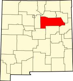
Rociada is a settled area in San Miguel County, New Mexico, United States, located 27 miles northwest of Las Vegas, the county seat. Rociada's name means "sprinkled with dew" in Spanish, reflecting its relatively high-elevation, mild, and moist climate in the summer compared to hot and arid areas of Northern New Mexico. [2] [3]
The Pendaries Gristmill, one mile east of Rociada is perhaps the best preserved gristmill in New Mexico. Built in the 1870s, the building is on the U.S. National Register of Historic Places. [4]
The Calf Canyon/Hermits Peak Fire (April to August 2022), one of the largest in New Mexico history, destroyed the forests on all the hillsides around the Rociada valley. Heavy monsoon rains resulted in flooding caused by water runoff from the denuded slopes. The area was evacuated during the fire. [5]
Climate data for Gascon (Rociada), New Mexico, 1991–2020 normals, 1953-2020 extremes: 8250ft (2515m) | |||||||||||||
---|---|---|---|---|---|---|---|---|---|---|---|---|---|
Month | Jan | Feb | Mar | Apr | May | Jun | Jul | Aug | Sep | Oct | Nov | Dec | Year |
Record high °F (°C) | 71 (22) | 70 (21) | 78 (26) | 78 (26) | 85 (29) | 90 (32) | 91 (33) | 92 (33) | 89 (32) | 82 (28) | 74 (23) | 72 (22) | 92 (33) |
Mean maximum °F (°C) | 59.6 (15.3) | 59.1 (15.1) | 64.0 (17.8) | 67.8 (19.9) | 75.4 (24.1) | 84.2 (29.0) | 83.1 (28.4) | 80.9 (27.2) | 78.6 (25.9) | 73.6 (23.1) | 66.8 (19.3) | 60.2 (15.7) | 85.8 (29.9) |
Mean daily maximum °F (°C) | 44.3 (6.8) | 45.1 (7.3) | 51.2 (10.7) | 56.6 (13.7) | 65.1 (18.4) | 75.0 (23.9) | 76.0 (24.4) | 73.9 (23.3) | 69.4 (20.8) | 61.3 (16.3) | 51.8 (11.0) | 44.0 (6.7) | 59.5 (15.3) |
Daily mean °F (°C) | 31.3 (−0.4) | 32.6 (0.3) | 37.7 (3.2) | 42.9 (6.1) | 50.6 (10.3) | 59.2 (15.1) | 61.7 (16.5) | 60.2 (15.7) | 55.1 (12.8) | 46.9 (8.3) | 37.8 (3.2) | 31.1 (−0.5) | 45.6 (7.6) |
Mean daily minimum °F (°C) | 18.2 (−7.7) | 20.2 (−6.6) | 24.3 (−4.3) | 29.2 (−1.6) | 36.2 (2.3) | 43.4 (6.3) | 47.4 (8.6) | 46.5 (8.1) | 40.8 (4.9) | 32.4 (0.2) | 23.7 (−4.6) | 18.2 (−7.7) | 31.7 (−0.2) |
Mean minimum °F (°C) | −0.3 (−17.9) | −0.1 (−17.8) | 4.6 (−15.2) | 12.7 (−10.7) | 22.4 (−5.3) | 33.0 (0.6) | 40.5 (4.7) | 39.0 (3.9) | 29.0 (−1.7) | 15.6 (−9.1) | 5.6 (−14.7) | −2.5 (−19.2) | −7.1 (−21.7) |
Record low °F (°C) | −26 (−32) | −23 (−31) | −12 (−24) | −9 (−23) | 5 (−15) | 20 (−7) | 30 (−1) | 29 (−2) | 15 (−9) | −1 (−18) | −19 (−28) | −21 (−29) | −26 (−32) |
Average precipitation inches (mm) | 0.96 (24) | 1.46 (37) | 1.92 (49) | 1.91 (49) | 1.88 (48) | 1.79 (45) | 4.68 (119) | 3.87 (98) | 2.26 (57) | 1.63 (41) | 1.30 (33) | 1.28 (33) | 24.94 (633) |
Average snowfall inches (cm) | 14.50 (36.8) | 16.90 (42.9) | 22.90 (58.2) | 15.80 (40.1) | 2.30 (5.8) | 0.00 (0.00) | 0.00 (0.00) | 0.00 (0.00) | 0.00 (0.00) | 7.00 (17.8) | 11.00 (27.9) | 17.90 (45.5) | 108.3 (275) |
Source 1: NOAA [7] | |||||||||||||
Source 2: XMACIS2 (records & monthly max/mins) [8] |