Sierra County | |
---|---|
Coordinates: 33°08′N107°11′W / 33.14°N 107.19°W | |
Country | United States |
State | New Mexico |
Founded | 1884 |
Named for | the Black Range (Spanish: Sierra Diablo) |
Seat | Truth or Consequences |
Largest city | Truth or Consequences |
Area | |
• Total | 4,236 sq mi (10,970 km2) |
• Land | 4,179 sq mi (10,820 km2) |
• Water | 57 sq mi (150 km2) 1.4% |
Population (2020) | |
• Total | 11,576 |
• Density | 2.9/sq mi (1.1/km2) |
Time zone | UTC−7 (Mountain) |
• Summer (DST) | UTC−6 (MDT) |
Congressional district | 2nd |
Website | www |
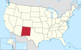
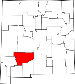
Sierra County (Spanish : Condado de Sierra) is a county located in the U.S. state of New Mexico. As of the 2020 Census, the population was 11,576. [1] Its county seat is Truth or Consequences. [2]
According to the U.S. Census Bureau, the county has a total area of 4,236 square miles (10,970 km2), of which 4,179 square miles (10,820 km2) is land and 57 square miles (150 km2) (1.4%) is water. [3]
Census | Pop. | Note | %± |
---|---|---|---|
1890 | 3,630 | — | |
1900 | 3,158 | −13.0% | |
1910 | 3,536 | 12.0% | |
1920 | 4,619 | 30.6% | |
1930 | 5,184 | 12.2% | |
1940 | 6,962 | 34.3% | |
1950 | 7,186 | 3.2% | |
1960 | 6,409 | −10.8% | |
1970 | 7,189 | 12.2% | |
1980 | 8,454 | 17.6% | |
1990 | 9,912 | 17.2% | |
2000 | 13,270 | 33.9% | |
2010 | 11,988 | −9.7% | |
2020 | 11,576 | −3.4% | |
U.S. Decennial Census [4] 1790-1960 [5] 1900-1990 [6] 1990-2000 [7] 2010-2016 [1] |
As of the 2000 census, [8] there were 13,270 people, 6,113 households, and 3,618 families living in the county. The population density was 3 people per square mile (1.2 people/km2). There were 8,727 housing units at an average density of 2 units per square mile (0.77/km2). The racial makeup of the county was 86.97% White, 0.48% Black or African American, 1.48% Native American, 0.17% Asian, 0.08% Pacific Islander, 8.27% from other races, and 2.54% from two or more races. 26.28% of the population were Hispanic or Latino of any race.
There were 6,113 households, out of which 20.40% had children under the age of 18 living with them, 47.50% were married couples living together, 8.60% had a female householder with no husband present, and 40.80% were non-families. 35.90% of all households were made up of individuals, and 19.30% had someone living alone who was 65 years of age or older. The average household size was 2.13 and the average family size was 2.75.
In the county, the population was spread out, with 20.10% under the age of 18, 5.40% from 18 to 24, 19.50% from 25 to 44, 27.40% from 45 to 64, and 27.70% who were 65 years of age or older. The median age was 49 years. For every 100 females there were 100.00 males. For every 100 females age 18 and over, there were 97.70 males.
The median income for a household in the county was $24,152, and the median income for a family was $29,787. Males had a median income of $24,570 versus $19,839 for females. The per capita income for the county was $15,023. About 13.80% of families and 20.90% of the population were below the poverty line, including 31.50% of those under age 18 and 14.70% of those age 65 or over.
As of the 2010 census, there were 11,988 people, 5,917 households, and 3,126 families living in the county. [9] The population density was 2.9 inhabitants per square mile (1.1 inhabitants/km2). There were 8,356 housing units at an average density of 2.0 units per square mile (0.77 units/km2). [10] The racial makeup of the county was 85.6% white, 1.7% American Indian, 0.4% black or African American, 0.4% Asian, 8.6% from other races, and 3.3% from two or more races. Those of Hispanic or Latino origin made up 28.0% of the population. [9] In terms of ancestry, 14.0% were German, 9.4% were American, 8.4% were English, and 8.0% were Irish. [11]
Of the 5,917 households, 17.8% had children under the age of 18 living with them, 40.0% were married couples living together, 8.9% had a female householder with no husband present, 47.2% were non-families, and 40.8% of all households were made up of individuals. The average household size was 1.98 and the average family size was 2.64. The median age was 54.5 years. [9]
The median income for a household in the county was $25,583, the lowest of any county in New Mexico. [12] The median income for a family was $38,641. Males had a median income of $32,059 versus $26,213 for females. The per capita income for the county was $16,667. About 15.6% of families and 22.5% of the population were below the poverty line, including 29.8% of those under age 18 and 12.9% of those age 65 or over. [13]
Spaceport America is located in Sierra County, 45 miles (72 kilometers) north of Las Cruces and 30 miles (48 kilometers) east of Truth or Consequences. Sierra County voters approved the creation of a spaceport tax district in April 2008, freeing up funding for its construction. [14] The first launch from Spaceport America occurred on September 25, 2006, since which over 300 launches have occurred. On May 22, 2021, Virgin Galactic's VSS Unity launched from the spaceport with three people aboard becoming the first crewed launch from both Spaceport America and New Mexico and making New Mexico the third U.S. state, after California and Florida, to send humans into space. [15]
Year | Republican | Democratic | Third party(ies) | |||
---|---|---|---|---|---|---|
No. | % | No. | % | No. | % | |
2020 | 3,542 | 59.58% | 2,265 | 38.10% | 138 | 2.32% |
2016 | 3,010 | 58.10% | 1,612 | 31.11% | 559 | 10.79% |
2012 | 2,928 | 57.39% | 1,964 | 38.49% | 210 | 4.12% |
2008 | 3,017 | 55.00% | 2,352 | 42.88% | 116 | 2.11% |
2004 | 3,162 | 61.31% | 1,926 | 37.35% | 69 | 1.34% |
2000 | 2,721 | 59.33% | 1,689 | 36.83% | 176 | 3.84% |
1996 | 2,140 | 44.54% | 2,154 | 44.83% | 511 | 10.63% |
1992 | 1,562 | 35.36% | 1,771 | 40.09% | 1,085 | 24.56% |
1988 | 2,507 | 60.19% | 1,595 | 38.30% | 63 | 1.51% |
1984 | 2,663 | 66.00% | 1,335 | 33.09% | 37 | 0.92% |
1980 | 2,222 | 62.50% | 1,169 | 32.88% | 164 | 4.61% |
1976 | 1,665 | 51.04% | 1,564 | 47.95% | 33 | 1.01% |
1972 | 2,074 | 67.47% | 934 | 30.38% | 66 | 2.15% |
1968 | 1,624 | 57.06% | 930 | 32.68% | 292 | 10.26% |
1964 | 1,501 | 47.67% | 1,633 | 51.86% | 15 | 0.48% |
1960 | 1,890 | 60.64% | 1,220 | 39.14% | 7 | 0.22% |
1956 | 1,954 | 65.00% | 1,035 | 34.43% | 17 | 0.57% |
1952 | 2,033 | 63.61% | 1,158 | 36.23% | 5 | 0.16% |
1948 | 1,274 | 47.54% | 1,389 | 51.83% | 17 | 0.63% |
1944 | 1,112 | 52.26% | 1,008 | 47.37% | 8 | 0.38% |
1940 | 1,372 | 47.15% | 1,534 | 52.71% | 4 | 0.14% |
1936 | 951 | 37.12% | 1,587 | 61.94% | 24 | 0.94% |
1932 | 667 | 30.18% | 1,515 | 68.55% | 28 | 1.27% |
1928 | 766 | 53.79% | 657 | 46.14% | 1 | 0.07% |
1924 | 632 | 48.17% | 546 | 41.62% | 134 | 10.21% |
1920 | 862 | 56.79% | 642 | 42.29% | 14 | 0.92% |
1916 | 460 | 47.13% | 493 | 50.51% | 23 | 2.36% |
1912 | 176 | 28.16% | 352 | 56.32% | 97 | 15.52% |
Truth or Consequences Schools is the school district for all of the county. [17]
Valencia County is a county in the U.S. state of New Mexico. As of the 2020 census, the population was 76,205. The county seat is Los Lunas.
Torrance County is a county located in the center of the U.S. state of New Mexico. As of the 2020 census, the population was 15,045. The county seat is Estancia.
Roosevelt County is a county located in the U.S. state of New Mexico. As of the 2020 census, the population was 19,191. Its county seat is Portales. The county was created in 1903 from Chaves and Guadalupe counties and named for the then-current President of the United States, Theodore Roosevelt. The county's eastern border is the Texas state line. Roosevelt County comprises the Portales, NM Micropolitan Statistical Area, which is also included in the Clovis–Portales, NM Combined Statistical Area.
Quay County is a county in the state of New Mexico. As of the 2020 U.S. census, the population was 8,746. Its county seat is Tucumcari. The county was named for Pennsylvania senator Matthew Quay, who supported statehood for New Mexico. Its eastern border is the Texas state line, approximately 103.04 degrees west longitude.
Luna County is a county located in the U.S. state of New Mexico. As of the 2020 census, the population was 25,427. Its county seat is Deming. This county abuts the Mexican border. Luna County comprises the Deming, NM Micropolitan Statistical Area.
Lincoln County is a county in the U.S. state of New Mexico. As of the 2020 census, the population was 20,269. Its county seat is Carrizozo, while its largest community is Ruidoso.
Hidalgo County is the southernmost county of the U.S. state of New Mexico. As of the 2020 census, the population was 4,178. The county seat and largest city is Lordsburg. A bill creating Hidalgo from the southern part of Grant County was passed on February 25, 1919, taking effect at the beginning of 1920. The county was named for the town north of Mexico City where the Treaty of Guadalupe Hidalgo was signed, which in turn was named for Miguel Hidalgo y Costilla, the priest who is known as the "Father of Mexican Independence." The county is located on the Mexico–United States border.
Grant County is a county located in the U.S. state of New Mexico. At the 2020 census, the population was 28,185. Its county seat is Silver City. The county was founded in 1868 and named for Ulysses S. Grant, the 18th President of the United States.
Bernalillo County is the most populous county in the U.S. state of New Mexico. As of the 2020 census, the population was 676,444. The county seat, Albuquerque, is the most populous city in New Mexico.
Hatch is a village in Doña Ana County, New Mexico, United States. The population was 1,648 at the 2010 census. The town is experiencing moderate growth, along with its outliers of Salem, Arrey, Derry, and Rincon. Hatch is widely known as the "best chile place in the World," for growing a wide variety of peppers, especially the New Mexican cuisine staple, and one of New Mexico's state vegetables, the New Mexico chile.
Rincon is a census-designated place (CDP) in Doña Ana County, New Mexico, United States. As of the 2010 census, the CDP population was 271. It is part of the Las Cruces Metropolitan Statistical Area.
Mescalero is a census-designated place (CDP) in Otero County, New Mexico, United States, located on the Mescalero Apache Reservation. The population was 1,338 at the 2010 census.
Naschitti is a census-designated place (CDP) in San Juan County, New Mexico, United States. The population was 360 at the 2000 census. It is part of the Farmington Metropolitan Statistical Area. The town was established in 1886, when Tom Bryan set up a trading post east of the Chuska Mountains. With a Navajo name, Naschitti means "badger springs."
Elephant Butte is a city in Sierra County, New Mexico, United States, located near Elephant Butte Reservoir and Elephant Butte Lake State Park. The population was 1,447 at the time of the 2020 census.
Truth or Consequences is a city in the U.S. state of New Mexico, and the county seat of Sierra County. In 2020, the population was 6,052. It has frequently been noted on lists of unusual place names for having chosen to rename itself in March 1950 after the Truth or Consequences radio show. The name is often hyphenated for clarity, though the formal name contains no punctuation.
Williamsburg is a village in Sierra County, New Mexico, United States. The population was 462 at the 2020 census. The village, though small, is located adjacent to Truth or Consequences, and has essentially become a suburb. Though the town is experiencing moderate growth now, especially along I-25, in the near future there is a high possibility of its becoming a booming bedroom community for lakesiders from Elephant Butte. Williamsburg, New Mexico is named after its first mayor, Dr. Thomas B. Williams (1893-1967).
Sentinel Butte is a city in Golden Valley County, North Dakota, United States. The population was 61 at the 2020 census.
Butte Falls is a city in Jackson County, Oregon, United States. The population was 423 at the 2010 census. As of July 1, 2018, the city's population was estimated to be 450.
Eagle Butte is a city in Dewey and Ziebach counties in South Dakota, United States. The population was 1,258 at the 2020 census. It is adjacent to the North Eagle Butte CDP.
Doña Ana County is a county located in the southern part of the New Mexico, United States. As of the 2020 U.S. Census, its population was 219,561, which makes it the second-most populated county in New Mexico. Its county seat is Las Cruces, the second-most populous municipality in New Mexico after Albuquerque, with 111,385 as of the 2020 U.S. Census.