Hillsboro, New Mexico

Last updated

Hillsboro, New Mexico
Hillsboro New Mexico Community Center.jpg
Hillsboro New Mexico Community Center
USA New Mexico location map.svg
Red pog.svg
Hillsboro, New Mexico
Location in the New Mexico
Coordinates: 32°55′19″N107°34′38″W / 32.92194°N 107.57722°W / 32.92194; -107.57722
Country United States
State New Mexico
County Sierra
Area
  Total2.13 sq mi (5.5 km2)
Elevation
[1]
5,364 ft (1,635 m)
Population
 (2010)
  Total124
  Density58/sq mi (22/km2)
Time zone Mountain
  Summer (DST) Mountain
ZIP code
88042
Area code 575
FIPS code 35-32380
GNIS feature ID2584112 [1]
Hillsboro New Mexico geologic map showing mine locations. Hillsboro New Mexico geologic map.png
Hillsboro New Mexico geologic map showing mine locations.

Hillsboro is an unincorporated community in Sierra County, New Mexico, United States, located in the southwestern part of the state. It was founded in 1877, following the discovery of gold. The community was the county seat of Sierra County from 1884 until 1936, when Hot Springs (now called Truth or Consequences) became the county seat.

Contents

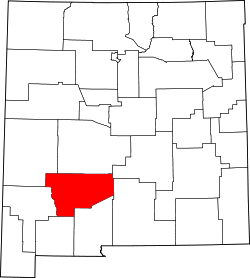
The town was named Hillsborough by prospectors in December 1877, but later shortened to Hillsboro. By 1880, the town had four companies of soldiers and 400 miners, but the population soon grew to 700. A county courthouse was built in 1892. By 1907, the population was 1200. A flood on 10 June 1914 caused considerable damage to many town buildings. [2] New Mexico State Road 152 and NM 27 intersect in and bisect the town.

Geology

The first house was built in August 1877 after two prospectors, Dan Dugan and Dave Stitzel, working in the area of the future Opportunity Mine, collected loose pieces of rock (float is the geologic term) assayed at $160 per ton in gold and silver. [3] Soon, ore was discovered at the nearby Rattlesnake vein (geology) by Dugan and Frank Pitcher, [2] and a placer deposit of gold was found in November at the Rattlesnake and Wicks gulches. Ore was pulverized with arrastres located in Hillsboro, including a 10-stamp mill built in 1878. Total production prior to 1904 was about $6,750,000. Between 1911 and 1931, total production of gold ore was 836 tons, gold-copper-silver ore was 5,470 tons, and copper ore was 200 tons. [4] In his report, Harley wrote, "The ore deposits of the Hillsboro or Las Animas mining district are of four general types as follows: (1) fissure veins in andesite flows, (2) disseminated deposits in monzonite porphyry, (3) replacement deposits in limestone, and (4) placer gold deposits." [5]

The Copper Flat volcano to the northeast of Hillsboro is the source of the gold in the area. The 4 mile wide volcano is characterized by a Cretaceous quartz monzonite stock within a topographic depression, surrounded by surface andesite flows at least 2,300 feet thick, and radial quartz latite or rhyolite dikes. The stock generated the porphyry copper deposits, gold-bearing veins, and gold placers. There are about 26 major veins forming a radial pattern from the stock. The Golddust Camp placer deposits are found in the alluvium of the dry gulches radiating off Copper Flat and the andesite flows. The fissure veins produced 51,000 ounces of gold, while the placer deposits produced 110,000 ounces. [6]

The Sternberg Mine at Copper Flat produced 200 tons of copper ore between 1911 and 1934. By 1959, Bear Creek Mining Company had discovered a mineralized breccia pipe within the stock. Quintana Minerals Corporation started open-pit mining in 1980, averaging 0.45 per cent copper. Ore minerals include pyrite, chalcopyrite, sphalerite and galena. [6]

Climate

According to the Köppen Climate Classification system, Hillsboro has a cold semi-arid climate, abbreviated "BSk" on climate maps. The hottest temperature recorded in Hillsboro was 107 °F (41.7 °C) on June 1516, 1896, June 22, 1981, and June 26, 1994, while the coldest temperature recorded was −14 °F (−25.6 °C) on January 11, 1962. [7]

Climate data for Hillsboro, New Mexico, 1991–2020 normals, extremes 1893–present
MonthJanFebMarAprMayJunJulAugSepOctNovDecYear
Record high °F (°C)81
(27)
84
(29)
87
(31)
94
(34)
104
(40)
107
(42)
105
(41)
104
(40)
102
(39)
94
(34)
84
(29)
83
(28)
107
(42)
Mean maximum °F (°C)67.9
(19.9)
73.6
(23.1)
80.7
(27.1)
86.1
(30.1)
94.1
(34.5)
101.4
(38.6)
100.6
(38.1)
96.9
(36.1)
93.3
(34.1)
86.9
(30.5)
77.1
(25.1)
68.6
(20.3)
102.8
(39.3)
Average high °F (°C)54.8
(12.7)
59.9
(15.5)
67.3
(19.6)
74.9
(23.8)
83.3
(28.5)
92.5
(33.6)
91.8
(33.2)
89.2
(31.8)
84.0
(28.9)
75.1
(23.9)
63.4
(17.4)
53.7
(12.1)
74.2
(23.4)
Daily mean °F (°C)39.9
(4.4)
44.0
(6.7)
50.6
(10.3)
57.6
(14.2)
65.5
(18.6)
74.4
(23.6)
76.7
(24.8)
74.6
(23.7)
68.5
(20.3)
58.4
(14.7)
47.2
(8.4)
39.3
(4.1)
58.1
(14.5)
Average low °F (°C)25.0
(−3.9)
28.1
(−2.2)
34.0
(1.1)
40.3
(4.6)
47.7
(8.7)
56.3
(13.5)
61.7
(16.5)
60.0
(15.6)
53.0
(11.7)
41.8
(5.4)
31.3
(−0.4)
24.8
(−4.0)
42.0
(5.6)
Mean minimum °F (°C)12.5
(−10.8)
15.4
(−9.2)
20.1
(−6.6)
27.0
(−2.8)
35.2
(1.8)
46.4
(8.0)
54.6
(12.6)
53.7
(12.1)
43.1
(6.2)
27.8
(−2.3)
17.0
(−8.3)
11.6
(−11.3)
9.4
(−12.6)
Record low °F (°C)−14
(−26)
−10
(−23)
8
(−13)
17
(−8)
27
(−3)
39
(4)
46
(8)
47
(8)
35
(2)
15
(−9)
5
(−15)
−5
(−21)
−14
(−26)
Average precipitation inches (mm)0.64
(16)
0.42
(11)
0.30
(7.6)
0.35
(8.9)
0.68
(17)
0.83
(21)
2.08
(53)
2.41
(61)
1.97
(50)
0.99
(25)
0.74
(19)
0.87
(22)
12.28
(311.5)
Average snowfall inches (cm)1.2
(3.0)
0.3
(0.76)
0.0
(0.0)
0.0
(0.0)
0.0
(0.0)
0.0
(0.0)
0.0
(0.0)
0.0
(0.0)
0.0
(0.0)
0.3
(0.76)
0.3
(0.76)
0.6
(1.5)
2.7
(6.78)
Average precipitation days (≥ 0.01 in)2.82.32.01.73.04.010.19.76.64.12.73.552.5
Average snowy days (≥ 0.1 in)0.40.20.00.00.00.00.00.00.00.00.10.41.1
Source 1: NOAA [8]
Source 2: National Weather Service [7]

Education

Truth or Consequences Municipal Schools is the school district for the entire county. [9] Truth or Consequences Middle School and Hot Springs High School, both in Truth or Consequences, are the district's secondary schools.

Notable people

See also

Notes

  1. 1 2 U.S. Geological Survey Geographic Names Information System: Hillsboro, New Mexico
  2. 1 2 Sherman, James E.; Sherman, Barbara H. (1975). Ghost Towns and Mining Camps of New Mexico . Norman: University of Oklahoma Press. pp.  112–115. ISBN   0806111062.
  3. Florin, Lambert (1970). Ghost Towns of the West . Superior Publishing Company. pp.  624–625. ISBN   0883940132.
  4. Harley, pp 139-140
  5. Harley, p 133)
  6. 1 2 Hedlund, D.C. (1985). Economic geology of some selected mines in the Hillsboro and San Lorenzo quadrangles, Grant and Sierra Counties, New Mexico. Denver: US Dept. of the Interior, USGS Report 85-0456. pp. 4–13.
  7. 1 2 "NOAA Online Weather Data – NWS El Paso". National Weather Service. Retrieved August 10, 2023.
  8. "U.S. Climate Normals Quick Access – Station: Hillsboro, NM". National Oceanic and Atmospheric Administration. Retrieved August 10, 2023.
  9. "2020 CENSUS - SCHOOL DISTRICT REFERENCE MAP: Sierra County, NM" (PDF). U.S. Census Bureau . Retrieved July 12, 2022. - Text list
  10. Hillsboro Historical Society (2011). Around Hillsboro. Charleston: Arcadia Publishing. pp. 21–28. ISBN   9780738579528.

Related Research Articles

U.S. Silver & Gold Inc. was a mining company based in Wallace, Idaho near Coeur d'Alene, Idaho. The chairman of the company was Bobby E. Cooper, the CEO was Tom Parker.

<span class="mw-page-title-main">Silver mining</span> Extraction silver from the ground

Silver mining is the extraction of silver from minerals, starting with mining. Because silver is often found in intimate combination with other metals, its extraction requires elaborate technologies. In 2008, ca. 25,900 metric tons were consumed worldwide, most of which came from mining.

Harry Pye was a prospector and sometime mule skinner in New Mexico Territory who discovered silver chloride in the Black Range in 1879 initiating a multimillion-dollar silver rush.

<span class="mw-page-title-main">Copper mining in the United States</span>

In the United States, copper mining has been a major industry since the rise of the northern Michigan copper district in the 1840s. In 2017, the US produced 1.27 million metric tonnes of copper, worth $8 billion, making it the world's fourth largest copper producer, after Chile, China, and Peru. Copper was produced from 23 mines in the US. Top copper producing states in 2014 were Arizona, Utah, New Mexico, Nevada, and Montana. Minor production also came from Idaho, and Missouri. As of 2014, the US had 45 million tonnes of known remaining reserves of copper, the fifth largest known copper reserves in the world, after Chile, Australia, Peru, and Mexico.

<span class="mw-page-title-main">Gold mining in the United States</span>

In the United States, gold mining has taken place continually since the discovery of gold at the Reed farm in North Carolina in 1799. The first documented occurrence of gold was in Virginia in 1782. Some minor gold production took place in North Carolina as early as 1793, but created no excitement. The discovery on the Reed farm in 1799 which was identified as gold in 1802 and subsequently mined marked the first commercial production.

<span class="mw-page-title-main">Silver mining in the United States</span>

Silver mining in the United States began on a major scale with the discovery of the Comstock Lode in Nevada in 1858. The industry suffered greatly from the demonetization of silver in 1873 by the Coinage Act of 1873, known pejoratively as the "Crime of 73", but silver mining continues today.

<span class="mw-page-title-main">Uranium mining in Colorado</span>

Uranium mining in Colorado, United States, goes back to 1872, when pitchblende ore was taken from gold mines near Central City, Colorado. The Colorado uranium industry has seen booms and busts, but continues to this day. Not counting byproduct uranium from phosphate, Colorado is considered to have the third largest uranium reserves of any US state, behind Wyoming and New Mexico.

Silver mining in Colorado has taken place since the 1860s. In the past, Colorado called itself the Silver State.

<span class="mw-page-title-main">Lake Valley, Sierra County, New Mexico</span>

Lake Valley was a silver-mining town in Sierra County, U.S. state of New Mexico.

<span class="mw-page-title-main">Copper mining in Michigan</span> Important industry in the 19th and 20th centuries

In Michigan, copper mining became an important industry in the 19th and early 20th centuries. Its rise marked the start of copper mining as a major industry in the United States.

Silver mining in Nevada, a state of the United States, began in 1858 with the discovery of the Comstock Lode, the first major silver-mining district in the United States. Nevada calls itself the "Silver State." Nevada is the nation's second-largest producer of silver, after Alaska. In 2014 Nevada produced 10.93 million troy ounces of silver, of which 6.74 million ounces were as a byproduct of the mining of gold. The largest byproducers were the Hycroft Mine, the Phoenix Mine, the Midas Mine and Round Mountain.

Gold mining in Alaska, a state of the United States, has been a major industry and impetus for exploration and settlement since a few years after the United States acquired the territory in 1867 from the Russian Empire. Russian explorers discovered placer gold in the Kenai River in 1848, but no gold was produced. Gold mining started in 1870 from placers southeast of Juneau, Alaska.

The Willow Creek mining district, also known as the Independence Mine/Hatcher Pass district, is a gold-mining area in the U.S. state of Alaska. Underground hard-rock mining of gold from quartz veins accounts for most of the mineral wealth extracted from the Hatcher Pass area. The first mining efforts were placer mining of stream gravels, and placer mining in the area has continued sporadically to this day. Robert Hatcher discovered gold and staked the first claim in the Willow Creek valley in September 1906. The first lode mill in the area started operating in 1908. Underground mining continued at a variety of locations around the pass until 1951. In the 1980s one of the area's hard-rock mines was briefly re-opened. At least one mining company is actively exploring for gold in the area now. Through 2006 the district produced 667-thousand ounces of hard rock gold and 60-thousand ounces of placer gold.

<span class="mw-page-title-main">Castle Dome Landing, Arizona</span> Ghost town in Yuma County, Arizona

Castle Dome Landing, Arizona is a ghost town in the Castle Dome Mountains of Yuma County in the U.S. state of Arizona. It was first settled as a transport depot and mining camp around 1863 in what was then the Arizona Territory.

The Bodie Mine is an inactive, privately owned gold mine in Okanogan County, Washington, United States. It is located within a triangle formed by the town of Wauconda, Washington the original town of Bodie, Washington, and the later ghost town of Bodie, on Toroda Road.

<span class="mw-page-title-main">Beanland Mine</span>

Beanland Mine, also known as Clenor Mine, is an abandoned surface and underground mine in Northeastern Ontario, Canada. It is located about 1 km (0.62 mi) west of Arsenic Lake and 4 km (2.5 mi) northwest of the town of Temagami in central Strathy Township. It is named after Sydney Beanland, who first claimed the mine site in the 1920s and was a director for the mine from 1937 to 1938.

<span class="mw-page-title-main">Kingston, New Mexico</span> Census-designated place in New Mexico, United States

Kingston is a census-designated place (CDP) in Sierra County, New Mexico, United States. Its population was 32 as of the 2010 census. The community is located in the Black Range along New Mexico State Road 152.

Chloride is an unincorporated community in Sierra County, in the U.S. state of New Mexico. The community is located at the confluence of Chloride Creek with Mineral Creek. Most of the old mine workings are to the west, along Chloride Creek. Winston is approximately two miles to the east.

Farallon Negro is a volcano in the Catamarca province of Argentina. Active between about 9-8 million years ago, it was formerly a stratovolcano or a multi vent volcano. Eventually, erosion removed most of the volcano and exposed the underlying structure including subvolcanic intrusions.

<span class="mw-page-title-main">Yellow Aster Mine</span> Former gold mine in California

Yellow Aster Mine was a large gold mine in Southern California.

References

32°55′15″N107°34′01″W / 32.92083°N 107.56694°W / 32.92083; -107.56694