Oasis, New Mexico | |
|---|---|
Census-designated place | |
 Oasis, New Mexico | |
| Coordinates: 32°55′40″N107°18′59″W / 32.92778°N 107.31639°W [1] | |
| Country | United States |
| State | New Mexico |
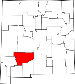
| County | Sierra |
| Area | |
• Total | 2.09 sq mi (5.41 km2) |
| • Land | 2.09 sq mi (5.41 km2) |
| • Water | 0 sq mi (0.00 km2) |
| Elevation | 4,252 ft (1,296 m) |
| Population | |
• Total | 161 |
| • Density | 77.1/sq mi (29.75/km2) |
| Time zone | UTC-7 (Mountain (MST)) |
| • Summer (DST) | UTC-6 (MDT) |
| Area code | 575 |
| GNIS feature ID | 2584168 [1] |
Oasis is a census-designated place in Sierra County, New Mexico, United States. Its population was 149 as of the 2010 census. [4]