References
- 1 2 U.S. Geological Survey Geographic Names Information System: Placitas, Sierra County, New Mexico
- ↑ "Current Placitas, New Mexico Population, Demographics and stats in 2020, 2019".
- ↑ "Placita New Mexico, just south of Monticello".
- ↑ "Domestic Names".
- ↑ "2020 CENSUS - SCHOOL DISTRICT REFERENCE MAP: Sierra County, NM" (PDF). U.S. Census Bureau . Retrieved July 12, 2022. - Text list
33°22′38″N107°25′59″W / 33.37722°N 107.43306°W
Municipalities and communities of Sierra County, New Mexico, United States | ||
|---|---|---|
| Cities | 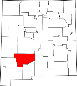 | |
| Villages | ||
| CDPs | ||
| Other communities | ||
| Ghost towns | ||
| | This Sierra County, New Mexico state location article is a stub. You can help Wikipedia by expanding it. |