Cuchillo, New Mexico

Last updated

St. Joseph Church St Joseph Church, Cuchillo NM.jpg
St. Joseph Church

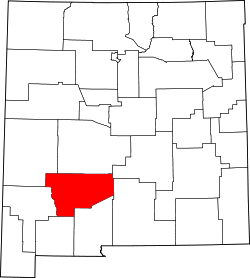
Cuchillo, originally known as Cuchillo Negro, is an unincorporated community in Sierra County, New Mexico, United States. [1] It was named for Apache chieftain Baishan, known by his Spanish name Cuchillo Negro "Black Knife", who was killed in a skirmish with American troops in 1857. The town is located on the north bank of Cuchillo Negro Creek. Cuchillo's name change came after the 1900 Census. It was recorded under its present name in the 1910 Census. [2] :54

Contents

History

The town was thought to have been founded by at least 1871. That place had not appeared in the 1870 Census; however, areas along Cuchillo Negro Creek between there and the Rio Grande had been farmed for some time before 1869, according to the local Indian Agent's report of his tour of the area in that year. They had been planted by people from Alamocita, to the west on the Rio Grande, in late 1867. Alamocita was founded by former residents of Alamosa abandoned after it was destroyed by a flood in 1867. The agent believed they were planting crops of corn for supplying the Southern Apache being rationed at Canada Alamosa and in anticipation of a reservation being formed in that vicinity. [2] :55–56

Some of these farmers were living in the area until, on January 10, 1872, The Borderer, of Las Cruces, published a letter from a newspaper publisher writing from Alemán Ranch that settlers on the Cuchillo Negro were all coming in for fear of an Indian outbreak. [2] :56 On September 19 of that year, Gen. O. O. Howard wrote from a New Mexican hamlet he called Cuchillo, that he had bought 30 days' rations at a general store there for the Apache band of Ponce, in return for his help in finding and getting Cochise to meet with Howard to make peace. [2] :55–56 The town first appears as the Plaza Cuchillo Negro on a 1875 Diagram of Southern Apache Indian Reservation. [2] :27,56 This probably indicated that the houses of the residents had been built in a typical fashion for New Mexico frontier settlements. They were often located around a central plaza forming a defensive wall around it on the outside, as protection from the raids of hostile Apache or Navajo.

The town of Cuchillo Negro first appears on the Census of June 1880. It found the town had 233 occupants in 51 houses. All but three of the population were native born New Mexicans. Fifty-five heads of families were farmers, thirty were laborers, two were freighters, one a tailor and one a miner. [2] :56 In 1881, the creek at the town and below was described as being a fine stream of excellent water, and the land was all susceptible to irrigation by the stream. [2] :92

A post office began operations at Cuchillo Negro from 1883, and has continued to the present day. [3] [4] By 1895, the town was reported as having developed a community ditch irrigation system which was described, as originating at a diversion dam eight miles upstream, that irrigated 300 acres at the town, and 200 acres farther upstream from private ditches. [2] :92

In 1928, the community ditch irrigated 450 acres and there were other diversion dams and private ditches up stream as far as Chise and beyond. Three private ditches below the town, diverted any flood waters to irrigate hay fields and pasture. In 1940, only 400 acres were irrigated at the town by the ditch. [2] :92

Education

Truth or Consequences Municipal Schools is the school district for the entire county. [5] Truth or Consequences Middle School and Hot Springs High School, both in Truth or Consequences, are the district's secondary schools.

See also

Related Research Articles

<span class="mw-page-title-main">Chiricahua</span> Band of Apache Native Americans

Chiricahua is a band of Apache Native Americans.

<span class="mw-page-title-main">Sierra County, New Mexico</span> County in New Mexico, United States

Sierra County is a county located in the U.S. state of New Mexico. As of the 2020 Census, the population was 11,576. Its county seat is Truth or Consequences.

<span class="mw-page-title-main">Hatch, New Mexico</span> Village in New Mexico, United States

Hatch is a village in Doña Ana County, New Mexico, United States. The population was 1,648 at the 2010 census. The town is experiencing moderate growth, along with its outliers of Salem, Arrey, Derry, and Rincon. Hatch is widely known as the "best chile place in the World," for growing a wide variety of peppers, especially the New Mexican cuisine staple, and one of New Mexico's state vegetables, the New Mexico chile.

<span class="mw-page-title-main">Hillsboro, New Mexico</span> Unincorporated community & CDP in New Mexico, United States

Hillsboro is an unincorporated community in Sierra County, New Mexico, United States, located in the southwestern part of the state. It was founded in 1877, following the discovery of gold. The community was the county seat of Sierra County from 1884 until 1936, when Hot Springs became the county seat.

Southwestern New Mexico is a region of the U.S. state of New Mexico commonly defined by Hidalgo County, Grant County, Catron County, Luna County, Doña Ana County, Sierra County, and Socorro County. Some important towns there are Lordsburg, Silver City, Deming, Las Cruces, Truth or Consequences, Socorro, Reserve, and Rodeo. Natural attractions there include White Sands National Park, the Organ Mountains, Bosque del Apache National Wildlife Refuge, and the Gila Wilderness surrounding the Gila Cliff Dwellings National Monument. Southwestern New Mexico is also home to both the Very Large Array and White Sands Missile Range containing the Trinity Site.

Upham is an inhabited, unincorporated community and place in Sierra County, New Mexico, United States. It has gained recognition for being near the site for the Spaceport America facility being developed by the New Mexico Spaceport Authority. This will be Virgin Galactic's world headquarters and mission control location.

<span class="mw-page-title-main">Baishan (Apache)</span>

Baishan, Spanish name Cuchillo Negro, was a Tchihende (Mimbres) Apache chieftain, of the Warm Springs Apache Band during the 1830s to 1850s.

<span class="mw-page-title-main">Percha Diversion Dam</span> Dam in Sierra County, New Mexico

The Percha Diversion Dam is a structure built in 1918 on the Rio Grande in New Mexico, United States. It diverts water from the Rio Grande into the Rincon Valley Main Canal, an irrigation canal.

Canada Alamosa an Americanized version of the Spanish Cañada Alamosa, is a term historically applied to five geographical features, all in the same immediate area in southwest Socorro and northwest Sierra Counties, New Mexico. In historical texts the name, Canada Alamosa is applied inter-changeably to the five features, and it is often only the context that distinguishes one feature from the other.

Las Palomas is a census-designated place in Sierra County, New Mexico, United States. Its population was 173 as of the 2010 census. The community is located near Exit 71 of Interstate 25; New Mexico State Road 187 also passes through the community.

Monticello is an unincorporated community located in Sierra County, New Mexico, United States. Monticello is located on Alamosa Creek, 22 miles (35 km) northwest of Truth or Consequences. Monticello has a post office with ZIP code 87939.

Cuchillo Negro Creek is a stream in Sierra County, in the U.S. state of New Mexico. The stream is a tributary of the Rio Grande.

Chloride is an unincorporated community in Sierra County, in the U.S. state of New Mexico. The community is located at the confluence of Chloride Creek with Mineral Creek. Most of the old mine workings are to the west, along Chloride Creek. Winston is approximately two miles to the east.

Fort McRae was a Union Army post, established in 1863, then a U.S. Army post from 1866 and closed in 1876, in what is now Sierra County, New Mexico. The post was named for Alexander McRae (1829–1862) a slain hero of the 1862 Battle of Valverde.

Monticello Canyon, originally known in Spanish as the Cañada Alamosa, is a valley or glen drained by Alamosa Creek in Sierra County and Socorro County, New Mexico. Its mouth is at an elevation of 4,419 feet, in Sierra County. Its head is at 33°34′10″N107°35′36″W at an elevation of 7,540 feet in the San Mateo Mountains, within the Cibola National Forest, in Socorro County.

Sierra Cuchillo or Cuchillo Negro Mountains is a range of mountains, primarily in Sierra County and some in southern Socorro County, New Mexico. They were named for the knife-like shape of some of the peaks in the range, or for Cuchillo Negro an Apache leader in the region in the mid 19th century.

San Ygnacio de la Alamosa, also known as Alamosa, is now a ghost town, in Sierra County, New Mexico, United States. San Ygnacio de la Alamosa was founded in 1859 as a native New Mexican colonizing settlement from San Antonio. The site of the new colony was along the west bank of the Rio Grande, 35 miles south of Fort Craig, on the south bank of Alamosa Creek nearby its mouth and confluence with the Rio Grande, in what was then southern Socorro County.

Alamocita, initially called New Alamosa, was a later 19th century native New Mexican frontier settlement along the east bank of the Rio Grande and is now a ghost town in Sierra County, New Mexico, United States.

Placitas is a populated place in Montecello Canyon just southeast of Monticello on Highway 142 in Sierra County, New Mexico, United States. The elevation of Placitas is 5,204 feet. It has a population of 576 as of 2020.

Zapata, sometimes called Zapato, or San Ignacio is a ghost town in Sierra County, New Mexico, United States. Its site was submerged by the Elephant Butte Reservoir some years after it had been abandoned.

References

  1. U.S. Geological Survey Geographic Names Information System: Cuchillo, New Mexico
  2. 1 2 3 4 5 6 7 8 9 Wilson, John P., Between the River and the Mountains: A History of Early Settlement in Sierra County, New Mexico, Report #40, John P. Wilson, Las Cruces, New Mexico, August 1985 [ permanent dead link ]
  3. U.S. Geological Survey Geographic Names Information System: Cuchillo Post Office
  4. The Origins of Sierra County:Political and Economic Roots by James B. Sullivan, pp,6-13, SOUTHERN NEW MEXICO HISTORICAL REVIEW, Doña Ana County Historical Society, Volume IX, No.1, Las Cruces, New Mexico January 2002
  5. "2020 CENSUS - SCHOOL DISTRICT REFERENCE MAP: Sierra County, NM" (PDF). U.S. Census Bureau . Retrieved July 12, 2022. - Text list

33°14′09″N107°21′38″W / 33.23583°N 107.36056°W / 33.23583; -107.36056