Rowe, New Mexico

Last updated

Rowe, New Mexico
Rowe, New Mexico.JPG
Church in Rowe, July 2010
USA New Mexico location map.svg
Red pog.svg
Rowe, New Mexico
Location in New Mexico
Usa edcp location map.svg
Red pog.svg
Rowe, New Mexico
Location in the United States
Coordinates: 35°29′52″N105°40′19″W / 35.49778°N 105.67194°W / 35.49778; -105.67194
Country United States
State New Mexico
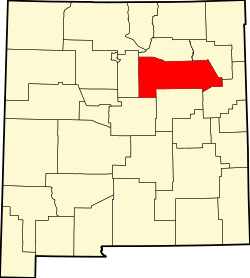
County San Miguel
Area
[1]
  Total6.11 sq mi (15.83 km2)
  Land6.11 sq mi (15.83 km2)
  Water0.00 sq mi (0.00 km2)
Elevation
[2]
6,785 ft (2,068 m)
Population
 (2020) [3]
  Total304
  Density49.74/sq mi (19.20/km2)
Time zone UTC-7 (Mountain (MST))
  Summer (DST) UTC-6 (MDT)
FIPS code 35-65000
GNIS feature ID2629123 [2]

Rowe is a census-designated place (CDP) in San Miguel County, New Mexico, United States. [2]

Contents

The CDP is located along Interstate 25 near the Pecos National Historical Park.

History

Rowe was established to provide labor for the Santa Fe Railroad in the late 1870s and early 1880s. The majority of the population came from Las Ruedas 2 miles (3.2 km) away on the Pecos River. A pipeline to provide water for steam engines was laid between Rowe and the then village of Las Ruedas. Las Ruedas ceased to exist and by the time of the 1880 U.S. Federal Census most of the former residents of Las Ruedas were resettled in Rowe.

The old Las Ruedas townsite is privately owned.

Demographics

Historical population
CensusPop.Note
2020 304
U.S. Decennial Census [4] [3]

Education

It is within Pecos Independent Schools. [5]

As of 2001 a bookmobile served the community but it had no permanent library facility. [6]

The Native American Preparatory School operated in the nearby area, in proximity to South San Ysidro, [7] from 1995 until it closed in 2002. [8]

See also

Related Research Articles

<span class="mw-page-title-main">San Miguel County, New Mexico</span> County in New Mexico, United States

San Miguel County is a county in the U.S. state of New Mexico. As of the 2020 census, the population was 27,201. Its county seat is Las Vegas.

<span class="mw-page-title-main">Pecos, New Mexico</span> Village in New Mexico, United States

Pecos is a village in San Miguel County, New Mexico, United States. The population was 1,392 at the 2010 census, shrinking slower than other parts of San Miguel County, partly because Pecos is within commuting distance of Santa Fe. The village is built along the Pecos River, which flows from the north out of the Santa Fe National Forest. Notable locations nearby include Pecos National Historical Park, Glorieta Pass, and Pecos Benedictine Monastery. It is also an entry point for hunting, fishing, hiking and camping in the Pecos Wilderness. The closest metropolitan area is the Santa Fe metropolitan area, approximately 26 miles (42 km) to the west.

<span class="mw-page-title-main">Agua Fria, New Mexico</span> CDP in New Mexico, United States

Agua Fria is a census-designated place (CDP) in Santa Fe County, New Mexico, United States. It is part of the Santa Fe, New Mexico Metropolitan Statistical Area. The population was 2,800 at the 2010 census. Agua Fria Village is a "Traditional Historic Community" (THC) as designated by the Santa Fe Board of County Commissioners in 1995 and subsequent Santa Fe County Ordinance #1996-16, as allowed by State Statute.

<span class="mw-page-title-main">Eldorado at Santa Fe, New Mexico</span> CDP in New Mexico, United States

Eldorado at Santa Fe, locally known as Eldorado, is a census-designated place (CDP) in Santa Fe County, New Mexico, United States. It is part of the Santa Fe, New Mexico Metropolitan Statistical Area. The population was 6,130 at the 2010 census.

<span class="mw-page-title-main">Glorieta, New Mexico</span> CDP in New Mexico, United States

Glorieta is a census-designated place (CDP) in Santa Fe County, New Mexico, United States. It is part of the Albuquerque–Santa Fe–Las Vegas combined statistical area. The population was 430 at the 2010 census. The community is located in the southern Sangre de Cristo Mountains, along Interstate 25 on the east side of Glorieta Pass.

<span class="mw-page-title-main">Santa Cruz, New Mexico</span> CDP in New Mexico, United States

Santa Cruz, historically known as Santa Cruz de la Cañada, is a census-designated place (CDP) in Santa Fe County, New Mexico, United States. It is part of the Santa Fe, New Mexico Metropolitan Statistical Area. The population was 423 at the 2000 census.

<span class="mw-page-title-main">Tesuque, New Mexico</span> CDP in New Mexico, United States

Tesuque is a census-designated place (CDP) in Santa Fe County, New Mexico, United States. It is part of the Santa Fe, New Mexico, Metropolitan Statistical Area. The population was 1,094 at the 2020 census. The area is separate from but located near Tesuque Pueblo, a member of the Eight Northern Pueblos, and the Pueblo people are from the Tewa ethnic group of Native Americans who speak the Tewa language. The pueblo was listed as a historic district on the National Register of Historic Places in 1973.

<span class="mw-page-title-main">Ribera, New Mexico</span> CDP in New Mexico, United States

Ribera is an unincorporated community and census-designated place in San Miguel County, New Mexico. Located in the northern part of the state, it is at the foot of Rowe Mesa and along the Pecos River, 50 miles (80 km) southeast of Santa Fe.

<span class="mw-page-title-main">Albuquerque–Santa Fe–Los Alamos combined statistical area</span> Combined statistical area in New Mexico, United States

The Albuquerque–Santa Fe–Los Alamos combined statistical area is made up of eight counties in north central New Mexico. The combined statistical area consists of the Albuquerque and Santa Fe metropolitan statistical areas, and the Las Vegas, Los Alamos, and Española micropolitan statistical areas. The 2013 delineations included the Grants micropolitan statistical area, but it was removed in the 2018 revisions. As of the 2020 census, the CSA had a population of 1,162,523. Roughly 56% of New Mexico's residents live in this area. Prior to the 2013 redefinitions, the CSA consisted only of the Santa Fe metropolitan statistical area and the Española micropolitan statistical area. The total land area of the Albuquerque–Santa Fe–Las Vegas combined statistical area in the 2013 definition is 26,421 sq mi (68,430 km2).

The Native American Preparatory School Inc. (NAPS) was a residential university preparatory school located in unincorporated San Miguel County, New Mexico, in proximity to South San Ysidro. The school had a Rowe PO Box. The school's website also listed an office in Santa Fe.

Pecos Independent Schools is a public school district based in Pecos, New Mexico, United States. The district covers a 383-square-mile (990 km2) area in western San Miguel County.

Las Ruedas was a small Hispanic village located in San Miguel County, New Mexico, on the Pecos River not far away from present-day Rowe, New Mexico on the Los Trigos Land Grant. It was originally settled in the early 19th century and survived until the 1880s when the Santa Fe Railroad passed by the area. The railroad drew most of the residents to Rowe. The 1870 census has people living in Las Ruedas, but most seem to have gone by the 1900 census. In the 1900 Federal Census many of the 1870 inhabitants of Las Ruedas can now be found in Rowe, New Mexico.

<span class="mw-page-title-main">Jemez Pueblo, New Mexico</span> CDP in New Mexico, United States

Jemez Pueblo is a census-designated place (CDP) in Sandoval County, New Mexico, United States. The population was 1,963 at the 2020 census. It is part of the Albuquerque Metropolitan Statistical Area.

<span class="mw-page-title-main">San Miguel del Vado, New Mexico</span> Unincorporated community in New Mexico, United States

San Miguel del Vado is an unincorporated community in San Miguel County, New Mexico, United States.

North San Ysidro is an unincorporated community and census-designated place in San Miguel County, New Mexico, United States. Its population was 159 as of the 2010 census.

Conejo is an unincorporated community and census-designated place (CDP) in Santa Fe County, New Mexico, United States. It was first listed as a CDP prior to the 2020 census.

La Tierra is a census-designated place (CDP) in Santa Fe County, New Mexico, United States. It was first listed as a CDP prior to the 2020 census.

Sunlit Hills is an unincorporated community and census-designated place (CDP) in Santa Fe County, New Mexico, United States. It was first listed as a CDP prior to the 2020 census.

Tano Road is an unincorporated community and census-designated place (CDP) in Santa Fe County, New Mexico, United States. It was first listed as a CDP prior to the 2020 census.

Tres Arroyos is an unincorporated community and census-designated place (CDP) in Santa Fe County, New Mexico, United States. It was first listed as a CDP prior to the 2020 census.

References

  1. "ArcGIS REST Services Directory". United States Census Bureau. Retrieved October 12, 2022.
  2. 1 2 3 U.S. Geological Survey Geographic Names Information System: Rowe, New Mexico
  3. 1 2 "Census Population API". United States Census Bureau. Retrieved October 12, 2022.
  4. "Census of Population and Housing". Census.gov. Retrieved June 4, 2016.
  5. "2020 CENSUS - SCHOOL DISTRICT REFERENCE MAP: San Miguel County, NM" (PDF). U.S. Census Bureau . Retrieved July 14, 2022.
  6. "DA 01-193". Federal Communications Commission. January 26, 2001. Retrieved July 15, 2022. Petitioner also acknowledges that Rowe has no public library but points out that it is served bi-weekly by the State mobile library.
  7. "Directions". Native American Preparatory School. May 25, 2000. Archived from the original on May 25, 2000. Retrieved July 15, 2022. The gate to the Native American Preparatory School is about 1/3 mile past the Village of South San Ysidro.
  8. Boyle, Christina (May 26, 2002). "Native American Preparatory School Graduates its Last Class". The Santa Fe New Mexican . p. B-1, B-4. - Clipping of first page and of second page at Newspapers.com. reprinted in Canku Ota, June 1, 2002.