Ruidoso Downs, New Mexico

Last updated
Ruidoso Downs, New Mexico
Racing at Ruidoso Downs.jpg
Horse racing at Ruidoso Downs
Lincoln County New Mexico Incorporated and Unincorporated areas Ruidoso Downs Highlighted.svg
Location of Ruidoso Downs, New Mexico
Usa edcp location map.svg
Red pog.svg
Ruidoso Downs, New Mexico
Location in the United States
Coordinates: 33°19′54″N105°35′46″W / 33.33167°N 105.59611°W / 33.33167; -105.59611 Coordinates: 33°19′54″N105°35′46″W / 33.33167°N 105.59611°W / 33.33167; -105.59611
Country United States
State New Mexico
County Lincoln
Area
[1]
  Total3.79 sq mi (9.82 km2)
  Land3.79 sq mi (9.82 km2)
  Water0.00 sq mi (0.00 km2)
Elevation
6,417 ft (1,956 m)
Population
 (2020) [2]
  Total2,620
  Density691.29/sq mi (266.93/km2)
Time zone UTC-7 (Mountain (MST))
  Summer (DST) UTC-6 (MDT)
ZIP code
88346
Area code 575
FIPS code 35-65280
GNIS feature ID0923669
Website ruidosodowns.us

Ruidoso Downs is a city in Lincoln County, New Mexico, United States, located within the Lincoln National Forest. The population was 1,824 at the 2000 census and 2,815 at the 2010 census. [3] Originally incorporated as a village, it became a city in May 2002. [4] Known locally as "the Downs", Ruidoso Downs is a suburb of adjacent Ruidoso and is a part of the Ruidoso Micropolitan Statistical Area. The city, located along U.S. Route 70, is named after the Ruidoso Downs Race Track, which is located in the city along with the Billy the Kid Casino and the Hubbard Museum of the American West.

Contents

History

According to a local Ruidoso Downs historian, early on Hispanos settlers called the area "San Juanito". The settlers began arriving in the early in the late 1840s, and introduced rodeo and horse racing to the area. Originally the area had scattered farms and ranches, with the Dowlin Mill constructed in 1868. A new wave of families arrived after the Lincoln County War. [5]

By around 1907 the road between Roswell and Alamogordo, which passed through the area, was still primitive, though it was improved in the 1920s through the Federal Aid Project. [5] The road that would become US 70 was paved in the area around 1945, and then improved again in 1958. The road became four lanes in 1981. [5]

In 1946 the Ruidoso News was founded and the airport opened, and two years later radio arrived. Electric lights appeared in the area in 1947. [5] The White Mountain Inn opened in the 1940s as a sanatorium and as a lodging establishment. [5]

Geography

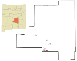
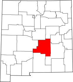
Ruidoso Downs is located in southern Lincoln County at 33°19′54″N105°35′46″W / 33.33167°N 105.59611°W / 33.33167; -105.59611 (33.331690, -105.596079). [6] It is bordered to the west by Ruidoso. Elevation is 6,420 feet (1,960 m).

U.S. Route 70 passes through the city, leading east 69 miles (111 km) to Roswell and southwest over Apache Summit 34 miles (55 km) to Tularosa. New Mexico State Road 48 departs US 70 just west of the city limits, leading north 22 miles (35 km) to Capitan.

According to the United States Census Bureau, the city has an area of 3.8 square miles (9.8 km2), all of it recorded as land. [7] The city is in the valley of the Rio Ruidoso, which rises to the west on Sierra Blanca Peak and flows east to form the Rio Hondo.

Demographics

Historical population
CensusPop.Note
1950 363
1960 40712.1%
1970 70272.5%
1980 94935.2%
1990 920−3.1%
2000 1,82498.3%
2010 2,81554.3%
2020 2,620−6.9%
U.S. Decennial Census [8] [2]

As of the census [9] of 2000, there were 1,824 people, 680 households, and 490 families residing in the village. The population density was 856.7 people per square mile (330.6/km2). There were 921 housing units at an average density of 432.6 per square mile (166.9/km2). The racial makeup of the village was 67.32% White, 0.77% African American, 3.56% Native American, 0.71% Asian, 0.27% Pacific Islander, 24.45% from other races, and 2.91% from two or more races. Hispanic or Latino of any race were 43.70% of the population.

There were 680 households, out of which 39.0% had children under the age of 18 living with them, 48.8% were married couples living together, 17.4% had a female householder with no husband present, and 27.8% were non-families. 21.2% of all households were made up of individuals, and 5.1% had someone living alone who was 65 years of age or older. The average household size was 2.68 and the average family size was 3.09.

In the city the population was spread out, with 29.1% under the age of 18, 8.2% from 18 to 24, 28.6% from 25 to 44, 24.8% from 45 to 64, and 9.4% who were 65 years of age or older. The median age was 35 years. For every 100 females, there were 95.9 males. For every 100 females age 18 and over, there were 92.4 males.

The median income for a household in the village was $29,375, and the median income for a family was $30,500. Males had a median income of $22,000 versus $17,623 for females. The per capita income for the village was $12,144. About 17.4% of families and 20.6% of the population were below the poverty line, including 29.7% of those under age 18 and 5.9% of those age 65 or over.

Transportation

Road heading towards Capitan Heading towards Capitan (4987224121).jpg
Road heading towards Capitan

Airports

Major highways

Key facilities

Hubbard Museum of the American West Hubbard Museum of the American West Ruidoso Downs New Mexico.jpg
Hubbard Museum of the American West

Events and culture

Ruidoso Downs Race Track and Casino, where the All American Futurity is held annually. Ruidoso Downs New Mexico Racetrack and Casino.jpg
Ruidoso Downs Race Track and Casino, where the All American Futurity is held annually.

The city is the annual location of the All American Futurity, which claims to be the richest race in Quarter Horse racing. [10]

See also

Related Research Articles

<span class="mw-page-title-main">Otero County, New Mexico</span> County in New Mexico, United States

Otero County is a county located in the U.S. state of New Mexico. As of the 2010 census, the population was 63,797. Its county seat is Alamogordo. Its southern boundary is the Texas state line. It is named for Miguel Antonio Otero, the territorial governor when the county was created.

<span class="mw-page-title-main">Lincoln County, New Mexico</span> County in New Mexico, United States

Lincoln County is a county in the U.S. state of New Mexico. As of the 2010 census, the population was 20,497. Its county seat is Carrizozo, while its largest community is Ruidoso.

<span class="mw-page-title-main">Chaves County, New Mexico</span> County in New Mexico, United States

Chaves County is a county in New Mexico, United States. As of the 2020 census, the population was 65,157. Its county seat is Roswell. Chaves County was named for Colonel Jose Francisco Chaves, a military leader there during the Civil War and later in Navajo campaigns. The county was created by the New Mexico Territorial Legislature on February 25, 1889, out of land from Lincoln County.

<span class="mw-page-title-main">Lincoln County, Idaho</span> County in Idaho, United States

Lincoln County is a county located in the U.S. state of Idaho. As of the 2020 census, the population was 5,127. The county seat and largest city is Shoshone. The county is named after President Abraham Lincoln. The Idaho Territory was created in 1863, during the Lincoln Administration of 1861–65.

<span class="mw-page-title-main">Gilpin County, Colorado</span> County in Colorado, United States

Gilpin County is a county located in the U.S. state of Colorado, smallest in land area behind only the City and County of Broomfield. As of the 2020 census, the population was 5,808. The county seat is Central City. The county was formed in 1861, while Colorado was still a territory, and was named after Colonel William Gilpin, the first territorial governor.

<span class="mw-page-title-main">Lincoln, Alabama</span> City in Alabama, United States

Lincoln is a city in Talladega County, Alabama, United States. It was incorporated in 1911. At the 2020 census, the population was 6,845. It was named for Major General Benjamin Lincoln, who served in the American army during the Revolutionary War.

<span class="mw-page-title-main">Madison, Illinois</span> City in Illinois, United States

Madison is a city in Madison and St. Clair counties in the U.S. state of Illinois. The population was 3,171 at the 2020 census, down from 3,891 in 2010. It is home to World Wide Technology Raceway at Gateway and the first Bulgarian Orthodox church in the United States.

<span class="mw-page-title-main">Troy, Illinois</span> City in Illinois, United States

Troy is a city in Madison County, Illinois, United States. The population was 10,960 at the 2020 census, up from 9,888 in 2010.

<span class="mw-page-title-main">Brownsboro Farm, Kentucky</span> City in Kentucky, United States

Brownsboro Farm is a home rule-class city in Jefferson County, Kentucky, United States. The population was 648 at the 2010 census.

<span class="mw-page-title-main">Lorton, Nebraska</span> Village in Nebraska, United States

Lorton is a village in Otoe County, Nebraska, United States. The population was 41 at the 2010 census.

<span class="mw-page-title-main">Vaughn, New Mexico</span> Town in New Mexico, United States

Vaughn is a town in Guadalupe County, New Mexico, United States. The population was 446 at the 2010 census, down from the figure of 539 recorded in 2000. It is located at an intersection of the Burlington Northern Santa Fe and Union Pacific railroad lines.

<span class="mw-page-title-main">Corona, New Mexico</span> Village in New Mexico, United States

Corona is a village in Lincoln County, New Mexico, United States, located along U.S. Route 54. The population was 172 at the time of the 2010 census.

<span class="mw-page-title-main">Ruidoso, New Mexico</span> City in New Mexico, United States

Ruidoso is a village in Lincoln County, New Mexico, United States, adjacent to the Lincoln National Forest. The population was 8,029 at the 2010 census. The city of Ruidoso Downs and the unincorporated area of Alto are suburbs of Ruidoso, and contribute to the Ruidoso Micropolitan Statistical Area's population of 21,223.

<span class="mw-page-title-main">Mescalero, New Mexico</span> Census-designated place in New Mexico, United States

Mescalero is a census-designated place (CDP) in Otero County, New Mexico, United States, located on the Mescalero Apache Reservation. The population was 1,338 at the 2010 census.

<span class="mw-page-title-main">Chamisal, New Mexico</span> Census-designated place in Taos County, New Mexico, United States

Chamisal is a census-designated place (CDP) in Taos County, New Mexico. It is located along the scenic High Road to Taos. The population was 301 at the time of the 2000 census.

<span class="mw-page-title-main">Encino, New Mexico</span> Village in New Mexico, United States

Encino is a village in Torrance County, New Mexico, United States. The population was 82 at the 2010 census. It is part of the Albuquerque Metropolitan Statistical Area.

<span class="mw-page-title-main">Lake Morton-Berrydale, Washington</span> Census-designated place in Washington, United States

Lake Morton-Berrydale is a census-designated place (CDP) in King County, Washington, United States. The population was 10,474 at the 2020 census.

<span class="mw-page-title-main">Vandalia, Missouri</span> City in Missouri, United States

Vandalia is a city in northeastern Audrain and extending into southeastern Ralls Counties in the U.S. state of Missouri. The population was 3,553 at the 2020 census, which includes about 1,000 prisoners incarcerated at the prison located within the city limits.

<span class="mw-page-title-main">Capitan, New Mexico</span> Village in New Mexico, United States

Capitan is a village in Lincoln County, New Mexico, United States, located north of the Lincoln National Forest between the Capitan and Sacramento Mountains at an elevation of 6,350 feet. The population was 1,489 at the 2010 census. Capitan was founded in the 1890s and incorporated in 1941.

Glencoe is an unincorporated community in Lincoln County, New Mexico, United States. Its ZIP code is 88324.

References

  1. "ArcGIS REST Services Directory". United States Census Bureau. Retrieved October 12, 2022.
  2. 1 2 "Census Population API". United States Census Bureau. Retrieved Oct 12, 2022.
  3. "Total Population: 2010 Census DEC Summary File 1 (P1), Ruidoso Downs city, New Mexico". data.census.gov. U.S. Census Bureau. Retrieved May 7, 2020.
  4. Population Estimates Boundary Changes Archived 2006-02-06 at the Wayback Machine , United States Census Bureau, 2007-07-01. Accessed 2008-11-06.
  5. 1 2 3 4 5 Orozco, Cynthia E. (March 13, 2014). "The History of Ruidoso Downs". Ruidoso News. Retrieved 2015-06-15.
  6. "US Gazetteer files: 2010, 2000, and 1990". United States Census Bureau. 2011-02-12. Retrieved 2011-04-23.
  7. "U.S. Gazetteer Files: 2019: Places: New Mexico". U.S. Census Bureau Geography Division. Retrieved May 7, 2020.
  8. "Census of Population and Housing". Census.gov. Retrieved June 4, 2015.
  9. "U.S. Census website". United States Census Bureau . Retrieved 2008-01-31.
  10. ruidownsracing.com