Nogal, New Mexico | |
|---|---|
 Skyline  Nogal Mercantile | |
 Nogal  Nogal | |
| Coordinates: 33°32′18″N105°42′43″W / 33.53833°N 105.71194°W | |
| Country | United States |
| State | New Mexico |
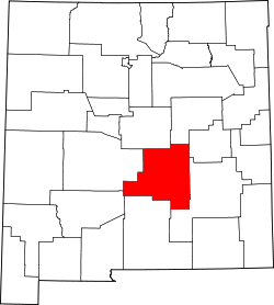
| County | Lincoln |
| Area | |
• Total | 7.61 sq mi (19.71 km2) |
| • Land | 7.61 sq mi (19.71 km2) |
| • Water | 0 sq mi (0.00 km2) |
| Elevation | 6,798 ft (2,072 m) |
| Population | |
• Total | 105 |
| • Density | 13.8/sq mi (5.33/km2) |
| Time zone | UTC-7 (Mountain (MST)) |
| • Summer (DST) | UTC-6 (MDT) |
| ZIP code | 88341 |
| Area code | 575 |
| GNIS feature ID | 2584164 [2] |
| FIPS code | 35-52190 |
Nogal is a census-designated place and unincorporated community in Lincoln County, New Mexico, United States. Its population was 96 as of the 2010 census. [4] Nogal has a post office with ZIP code 88341, which opened on November 9, 1880. [5] [6]