Mountainair, New Mexico

Last updated

Mountainair, New Mexico
Mountainair.JPG
Mural in downtown Mountainair
Nickname: 
Monta
Motto: 
"Gateway to ancient cities"
Torrance County New Mexico Incorporated and Unincorporated areas Mountainair Highlighted.svg
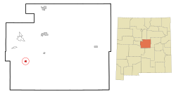
Location of Mountainair, New Mexico
Usa edcp location map.svg
Red pog.svg
Mountainair, New Mexico
Location in the United States
Coordinates: 34°31′11″N106°14′36″W / 34.51972°N 106.24333°W / 34.51972; -106.24333
Country United States
State New Mexico
County Torrance
Area
[1]
  Total1.58 sq mi (4.09 km2)
  Land1.58 sq mi (4.09 km2)
  Water0.00 sq mi (0.00 km2)
Elevation
[2]
6,513 ft (1,985 m)
Population
 (2020) [3]
  Total884
  Density559.14/sq mi (215.93/km2)
Time zone UTC-7 (Mountain (MST))
  Summer (DST) UTC-6 (MDT)
ZIP code
87036
Area code 505
FIPS code 35-50370
GNIS feature ID2413025 [2]
Website http://mountainairnm.gov

Mountainair is a town in Torrance County, New Mexico, United States. It was founded in 1902 by John Corbett, Colonel E. C. Manning, and Elias S. Stover. The population was 884 at the 2020 census. It is part of the Albuquerque Metropolitan Statistical Area. The main visitor center for Salinas Pueblo Missions National Monument is located within the town.

Contents

Geography

According to the United States Census Bureau, the town has a total area of 1.0 square mile (2.7 km2), all land.

Demographics

Historical population
CensusPop.Note
1920 577
1930 1,02778.0%
1940 1,47743.8%
1950 1,418−4.0%
1960 1,60513.2%
1970 1,022−36.3%
1980 1,17014.5%
1990 926−20.9%
2000 1,11620.5%
2010 928−16.8%
2020 884−4.7%
U.S. Decennial Census [4] [3]

As of the census [5] of 2000, there were 1,116 people, 452 households, and 281 families residing in the town. The population density was 1,064.2 inhabitants per square mile (410.9/km2). There were 545 housing units at an average density of 519.7 per square mile (200.7/km2). The racial makeup of the town was 61.20% White, 1.79% African American, 1.61% Native American, 0.27% Asian, 0.09% Pacific Islander, 29.48% from other races, and 5.56% from two or more races. Hispanic or Latino of any race were 53.14% of the population.

There were 452 households, out of which 31.6% had children under the age of 18 living with them, 42.3% were married couples living together, 16.2% had a female householder with no husband present, and 37.8% were non-families. 35.2% of all households were made up of individuals, and 20.8% had someone living alone who was 65 years of age or older. The average household size was 2.47 and the average family size was 3.22.

In the town, the population was spread out, with 29.9% under the age of 18, 8.7% from 18 to 24, 20.4% from 25 to 44, 23.4% from 45 to 64, and 17.6% who were 65 years of age or older. The median age was 38 years. For every 100 females, there were 87.6 males. For every 100 females age 18 and over, there were 79.8 males.

The median income for a household in the town was $21,146, and the median income for a family was $25,125. Males had a median income of $25,625 versus $21,094 for females. The per capita income for the town was $12,566. About 19.3% of families and 24.7% of the population were below the poverty line, including 40.5% of those under age 18 and 15.7% of those age 65 or over.

Government

The Mayor of Mountainair is Peter Nieto. The town is represented by the Mountainair Town Council which includes Mayor Pro-Tem Jose Richard Torres, Juanita Carrillo, Ernie Lopez & Aurora Zamora. The Town Clerk is Dennis Fulfer. The Chief of Police is Juan Reyes, Jr. The Public Works Supervisor is Daniel Archuleta.

Education

Its school district is Mountainair Public Schools. [6]

Notable person

Francine Neff, the 35th Treasurer of the United States, grew up on a small vegetable farm outside Mountainair.

Related Research Articles

<span class="mw-page-title-main">Valencia County, New Mexico</span> County in New Mexico, United States

Valencia County is a county in the U.S. state of New Mexico. As of the 2020 census, the population was 76,205. The county seat is Los Lunas.

<span class="mw-page-title-main">Torrance County, New Mexico</span> County in New Mexico, United States

Torrance County is a county located in the center of the U.S. state of New Mexico. As of the 2020 census, the population was 15,045. The county seat is Estancia.

<span class="mw-page-title-main">Sierra County, New Mexico</span> County in New Mexico, United States

Sierra County is a county located in the U.S. state of New Mexico. As of the 2020 Census, the population was 11,576. Its county seat is Truth or Consequences.

<span class="mw-page-title-main">San Miguel County, New Mexico</span> County in New Mexico, United States

San Miguel County is a county in the U.S. state of New Mexico. As of the 2020 census, the population was 27,201. Its county seat is Las Vegas.

<span class="mw-page-title-main">Roosevelt County, New Mexico</span> County in New Mexico, United States

Roosevelt County is a county located in the U.S. state of New Mexico. As of the 2020 census, the population was 19,191. Its county seat is Portales. The county was created in 1903 from Chaves and Guadalupe counties and named for the then-current President of the United States, Theodore Roosevelt. The county's eastern border is the Texas state line.

<span class="mw-page-title-main">Quay County, New Mexico</span> County in New Mexico, United States

Quay County is a county in the state of New Mexico. As of the 2020 U.S. census, the population was 8,746. Its county seat is Tucumcari. The county was named for Pennsylvania senator Matthew Quay, who supported statehood for New Mexico. Its eastern border is the Texas state line, approximately 103.04 degrees west longitude.

<span class="mw-page-title-main">Luna County, New Mexico</span> County in New Mexico, United States

Luna County(Spanish: Condado de Luna) is a county located in the U.S. state of New Mexico. As of the 2020 census, the population was 25,427. Its county seat is Deming. This county abuts the Mexican border. Luna County comprises the Deming, NM Micropolitan Statistical Area.

<span class="mw-page-title-main">Lincoln County, New Mexico</span> County in New Mexico, United States

Lincoln County is a county in the U.S. state of New Mexico. As of the 2020 census, the population was 20,269. Its county seat is Carrizozo, while its largest community is Ruidoso.

<span class="mw-page-title-main">Bernalillo County, New Mexico</span> County in New Mexico, United States

Bernalillo County is the most populous county in the U.S. state of New Mexico. As of the 2020 census, the population was 676,444. The county seat, Albuquerque, is the most populous city in New Mexico.

<span class="mw-page-title-main">Alcalde, New Mexico</span> CDP in New Mexico, United States

Alcalde is a census-designated place (CDP) in Rio Arriba County, New Mexico, United States. The population was 285 at the 2010 census.

<span class="mw-page-title-main">Naschitti, New Mexico</span> CDP in New Mexico, United States

Naschitti is a census-designated place (CDP) in San Juan County, New Mexico, United States. The population was 360 at the 2000 census. It is part of the Farmington Metropolitan Statistical Area. The town was established in 1886, when Tom Bryan set up a trading post east of the Chuska Mountains. With a Navajo name, Naschitti means "badger springs."

<span class="mw-page-title-main">Cedar Grove, New Mexico</span> CDP in New Mexico, United States

Cedar Grove is a census-designated place (CDP) in Santa Fe County, New Mexico, United States. It is part of the Santa Fe, New Mexico Metropolitan Statistical Area. The population was 747 at the 2010 censuCedar Grove was formerly a stage and freight stop. It has developed into a Santa Fe suburb. New Mexico "cedars" are abundant in the town.

<span class="mw-page-title-main">Encino, New Mexico</span> Village in New Mexico, United States

Encino is a village in Torrance County, New Mexico, United States. The population was 82 at the 2010 census. It is part of the Albuquerque Metropolitan Statistical Area.

<span class="mw-page-title-main">Estancia, New Mexico</span> Town in New Mexico, United States

Estancia is a town in Torrance County, New Mexico, United States. As of the 2020 census, the town population was 1,242. It is the county seat of Torrance County.

<span class="mw-page-title-main">Manzano, New Mexico</span> CDP in New Mexico, United States

Manzano is a census-designated place (CDP) in Torrance County, New Mexico, United States. The population was 54 at the 2000 census. The Quarai Ruins of Salinas Pueblo Missions National Monument are located near the town. The center of population of New Mexico is located in Manzano.

<span class="mw-page-title-main">Moriarty, New Mexico</span> Town in New Mexico, United States

Moriarty is a town in Torrance County, New Mexico, United States. The population was 1,910 at the 2010 Census. It is part of the Albuquerque Metropolitan Statistical Area.

<span class="mw-page-title-main">Torreon, Torrance County, New Mexico</span> Census-designated place in Torrance County, New Mexico, United States

Torreon is a farming community and census-designated place (CDP) in Torrance County, New Mexico, United States. The population was 244 at the 2000 census. It is part of the Albuquerque Metropolitan Statistical Area.

<span class="mw-page-title-main">Willard, New Mexico</span> Village in New Mexico, United States

Willard is a village in Torrance County, New Mexico, United States. The population was 253 at the 2010 census. It is part of the Albuquerque Metropolitan Statistical Area. The village is not experiencing the same extreme growth that towns farther north in the state are. A wind farm has recently been constructed upon the mesa just south of the town. It provides power for about 25,000 homes in Arizona.

<span class="mw-page-title-main">Peralta, New Mexico</span> Town in New Mexico, United States

Peralta is a town in Valencia County, New Mexico, United States. Prior to its incorporation on July 1, 2007, it was a census-designated place (CDP). The population was 3,660 as of the 2010 census. Peralta is part of the Albuquerque metropolitan area.

<span class="mw-page-title-main">Jackson Township, Mercer County, Pennsylvania</span> Township in Pennsylvania, United States

Jackson Township is a township in Mercer County, Pennsylvania, United States. The population was 1,181 at the 2020 census, a decrease from the figure of 1,273 in 2010.

References

  1. "ArcGIS REST Services Directory". United States Census Bureau. Retrieved October 12, 2022.
  2. 1 2 U.S. Geological Survey Geographic Names Information System: Mountainair, New Mexico
  3. 1 2 "Census Population API". United States Census Bureau. Retrieved October 12, 2022.
  4. "Census of Population and Housing". Census.gov. Retrieved June 4, 2015.
  5. "U.S. Census website". United States Census Bureau . Retrieved January 31, 2008.
  6. "2020 CENSUS - SCHOOL DISTRICT REFERENCE MAP: Torrance County, NM" (PDF). U.S. Census Bureau . Retrieved September 3, 2022.