
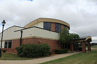
Cuyahoga County Airport, also known as Robert D. Shea Field, is a public use airport in northeastern Cuyahoga County, Ohio, United States. Owned and operated by Cuyahoga County since 1946, it also serves Lake County and Geauga County. The airport is located 10 nautical miles east of downtown Cleveland and sits on the border of three cities: Highland Heights, Richmond Heights and Willoughby Hills. It is included in the National Plan of Integrated Airport Systems for 2011–2015, which categorized it as a general aviation reliever airport for Cleveland Hopkins International Airport.

Put-in-Bay Airport is a public airport located in Put-in-Bay on South Bass Island in Ottawa County, Ohio, United States. The approach to Runway 21 is complicated by Perry's Victory and International Peace Memorial, which is almost exactly in line with the runway; pilots are asked to respect special procedures to avoid the monument. The airport is located in the center of the southern half of the island.

Springfield–Beckley Municipal Airport is a civil-military airport five miles (8 km) south of Springfield, in Clark County, Ohio, United States. It is owned by the city of Springfield. It is named after the Beckley family, a member of which knew the Wright Brothers, and witnessed and photographed their first flights.
Ohio University Airport or Gordon K. Bush Airport, also known as Snyder Field, is a public-use airport located on State Route 32/U.S. 50 in the village of Albany, about ten miles (16 km) southwest of the city of Athens, in Athens County, Ohio, United States.
Portage County Airport, also known as Portage County Regional Airport, is a public use airport in Portage County, Ohio, United States. It is owned by the Portage County Airport Authority and located three nautical miles (6 km) north of Ravenna, in Shalersville Township. This airport is included in the National Plan of Integrated Airport Systems for 2011–2015, which categorized it as a general aviation facility.
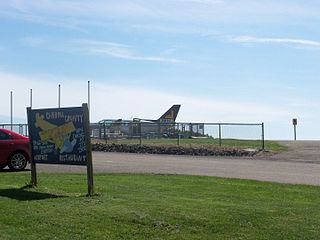
Newark–Heath Airport is a public airport located in Heath, Ohio. It is three miles (4.8 km) southwest of the central business district of Newark, a city in Licking County, Ohio, United States. The airport was opened in 1930 by the city of Newark, and was transferred to the Licking County Regional Airport Authority in 1967. The airport currently has a McDonnell Douglas F-4C Phantom II S.N. 64–0683 on static display.
Madison County Airport is a public airport located 3 miles (4.8 km) north of the central business district of London, a city in Madison County, Ohio, United States. It is owned by the Madison County Airport Authority.
Knox County Airport is five miles southwest of Mount Vernon, in Knox County, Ohio.

Union County Airport is a public use airport in Union County, Ohio, United States. It is owned by the Union County Airport Authority and located one nautical mile (2 km) southeast of the central business district of Marysville, Ohio. This airport is included in the National Plan of Integrated Airport Systems for 2011–2015, which categorized it as a general aviation facility.
Romeo State Airport is a public airport owned and operated by the State of Michigan located 2 miles (3.2 km) east of Romeo, Michigan, United States. The airport is uncontrolled and is used for general aviation purposes. It is included in the Federal Aviation Administration (FAA) National Plan of Integrated Airport Systems for 2017–2021, in which it is categorized as a local reliever airport facility.
Fairfield County Airport is a public use airport in Fairfield County, Ohio, United States. It is located three nautical miles (6 km) northwest of the central business district of Lancaster, the county seat. The airport is owned by the Fairfield County Commissioners.
Highland County Airport is a public-owned, public-use airport located at 9500 North Shore Drive three nautical mile (4.8 km) southeast of the central business district of the city of Hillsboro, in Highland County, Ohio, United States.
Galion Municipal Airport is three miles northeast of Galion in Crawford County, Ohio. The FAA's National Plan of Integrated Airport Systems for 2009–2013 classified it as a general aviation airport.
Carroll County–Tolson Airport is a county–owned, public-use airport located one nautical mile (1.85 km) southeast of the central business district of Carrollton, a village in Carroll County, Ohio, United States. It is owned by the Carroll County Airport Authority. According to the FAA's National Plan of Integrated Airport Systems for 2009–2013, it is categorized as a general aviation airport.

Luce County Airport is a county-owned public-use airport located three miles southeast of the central business district of Newberry, a city in Luce County, Michigan, United States. It is included in the Federal Aviation Administration (FAA) National Plan of Integrated Airport Systems for 2017–2021, in which it is categorized as a basic general aviation facility.

Marion Municipal Airport is three miles northeast of Marion, in Marion County, Ohio. The FAA's National Plan of Integrated Airport Systems for 2011–2015 categorized it as a general aviation facility.
Harry Clever Field is a public airport three miles southeast of New Philadelphia, in Tuscarawas County, Ohio. The National Plan of Integrated Airport Systems for 2018 categorized it as a general aviation facility.
The Youngstown Elser Metro Airport is a privately owned, public use general aviation airport located 7 miles southwest of Youngstown in Beaver Township, Mahoning County, Ohio, United States. It has a 10/28 asphalt runway of 4,012 ft × 50 ft in dimension.

Geauga County Airport, is a public use airport in southern Geauga County, Ohio, United States. Owned and operated by Geauga County since 1968, it serves all of Geauga County. The airport is located 40 nautical miles east of downtown Cleveland.
Holmes County Airport is a public airport located two miles southwest of Millersburg, Ohio, United States. It is owned and operated by the Holmes County Airport Authority.


