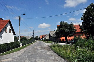
Lipnica is a village in the administrative district of Gmina Środa Śląska, within Środa Śląska County, Lower Silesian Voivodeship, in south-western Poland. Prior to 1945 it was in Germany.
Słabęcin is a village in the administrative district of Gmina Kruszwica, within Inowrocław County, Kuyavian-Pomeranian Voivodeship, in north-central Poland.

Kruszynek is a village in the administrative district of Gmina Włocławek, within Włocławek County, Kuyavian-Pomeranian Voivodeship, in north-central Poland. It lies approximately 11 kilometres (7 mi) south of Włocławek and 58 km (36 mi) south-east of Toruń.

Gertrudów is a village in the administrative district of Gmina Gomunice, within Radomsko County, Łódź Voivodeship, in central Poland. It lies approximately 6 kilometres (4 mi) east of Gomunice, 15 km (9 mi) north-east of Radomsko, and 69 km (43 mi) south of the regional capital Łódź.

Pieczyska is a village in the administrative district of Gmina Złoczew, within Sieradz County, Łódź Voivodeship, in central Poland. It lies approximately 4 kilometres (2 mi) north-west of Złoczew, 23 km (14 mi) south-west of Sieradz, and 74 km (46 mi) south-west of the regional capital Łódź.

Gołuchów is a village in the administrative district of Gmina Kije, within Pińczów County, Świętokrzyskie Voivodeship, in south-central Poland. It lies approximately 5 kilometres (3 mi) north-east of Kije, 13 km (8 mi) north-east of Pińczów, and 29 km (18 mi) south of the regional capital Kielce.
Stary Kiełbów is a village in the administrative district of Gmina Stara Błotnica, within Białobrzegi County, Masovian Voivodeship, in east-central Poland.

Stara Dąbrowa is a village in the administrative district of Gmina Leoncin, within Nowy Dwór Mazowiecki County, Masovian Voivodeship, in east-central Poland. It lies approximately 13 kilometres (8 mi) south-west of Nowy Dwór Mazowiecki and 33 km (21 mi) north-west of Warsaw.
Bochna is a village in the administrative district of Gmina Nur, within Ostrów Mazowiecka County, Masovian Voivodeship, in east-central Poland.

Krajęczyn is a village in the administrative district of Gmina Joniec, within Płońsk County, Masovian Voivodeship, in east-central Poland. It lies approximately 14 kilometres (9 mi) east of Płońsk and 53 km (33 mi) north-west of Warsaw.
Gurowo is a village in the administrative district of Gmina Niechanowo, within Gniezno County, Greater Poland Voivodeship, in west-central Poland.

Poświętne is a settlement in the administrative district of Gmina Szamotuły, within Szamotuły County, Greater Poland Voivodeship, in west-central Poland. It lies approximately 13 kilometres (8 mi) west of Szamotuły and 39 km (24 mi) north-west of the regional capital Poznań.
Piaskowo is a village in the administrative district of Gmina Ostroróg, within Szamotuły County, Greater Poland Voivodeship, in west-central Poland.

Rogi is a village in the administrative district of Gmina Lubniewice, within Sulęcin County, Lubusz Voivodeship, in western Poland. It lies approximately 8 kilometres (5 mi) north-west of Lubniewice, 14 km (9 mi) north of Sulęcin, and 20 km (12 mi) south of Gorzów Wielkopolski.

Banatki Duże is a village in the administrative district of Gmina Strzelce Opolskie, within Strzelce County, Opole Voivodeship, in south-western Poland. It lies approximately 14 kilometres (9 mi) north of Strzelce Opolskie and 25 km (16 mi) east of the regional capital Opole.

Powałki is a village in the administrative district of Gmina Chojnice, within Chojnice County, Pomeranian Voivodeship, in northern Poland. It lies approximately 7 kilometres (4 mi) north-east of Chojnice and 97 km (60 mi) south-west of the regional capital Gdańsk.

Pękalin is a village in the administrative district of Gmina Główczyce, within Słupsk County, Pomeranian Voivodeship, in northern Poland. It lies approximately 13 kilometres (8 mi) east of Główczyce, 39 km (24 mi) north-east of Słupsk, and 75 km (47 mi) west of the regional capital Gdańsk.

Dąbrówka-Młyn is a settlement in the administrative district of Gmina Luzino, within Wejherowo County, Pomeranian Voivodeship, in northern Poland. It lies approximately 5 kilometres (3 mi) east of Luzino, 7 km (4 mi) south-west of Wejherowo, and 37 km (23 mi) north-west of the regional capital Gdańsk.

Bożepole Małe is a village in the administrative district of Gmina Łęczyce, within Wejherowo County, Pomeranian Voivodeship, in northern Poland. It lies approximately 9 kilometres (6 mi) east of Łęczyce, 18 km (11 mi) west of Wejherowo, and 48 km (30 mi) north-west of the regional capital Gdańsk.
Róże is a village in the administrative district of Gmina Węgorzewo, within Węgorzewo County, Warmian-Masurian Voivodeship, in northern Poland, close to the border with the Kaliningrad Oblast of Russia.


