Waipa District is a municipality in the Waikato region of New Zealand that is administered by the Waipa District Council. Its most populous town is Cambridge. The seat of the council is at the second most populous town, Te Awamutu. The district is south and south-east of the city of Hamilton. It has five wards: Te Awamutu, Cambridge, Pirongia, Maungatautari and Kakepuku.
Mount Nimrod is a hill in the Hunters Hills area of Canterbury, New Zealand. It is situated within the Mount Nimrod Reserve.
North Harbour is a suburb on the North Shore of Auckland, New Zealand. It is located 12 kilometres north of the city centre, to the south of the suburb of Albany. The suburb has not been officially designated as a suburb by Auckland Council, the territorial authority. The place name holds no official status with the New Zealand Geographic Board, nor is it used by New Zealand Post. North Harbour is, however, a statistical area used in Statistics New Zealand datasets and North Harbour East and North Harbour West are area units. The general area that embodies what is referred to as the suburb of North Harbour is made up of parts of Albany, Rosedale, Schanpper Rock and Pinehill.

Ōtaki is a town in the Kapiti Coast District of the North Island of New Zealand, situated half way between the capital city Wellington, 70 km (43 mi) to the southwest, and Palmerston North, 70 km (43 mi) to the northeast.

Ōwhango is a small town in New Zealand situated about 20 kilometres (12 mi) south of Taumarunui on State Highway 4 (SH4), and about 2 kilometres (1.2 mi) west of the Whakapapa River, a tributary of the nascent Whanganui River.

Maketu is a small town on the Bay of Plenty Coast in New Zealand.

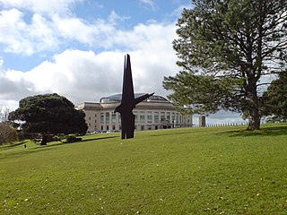
The Auckland Domain, referred to as Pukekawa / Auckland Domain by the Auckland Council, is a large park in Auckland, New Zealand. It is the oldest park in the city, and at 75 hectares is one of the largest. Located in the central suburb of Grafton, the park land is the remains of the explosion crater and most of the surrounding tuff ring of the Pukekawa volcano.
Lake Sparrow is a mountain tarn in New Zealand's Anatoki Range. It is located within Kahurangi National Park in the South Island's Tasman Region. It lies at an elevation of some 1,400 metres (4,600 ft), and covers approximately 4 hectares.

Waiwera is a small town in the north of the Auckland Region in New Zealand. The name is of Māori origin and means "Hot Water". Its main claim to fame was the hot water springs which were well known in pre-European times and reputedly visited by Māori from as far away as Thames. The first European settler to promote the springs was Robert Graham who established a health resort in 1848. During the late 19th century there was a regular steam ferry service from Auckland. The commercial hot pools closed in 2018.
The New Zealand Geographic Board Ngā Pou Taunaha o Aotearoa (NZGB) was established by the New Zealand Geographic Board Act 1946, which has since been replaced by the New Zealand Geographic Board Act 2008. Although an independent institution, it is responsible to the Minister for Land Information.

Meretoto / Ship Cove is a small bay in the Marlborough Region of New Zealand, renowned as the first place of prolonged contact between Māori and Europeans. It is located near the entrance of Queen Charlotte Sound / Tōtaranui, west of nearby Motuara Island and Long Island.

The Manganuioteao River is a river of the centre of New Zealand's North Island. It has its source in numerous streams and small rivers which flow west from the slopes of Mount Ruapehu, though the main course of the river flows predominantly southwest through rugged hill country to meet with the Whanganui River 10 kilometres (6 mi) north of Pipiriki, at the edge of the Whanganui National Park.

The Opotoru River is a river of the Waikato Region of New Zealand's North Island. It flows north, reaching the Raglan Harbour southwest of the town of Raglan. There is no regular monitoring of pollution, but 38 kilometres (24 mi) (31.2%) of the river has been fenced to protect it from farm stock.
The Paranui River is a river of the Northland Region of New Zealand's North Island. It flows north from its sources around Paranui to reach the Taipa River 5 kilometres (3 mi) from Taipa.

The Stephens Island / Takapourewa lighthouse is one of New Zealand most powerful lights with a range of 18 nautical miles. Perched 183 metres (600 ft) up, on top of Stephens Island, it guards Cook Strait and Tasman Bay / Te Tai-o-Aorere, at the top of the South Island / Te Wai Pounamu.The light flashes white once every six seconds from a white cast iron tower.

Mangapehi was a flag station on the North Island Main Trunk line, in the Waitomo District of New Zealand. It was 5.89 km (3.66 mi) north of Poro-O-Tarao and 5.15 km (3.20 mi) south of Kopaki.
Kohinurākau or Kōhinerākau is a 490 m (1,610 ft) mountain in the Kohinurākau Range, 8.5 km (5.3 mi) south-southwest of Havelock North in the Hawke's Bay region of New Zealand. The mountain is home to the main television and FM radio transmitter for Napier, Hastings and the wider Hawke's Bay region.

Harris Saddle, also known as Harris Pass and officially known as Harris Saddle / Tarahaka Whakatipu is a mountain pass in Otago, on the South Island of New Zealand. It is located near Lake Harris and Conical Hill, and is part of the Routeburn Track.

Scott Point is a point at the northern end of Ninety Mile Beach in North Auckland, New Zealand. It is the site of a major intertidal green-lipped mussel population.


