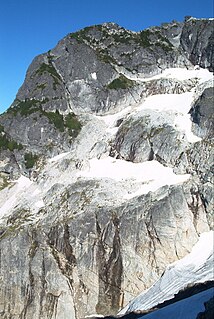
Mount Pugh is a peak near the western edge of the North Cascades, in Washington state. It is located 12.2 miles (19.6 km) west of Glacier Peak, one of the Cascade stratovolcanoes. It rises out of the confluence of the White Chuck River and the Sauk River, giving it very low footings. For example, it rises 6,150 feet (1,875 m) above the Sauk River Valley in just over 2 horizontal miles (3.2 km); its rise over the White Chuck River is almost as dramatic. The mountain is named for John Pugh, who settled nearby, in 1891.

Mount Blum, or Mount Bald, is a 7,685-foot (2,342 m) summit of the North Cascades range in Washington state, on the western edge of North Cascades National Park. It is the highest summit of a string of mountain peaks located east of Mount Shuksan and west of the Picket Range. Two small active glaciers rest on its northern flank. Mount Blum was named after John Blum, a United States Forest Service fire patrol pilot who crashed nearby in 1931.

Buckner Mountain is a tall peak in the North Cascades of Washington state and in the Stephen Mather Wilderness of North Cascades National Park. At 9,114 feet (2,778 m) in elevation it is the highest in Skagit County and one of about ten of Washington's non-volcanic peaks above 9,000 feet high. It is ranked as the 14th highest peak in the state, and the third highest peak in North Cascades National Park.
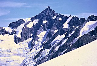
Forbidden Peak is an 8,815 feet (2,687 m) glacial horn located in North Cascades National Park, in Skagit County of Washington state. It is part of the North Cascades and is located near Cascade Pass. Forbidden Peak features a rock climbing route named West Ridge route which is featured in Fifty Classic Climbs of North America. The peak was first climbed by a party consisting of Fred Beckey, his brother Helmy Beckey, Jim Crooks, Lloyd Anderson and Dave Lind in 1940.

Sinister Peak is in Mount Baker-Snoqualmie and Wenatchee National Forests in the U.S. state of Washington. It is situated in Glacier Peak Wilderness and the North Cascades. Not quite 1 mi (1.6 km) east of Dome Peak, Sinister Peak is along a high ridge connecting the two peaks. The Chickamin Glacier is on the north slopes of Sinister Peak while the Garden Glacier is just southeast. Though some of the routes to the summit are technical, it can be reached by a moderate scramble.

Mount Challenger is in North Cascades National Park in the U.S. state of Washington. A difficult peak to approach due to its isolation, one of the most common routes to the summit involves ascending the Challenger Glacier on the north slopes of the peak. Mount Challenger is one of the taller peaks of the Picket Range.

Nooksack Tower is in North Cascades National Park in the U.S. state of Washington. Nooksack Tower is part of the Mount Shuksan Massif and is .75 mi (1.21 km) northeast of the main summit of Shuksan. Nooksack Tower looms to the west over Nooksack Cirque. The East Nooksack Glacier lies to the southeast, West Nooksack Glacier to the east and Price Glacier is on the north flanks of the tower. Nooksack Tower is one of the most difficult mountains to climb in the Cascade Range, with loose rock, 50-degree or greater slopes and ice ridges as well as accessibility issues and exposure, all weighing into the climbing equation. The descent may require ten or more rappels.
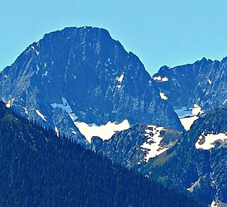
Mesahchie Peak is in North Cascades National Park in the U.S. state of Washington. Mesahchie Peak is named after the Chinook word for wicked. Mesahchie Peak is the highest summit along a ridge known as Ragged Ridge and is only .25 mi (0.40 km) east of Katsuk Peak. Both the Katsuk and Mesahchie Glaciers descended down the northwest and northeast flanks of the peak respectively.
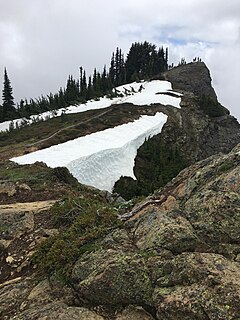
Mount Dickerman, or Dickerman Mountain, is a mountain in Mount Baker-Snoqualmie National Forest in Washington state. It is located northwest of Barlow Pass along the Mountain Loop Highway. A strenuous four mile trail leads from this highway to the summit with views which includes Glacier Peak, Monte Cristo Peak, and Sloan Peak.

Mount Hardy is an 8,080+ ft mountain summit located in Okanogan County in Washington state. It is part of the Okanogan Range which is a sub-range of the North Cascades Range. Mount Hardy is situated west of Methow Pass at headwaters of the Methow River on land administered by Okanogan National Forest. The nearest higher peak is Golden Horn, 1.75 miles (2.82 km) to the northeast. Mount Hardy can be seen from the North Cascades Highway which follows below the southwest slopes of the mountain.

Hinkhouse Peak is a 7,560-foot (2,300-metre) mountain summit located on the shared border of Okanogan County and Chelan County in Washington state. It is part of the Okanogan Range which is a sub-range of the North Cascades Range. Hinkhouse Peak is situated on land administered by Okanogan National Forest. The nearest higher peak is Liberty Bell Mountain, 1.52 miles (2.45 km) to the south. Hinkhouse Peak is situated north of Washington Pass, at the east end of a high ridge which connects to Cutthroat Peak. A high ridge extending southeast connects it to Constitution Crags. Most precipitation runoff from the peak drains into Early Winters Creek which is a tributary of the Methow River, but the south slope drains into a tributary of the Chelan River.
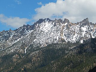
Vasiliki Ridge is a three mile long ridge located in Okanogan County of Washington state. It is part of the Methow Mountains which is a sub-range of the North Cascades. Vasiliki Ridge is situated north of Silver Star Mountain on land administered by Okanogan National Forest. The name Vasiliki was recommended by climber Fred Beckey who made the first ascent in 1952. Vasiliki Ridge can be seen from Washington Pass and from the North Cascades Highway.

Mount Ross is a 6,052 ft summit in the North Cascades Range of Washington, United States. It is located within North Cascades National Park and Stephen Mather Wilderness. It rises steeply from the North Cascades Highway and Newhalem, Washington which are both set at the southern foot of the mountain. Like many North Cascades peaks, Mount Ross is more notable for its large, steep rise above local terrain than for its absolute elevation. Mount Ross honors James Delmage Ross (1872–1939), the superintendent of the Skagit River Hydroelectric Project. Ross Dam and Ross Lake also bear his name. Mount Ross was first climbed on August 17, 1969 by Jack Roper, Maurine Roper, and Jan Bergerson. The nearest higher peak is The Roost, 1.09 miles (1.75 km) to the north. Precipitation runoff from the mountain drains into the Skagit River.

Antler Peak is a 7,017 feet (2,139 m) summit located in Mount Rainier National Park in Pierce County of Washington state. It is part of the Sourdough Mountains, a subset of the Cascade Range. Antler Peak is situated west of Dege Peak and northeast of Sunrise Historic District, with the Sourdough Ridge Trail traversing the south slope of Antler between the two. Mount Fremont is its nearest higher peak, 1.55 mi (2.49 km) to the west. Precipitation runoff from Antler Peak drains into the White River.

Tamanos Mountain is a 6,790 feet (2,070 m) summit located in Mount Rainier National Park in Pierce County of Washington state. It is part of the Cascade Range. Tamanos Mountain is situated west of Governors Ridge and northeast of the Cowlitz Chimneys, all of which can be seen from the Sunrise Historic District. The name tamanos derives from Chinook Jargon and has the meaning of guardian spirit. The normal climbing access is from the Owyhigh Lakes Trail, and from the lakes scramble up the south slope to the summit.

Governors Ridge is located in Mount Rainier National Park in Pierce County of Washington state. It is part of the Cascade Range and is situated west of Cayuse Pass and 1.09 mile east of Tamanos Mountain, which is its nearest higher peak. The name honors all the governors who have served the state of Washington. The highest rocky crag on the ridge is known as Governors Peak. There is also a 40-foot leaning spire known as Governors Needle, and Barrier Peak is at the southern culmination of the ridge. The normal climbing access is from the Owyhigh Lakes Trail.

Double Peak is the descriptive name of a 6,199 feet (1,889 m) double summit located in Mount Rainier National Park in Pierce County of Washington state. Part of the Cascade Range, it is situated northwest of Shriner Peak, south of Governors Ridge, and southeast of the Cowlitz Chimneys.

Barrier Peak is a small 6,521 ft summit located in Mount Rainier National Park in Pierce County of Washington state. It is part of the Cascade Range and is situated west of Cayuse Pass, 0.53 mile west-northwest of Buell Peak, and 0.4 mile south-southwest of Governors Ridge, which is its nearest higher peak. The normal climbing access is from the Owyhigh Lakes Trail. The peak was so named because it served as a barrier between the Cayuse Pass region and the rest of Mount Rainier National Park.

Mount Misch is a remote 7,435 ft mountain summit in the North Cascades, in Skagit County of Washington state. It is the highest point of the Buckindy Range, or Buckindy Ridge. It is located 19 miles east-northeast of Darrington, Washington, and 15 miles north-northwest of Glacier Peak which is one of the Cascade stratovolcanoes. It is situated in the Glacier Peak Wilderness on land administered by the Mount Baker-Snoqualmie National Forest. Mount Misch was named by mountaineer and author Fred Beckey for his friend Peter Misch (1909-1987), University of Washington geology professor and mountaineer, who was renowned for his study of the North Cascades. Precipitation runoff from Mount Misch and the unnamed Goat Creek glacier on its east slope drains into tributaries of the Suiattle River and ultimately the Skagit River.

Goat Mountain is a 6,844 ft summit in the Skagit Range which is a subset of the North Cascades of Washington state. It is located south of Mount Larrabee and north of Mount Shuksan in the Mount Baker Wilderness, which is managed by the Mount Baker-Snoqualmie National Forest. Goat Mountain has a subsidiary 6,725 ft summit known as the west peak, and remnants of what was colloquially known as the Swamp Creek glacier rest on the northern slope between the two summits. The Silver Tip Mine was located on the south slope of the mountain near the 3,000 ft level. The mine produced silver and gold in the 1940s. Precipitation runoff from the mountain drains into tributaries of the Fraser River and the Nooksack River.


