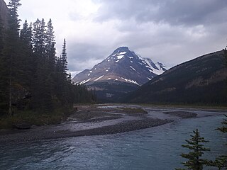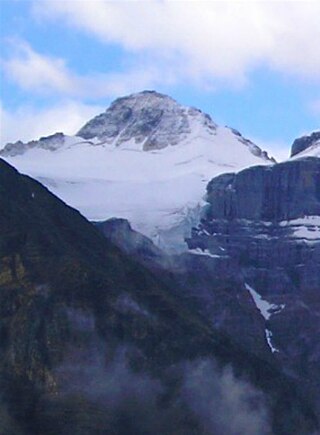
Mount Brazeau is a mountain in Alberta, Canada.

The Sawback Range is a mountain range of the Canadian Rockies that stretches from the Bow Valley in Alberta into southeastern Banff National Park.

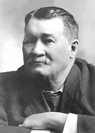
Leverett George DeVeber was a Canadian politician who served as Member of the Legislative Assemblies of Alberta and the North-West Territories, minister in the government of Alberta, and member of the Senate of Canada. Born in New Brunswick and trained as a physician, he joined the North-West Mounted Police and came west, eventually settling in Lethbridge after leaving the police force. He represented Lethbridge in the North-West Legislative Assembly from 1898 until 1905, when Lethbridge became part of the new province of Alberta. He was appointed Minister without Portfolio in Alberta's first government, but resigned four months later to accept an appointment to the Senate, where he remained until his death.
Lethbridge was a provincial electoral district in Alberta mandated to return a single member to the Legislative Assembly of Alberta from 1905 to 1909, and again from 1921 to 1971.

The Rainbow Range is a small subrange of the Park Ranges subdivisions of the Northern Continental Ranges of the Rocky Mountains on the border between Alberta and British Columbia in Mount Robson Provincial Park.

Highwood Pass is a mountain pass in Kananaskis Country, Alberta, Canada. It lies west of Mount Rae and Mount Arethusa of the Misty Range, south of Elbow Pass. It lies within the Peter Lougheed Provincial Park on Alberta Highway 40. The Highwood River originates in the pass.

The Park Ranges, also known as the Main Ranges, are a group of mountain ranges in the Canadian Rockies of southeastern British Columbia and southwestern Alberta, Canada. It is one of the three main subranges and the most central of the Continental Ranges, extending from southeast of Mount McGregor to the Fernie Basin.
Mount Farnham is British Columbia's 17th highest peak, and 21st most prominent. It was named after Paulding Farnham from New York. It is the highest peak in the Purcells.
Mount Morkill is located on the border of Alberta and British Columbia, near McBride which is a town in British Columbia, Canada. There is a subpeak to the southwest of the main peak, at an elevation of 2,185 m (7,169 ft) named The Gazetted Peak. It was named in 1965 after D.B. Morkill, a British Columbia land surveyor.
Mount Talbot is located on the northern side of Shale Pass on the Alberta-British Columbia border. It was officially named on 4 November 1925 after Senator Peter Talbot (1854-1919), an early pioneer of the Lacombe region of central Alberta. A teacher and farmer, he turned to politics and became an elected representative of the Northwest Territories and later the province of Alberta. In 1906, Sir Wilfrid Laurier appointed him to the Senate of Canada.
Mount Pauline is located on the south side of Beaverdam Pass on the Alberta-British Columbia border. It is the 26th most prominent in Alberta. It was named in 1925 after F.A. Pauline. The three slopes are covered in mostly metamorphic shale or slate, due to this it is unknown how difficult it would be to climb to the peak.

Mount Bess is located on the border of Alberta and British Columbia. It is the 83rd highest peak in Alberta. It was named in 1910 by J. Norman Collie after Bessie Gunn, who accompanied Collie's expedition.
Tatei Ridge is a mountain ridge east of Berg Lake at the northern end of Mount Robson Provincial Park on the Continental Divide marking the Alberta-British Columbia border. It was named in 1912 by Charles D. Walcott as tatei is the Stoney language word for "wind".
Mount Machray is located on the western side of Grant Pass, NE side of Mount Robson Provincial Park on the Continental Divide marking the Alberta-British Columbia border. It was named in 1923 after Robert Machray, Archbishop of Rupert's Land.
Mount McCord is located at the northern end of Miette Pass, NE side of Mount Robson Provincial Park on the Continental Divide marking the Alberta-British Columbia border. It was named in 1923 after W.C. McCord, a surveyor who led a Canadian Pacific Railway trail-making party in 1872.
Mount Ross Cox is located north of the Hooker Icefield in Hamber Provincial Park and straddles the Continental Divide marking the Alberta-British Columbia border. It was named in 1920 after Ross Cox who traveled the area in 1817.

Mount Little is situated at the northern end of Kootenay National Park, and straddles the Continental Divide marking the Alberta-British Columbia border. It was named in 1916 after George F. Little, a member of the first ascent party.

Resplendent Mountain, or Mount Resplendent is a peak in the Canadian Rockies, located at the northern end of Mount Robson Provincial Park in British Columbia, Canada. It is a part of the Rainbow Range, and is a sister peak to the more famous Mount Robson, its nearest neighbour. Together they form a classic panorama seen by travellers on Via Rail trains and Highway 16. The mountain was named by Arthur P. Coleman, and Arthur O. Wheeler wrote, "On the east side it is clad from top to bottom in pure white snow, and presents with the sun shining upon it a spectacle of such wonderful brilliance that the aptness of the name became immediately apparent." The first ascent was achieved on the same historic 1911 trip in which Conrad Kain first scouted the climbing routes later to be used on the first ascent of Mount Robson.

Mount Dromore is a summit in Alberta, Canada located in the Maligne River Valley at the head of Dromore Creek in Jasper National Park.
Mount Davidson is a 2,919-metre (9,577-foot) mountain summit located to the north of the head of Waiparous Creek, Municipal District of Bighorn No. 8, southwestern Alberta, Canada. Visible from Calgary, it is situated 18 km (11 mi) north of Lake Minnewanka. The first ascent of the mountain was made in October 1988 by Frank Campbell and Karl Nagy.


