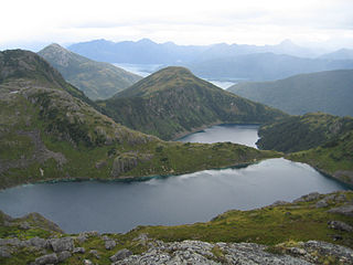
The Chugach Mountains of southern Alaska are the northernmost of the several mountain ranges that make up the Pacific Coast Ranges of the western edge of North America. The range is about 250 miles (402 km) long and 60 miles (97 km) wide, and extends from the Knik and Turnagain Arms of the Cook Inlet on the west to Bering Glacier, Tana Glacier, and the Tana River on the east. It is bounded on the north by the Matanuska, Copper, and Chitina rivers. The highest point of the Chugach Mountains is Mount Marcus Baker, at 13,094 feet (3,991 m), but with an average elevation of 4,006 feet (1,221 m), most of its summits are not especially high. Even so its position along the Gulf of Alaska ensures more snowfall in the Chugach than anywhere else in the world, an annual average of over 1500 cm (800 in).

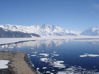
The Admiralty Mountains is a large group of high mountains and individually named ranges and ridges in northeastern Victoria Land, Antarctica. This mountain group is bounded by the Ross Sea, the Southern Ocean, and by the Dennistoun, Ebbe, and Tucker glaciers. The mountain range is situated on the Pennell Coast, a portion of Antarctica lying between Cape Williams and Cape Adare.

The Usarp Mountains is a major Antarctic mountain range, lying westward of the Rennick Glacier and trending N-S for about 190 kilometres (118 mi). The feature is bounded to the north by Pryor Glacier and the Wilson Hills. Its important constituent parts include Welcome Mountain, Mount Van der Hoeven, Mount Weihaupt, Mount Stuart, Mount Lorius, Smith Bench, Mount Roberts, Pomerantz Tableland, Daniels Range, Emlen Peaks, Helliwell Hills and Morozumi Range.

Jacoby Glacier is a steep glacier draining the eastern slopes of the Ames Range between Mount Boennighausen and Mount Andrus, in Marie Byrd Land, Antarctica. It was mapped by the United States Geological Survey from surveys and U.S. Navy air photos, 1959–65, and was named by the Advisory Committee on Antarctic Names for William J. Jacoby, a driller at Byrd Station, 1968–69.

The Sverdrup Mountains are a group of mountains about 80 km (50 mi) long, standing just west of the Gjelsvik Mountains in Queen Maud Land, East Antarctica. With its summit at 2,655 metres (8,711 ft), the massive Mount Krüger forms the highest point in the Sverdrup Mountains.

Ritscher Peak is a 2,790-metre (9,150 ft) peak located 11 kilometres (7 mi) west-southwest of Mount Mentzel in the Gruber Mountains of Queen Maud Land, Antarctica. This peak was discovered and mapped by the Third German Antarctic Expedition of 1938–39 and was named for Capt. Alfred Ritscher, leader of the expedition.
Skuggekammen Ridge is a jagged rock ridge extending southeastward from Mount Mentzel, in the Gruber Mountains of the Wohlthat Mountains, Queen Maud Land. Discovered and plotted from air photos by German Antarctic Expedition, 1938-39. Replotted from air photos and surveys by Norwegian Antarctic Expedition, 1956–60, and named Skuggekammen.
Solhogdene Heights is the heights 1 nautical mile (1.9 km) east of Mount Mentzel, overlooking the north side of Asimutbreen Glacier in the eastern Gruber Mountains of the Wohlthat Mountains, Queen Maud Land. Discovered and plotted from air photos by German Antarctic Expedition, 1938-39. Replotted from air photos and surveys by Norwegian Antarctic Expedition, 1956–60, and named Solhogdene.
Todt Ridge is a partially snow-covered ridge, 3 nautical miles (6 km) long, lying 5 nautical miles (9 km) east of Mount Mentzel at the east end of the Gruber Mountains of Queen Maud Land. Discovered by the German Antarctic Expedition, 1938–39, under Captain Alfred Ritscher. Named for Herbert Todt, an assistant to Ritscher who served as home secretary for the expedition.

Vangengeym Glacier is a glacier about 6 nautical miles (11 km) long, draining the vicinity east of Mount Mentzel and flowing north toward Mount Seekopf in the Gruber Mountains, Queen Maud Land. It was discovered and plotted from air photos by the German Antarctic Expedition, 1938–39, and was mapped from air photos and surveys by the Norwegian Antarctic Expedition, 1956–60; remapped by Soviet Antarctic Expedition, 1960–61 and named after Soviet meteorologist Georgiy Vangengeym (1886–1961).

The United States Geological Survey is a scientific agency of the United States government. The scientists of the USGS study the landscape of the United States, its natural resources, and the natural hazards that threaten it. The organization has four major science disciplines, concerning biology, geography, geology, and hydrology. The USGS is a fact-finding research organization with no regulatory responsibility.

The Geographic Names Information System (GNIS) is a database that contains name and locative information about more than two million physical and cultural features located throughout the United States of America and its territories. It is a type of gazetteer. GNIS was developed by the United States Geological Survey in cooperation with the United States Board on Geographic Names (BGN) to promote the standardization of feature names.


