
Letchworth State Park is a 14,427-acre (5,838 ha) New York State Park located in Livingston County and Wyoming County in the western part of the State of New York. The park is roughly 17 miles (27 km) long, following the course of the Genesee River as it flows north through a deep gorge and over several large waterfalls. It is located 35 miles (56 km) southwest of Rochester and 60 miles (97 km) southeast of Buffalo, and spans portions of the Livingston County towns of Leicester, Mount Morris and Portage, as well as the Wyoming County towns of Castile and Genesee Falls.

Detroit Dam is a gravity dam on the North Santiam River between Linn County and Marion County, Oregon. It is located in the Cascades, about 5 mi (8.0 km) west of the city of Detroit. It was constructed between 1949 and 1953 by the United States Army Corps of Engineers. The dam created 400-foot (120 m) deep Detroit Lake, more than 9 miles (14 km) long with 32 miles (51 km) of shoreline.

The Genesee River is a tributary of Lake Ontario flowing northward through the Twin Tiers of Pennsylvania and New York in the United States. The river contains several waterfalls in New York at Letchworth State Park and Rochester.
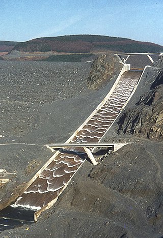
A spillway is a structure used to provide the controlled release of water downstream from a dam or levee, typically into the riverbed of the dammed river itself. In the United Kingdom, they may be known as overflow channels. Spillways ensure that water does not damage parts of the structure not designed to convey water.

Table Rock Lake is an artificial lake or reservoir in the Ozarks of southwestern Missouri and northwestern Arkansas in the United States. Designed, built and operated by the U.S. Army Corps of Engineers, the lake is impounded by Table Rock Dam, which was constructed from 1954 to 1958 on the White River.

Whittier Narrows Dam is a 56-foot tall earth dam on the San Gabriel River and the smaller, parallel Rio Hondo. The dam is located, as the name implies, at the Whittier Narrows. It provides water conservation storage and is also the central element of the Los Angeles County Drainage Area (LACDA) flood control system. Its reservoir has a capacity of 67,060 acre⋅ft (82,720,000 m3).

Dworshak Dam is a concrete gravity dam in the western United States, on the North Fork of the Clearwater River in north central Idaho. In Clearwater County, the dam is located approximately four miles (6 km) northwest of Orofino and impounds the Dworshak Reservoir for flood control and hydroelectricity generation.

Isabella Dam is an embankment dam located in the Kern River Valley, about halfway down the Kern River course, between the towns of Kernville and Lake Isabella in Kern County, California.

The Addicks Reservoir and Addicks Dam in conjunction with the Barker Reservoir prevent downstream flooding of Buffalo Bayou in the City of Houston, Texas. Both reservoirs were authorized under the Rivers and Harbors Act of June 20, 1938, which was modified by the Flood Control Acts of August 11, 1938; September 3, 1954; and October 27, 1965. The U.S. Army Corps of Engineers completed construction of Addicks Dam and the outlet facility in 1948.

Lake O’ the Pines is a reservoir on Big Cypress Bayou, also known as Big Cypress Creek, chiefly in Marion County, Texas, USA. The reservoir also occupies a small part of Upshur and Morris Counties. The dam is located approximately 8.5 miles (13.7 km) west of Jefferson.

Benbrook Lake is a reservoir on the Clear Fork of the Trinity River in Tarrant County, Texas, USA. The lake is located approximately 10 miles (16 km) southwest of the center of Fort Worth, where the Clear Fork and the West Fork of the Trinity River join. The lake is impounded by the Benbrook Dam. The lake and dam are owned and operated by the U.S. Army Corps of Engineers, Fort Worth District.

Milford Lake, also known as Milford Reservoir, is the largest man-made lake in Kansas with 15,700 acres (64 km2) of water. Over 33,000 acres (130 km2) of land resources are managed for quality recreational experiences as well as for protection of the project’s natural and cultural resources. Approximately 70% of the land resources are available for public hunting.

John Redmond Reservoir is a reservoir on the Neosho River in eastern Kansas. Built and managed by the U.S. Army Corps of Engineers, it is used for flood control, recreation, water supply, and wildlife management. It borders the Flint Hills National Wildlife Refuge to the northwest.

Santa Fe Dam is a flood-control dam on the San Gabriel River located in Irwindale in Los Angeles County, California, United States. For most of the year, the 92-foot (28 m)-high dam and its reservoir lie empty, but can hold more than 45,000 acre-feet (56,000,000 m3) of water during major storms. During the dry season, the basin behind the dam is used for groundwater recharge, as well as various recreational activities.

Gathright Dam is an earthen and rolled rock-fill embankment dam on the Jackson River 19 miles (31 km) north of Covington, Virginia. The dam is 257 feet (78 m) tall and 1,310 feet (400 m) long and has a controlled spillway within the structure's southern portion. It creates Lake Moomaw, which has a normal volume of 40 billion US gallons (150,000,000 m3). The dam serves flood control and recreational purposes and is operated by the U.S. Army Corps of Engineers.

Howard A. Hanson Dam is an earthen embankment dam on the Green River, 21 miles (34 km) east of Auburn, Washington. The dam was completed in 1961 and its primary purpose is flood control along with water supply for Tacoma, Washington.

The Pensacola Dam, also known as the Grand River Dam, is a multiple-arch buttress dam located between the towns of Disney and Langley on the Grand River in Mayes County, Oklahoma. The dam is operated by the Grand River Dam Authority and creates Grand Lake o' the Cherokees. After decades of vision and planning, it was constructed between 1938 and 1940 for the purposes of hydroelectric power generation, flood control and recreation. It is Oklahoma's first hydroelectric power plant and is referred to as the longest multiple-arch dam in the world.

Morris Dam is a concrete gravity dam across the San Gabriel River in the U.S. state of California. It impounds Morris Reservoir, directly downstream of San Gabriel Dam.

Council Grove Lake is a reservoir on the Neosho River in east-central Kansas. Built and managed by the U.S. Army Corps of Engineers, it is used for flood control, recreation, and water supply.

In February 2017, heavy rainfall damaged Oroville Dam's main and emergency spillways, prompting the evacuation of more than 180,000 people living downstream along the Feather River and the relocation of a fish hatchery.

