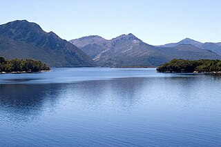
Cradle Mountain-Lake St Clair National Park is located in the Central Highlands area of Tasmania (Australia), 165 kilometres (103 mi) northwest of Hobart. The park contains many walking trails, and is where hikes along the well-known Overland Track usually begin. Major features are Cradle Mountain and Barn Bluff in the northern end, Mount Pelion East, Mount Pelion West, Mount Oakleigh and Mount Ossa in the middle and Lake St Clair in the southern end of the park. The park is part of the Tasmanian Wilderness World Heritage Area.

Mount Wellington, officially Kunanyi / Mount Wellington, is a mountain in the southeast of Tasmania, Australia. It is the summit of the Wellington Range and is within Wellington Park reserve. Hobart, Tasmania's capital city, is located at the foot of the mountain.

Mount Ossa is the highest mountain in Tasmania, with a summit elevation of 1,617 metres (5,305 ft) above sea level. It makes up part of the Pelion Range within Cradle Mountain-Lake St Clair National Park in the Central Highlands region of Tasmania, Australia.

The Overland Track is an Australian bushwalking track, traversing Cradle Mountain-Lake St Clair National Park, within the Tasmanian Wilderness World Heritage Area. It's walked by more than nine thousand people each year, with numbers limited in the warmer months. Officially the track runs for 65 kilometres (40 mi) from Cradle Mountain to Lake St Clair however many choose to extend it by walking along Lake St Clair for an extra day, bringing it to 82 kilometres (51 mi). It winds through terrain ranging from glacial mountains, temperate rainforest, wild rivers and alpine plains.

Mount Nelson is a suburb of the city of Hobart, Tasmania, Australia above the Hobart suburb of Sandy Bay and to the south of Hobart's CBD. Because of its views over the River Derwent (Tasmania), it is one of the more prestigious suburbs in Hobart.

The West Coast Range is a mountain range located in the West Coast region of Tasmania, Australia.

Mount Owen is a mountain directly east of the town of Queenstown on the West Coast Range in Western Tasmania, Australia.

Mount Huxley is a mountain located on the West Coast Range in the West Coast region of Tasmania, Australia. With an elevation of 926 metres (3,038 ft) above sea level, the mountain was named by Charles Gould in 1863 in honour of Professor Thomas Henry Huxley.

Mount Darwin is a mountain located in the West Coast region of Tasmania, Australia.

Mount Sorell is a mountain located in the West Coast region of Tasmania, Australia.

The Arthur Range is a mountain range in the South West Wilderness, located in south-west Tasmania, Australia. The range is broken into two main sections, the Western Arthurs and the Eastern Arthurs. Both sections of the range are popular overnight bushwalking destinations, generally in summer.

Mount Murchison is a mountain on the West Coast Range, located in the West Coast region of Tasmania, Australia.

The Ironstone Mountain is a mountain located in the Central Highlands region of Tasmania, Australia. Part of Great Western Tiers escarpment, the mountain is situated south of the small country village of Mole Creek.

Mount Pelion West is a mountain located in the Central Highlands region of Tasmania, Australia. The mountain is part of the Pelion Range and is situated within the Cradle Mountain-Lake St Clair National Park at the easternmost boundary of the Murchison River catchment.

Mount Pelion East is a mountain located in the Central Highlands region of Tasmania, Australia. The mountain is situated within the Cradle Mountain-Lake St Clair National Park.

Mount Anne is a mountain located in the Southwest National Park in south-west region of Tasmania, Australia. The mountain lies within the UNESCO World Heritage-listed Tasmanian Wilderness.

Mount Achilles is a mountain that is part of the Du Cane Range, located in the Cradle Mountain-Lake St Clair National Park in Tasmania, Australia. With an elevation of 1,353 metres (4,439 ft) above sea level, the peak is the 46th highest mountain in Tasmania.
Cathedral Mountain is a dominant mountain in the Cradle Mountain-Lake St Clair National Park in the central highlands in the state of Tasmania, Australia.

New Pelion Hut is the largest alpine hut in the Cradle Mountain-Lake St Clair National Park in the Central Highlands of Tasmania, Australia

The Pelion Range is a mountain range in the Cradle Mountain-Lake St Clair National Park, Tasmania, Australia.


