Related Research Articles
The Geologists Range is a mountain range about 55 km (34 mi) long, standing between the heads of Lucy and Nimrod Glaciers in Antarctica. Seen by the northern party of the New Zealand Geological Survey Antarctic Expedition (NZGSAE) (1961–62) and named to commemorate the work of geologists in Antarctic exploration.

The Shackleton Range is a mountain range in Antarctica that rises to 1,875 metres (6,152 ft) and extends in an east–west direction for about 100 miles (160 km) between the Slessor and Recovery Glaciers.
The Forrestal Range is a largely snow-covered mountain range, about 105 km (65 mi) long, standing east of Dufek Massif and the Neptune Range in the Pensacola Mountains of Antarctica. Discovered and photographed on 13 January 1956 on a transcontinental patrol plane flight of U.S. Navy Operation Deep Freeze I from McMurdo Sound to the vicinity of the Weddell Sea and return.

Palmer Land is the portion of the Antarctic Peninsula, Antarctica that lies south of a line joining Cape Jeremy and Cape Agassiz. This application of Palmer Land is consistent with the 1964 agreement between the Advisory Committee on Antarctic Names and the UK Antarctic Place-Names Committee, in which the name Antarctic Peninsula was approved for the major peninsula of Antarctica, and the names Graham Land and Palmer Land for the northern and southern portions, respectively. The line dividing them is roughly 69° S.
The Cook Mountains is a group of mountains bounded by the Mulock and Darwin glaciers in Antarctica.

Shackleton Glacier is a major Antarctic glacier, over 60 nautical miles long and from 5 to 10 nautical miles wide, descending from the Antarctic Plateau from the vicinity of Roberts Massif and flowing north through the Queen Maud Mountains to enter the Ross Ice Shelf between Mount Speed and Waldron Spurs. Discovered by the United States Antarctic Service (USAS) (1939–41) and named by the Advisory Committee on Antarctic Names (US-ACAN) for Sir Ernest Shackleton, British Antarctic explorer.

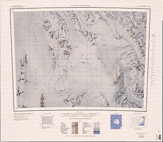
The Usarp Mountains are a major mountain range in North Victoria Land, Antarctica. They are west of the Rennick Glacier and trend north to south for about 190 kilometres (118 mi). The mountains are bounded to the north by Pryor Glacier and the Wilson Hills.

The Prince Charles Mountains are a major group of mountains in Mac. Robertson Land in Antarctica, including the Athos Range, the Porthos Range, and the Aramis Range. The highest peak is Mount Menzies, with a height of 3,228 m (10,591 ft). Other prominent peaks are Mount Izabelle and Mount Stinear. These mountains, together with other scattered peaks, form an arc about 420 km (260 mi) long, extending from the vicinity of Mount Starlight in the north to Goodspeed Nunataks in the south.

Mount Hunter is a mountain in northern Stribog Mountains, 1,410 metres (4,630 ft) high, standing 4 nautical miles (7 km) west-southwest of Duclaux Point on Pasteur Peninsula, Brabant Island, in the Palmer Archipelago, Antarctica. It surmounts Podayva Glacier to the north, Burevestnik Glacier to the northeast, Lister Glacier to the southeast and Dodelen Glacier to the west.
Pryor Glacier is a glacier flowing northeastward, to the north of Mount Shields and Yermak Point, into Rennick Bay. The feature is about 30 nautical miles (60 km) long and forms a physical separation between Wilson Hills and Usarp Mountains. Mapped by United States Geological Survey (USGS) from surveys and U.S. Navy aerial photographs, 1960–62. Named by Advisory Committee on Antarctic Names (US-ACAN) for Madison E. Pryor, scientific leader at McMurdo Station (1959) and U.S. Exchange Scientist at the Soviet Mirny Station (1962).
The Porthos Range is the second range south in the Prince Charles Mountains of Antarctica, extending for about 30 miles in an east-to-west direction between Scylla Glacier and Charybdis Glacier. First visited in December 1956 by the Australian National Antarctic Research Expeditions (ANARE) southern party under W.G. Bewsher (1956-57) and named after Porthos, a character in Alexandre Dumas, père's novel The Three Musketeers, the most popular book read on the southern journey.

Kyiv Peninsula is the predominantly ice-covered, oval shaped peninsula projecting 35 km in northwest direction from the west side of Graham Land, Antarctic Peninsula. It is bounded by Flandres Bay to the northeast and Beascochea Bay to the southwest, and separated from Wilhelm Archipelago to the northwest by Lemaire Channel and Penola Strait. The peninsula's north extremity Cape Renard divides Graham Coast to the southwest from Danco Coast to the northeast. Mount Tranchant and Mount Demaria are found on the west coast of the peninsula.
The Nash Range is a mainly ice-covered coastal range in the Churchill Mountains of Antarctica.
Wiggins Glacier is a 10 nautical miles (18 km) long glacier on Kyiv Peninsula in Antarctica, flowing from Bruce Plateau to the west coast of Graham Land just south of Blanchard Ridge. Charted by the French Antarctic Expedition, 1908–10, under Charcot, and named Glacier du Milieu. Feeling that a more distinctive name was needed, the United Kingdom Antarctic Place-Names Committee (UK-APC) in 1959 renamed the glacier for W.D.C. Wiggins, then Deputy Director of Overseas Surveys.
Mount Crowell is a mountain in the northern part of the Rare Range in Palmer Land. It was mapped by the United States Geological Survey from ground surveys and from U.S. Navy air photos, 1961–67, and named by the Advisory Committee on Antarctic Names for John C. Crowell, a geologist at McMurdo Station in the summer of 1966–67.
The Freyberg Mountains are a group of mountains in Victoria Land, Antarctica, bounded by Rennick Glacier, Bowers Mountains, Black Glacier, and Evans Neve. Named for New Zealand's most famous General, Lord Bernard Freyberg, by the Northern Party of New Zealand Geological Survey Antarctic Expedition (NZGSAE), 1963-64. This mountain group includes the Alamein Range. These topographical features all lie situated on the Pennell Coast, a portion of Antarctica lying between Cape Williams and Cape Adare.
Schmidt Hills is a group of rock hills, 15 nautical miles (28 km) long, lying north of Childs Glacier and west of Roderick Valley in the Neptune Range, Pensacola Mountains. Mapped by United States Geological Survey (USGS) from surveys and U.S. Navy air photos, 1956–66. Named by Advisory Committee on Antarctic Names (US-ACAN) for Dwight L. Schmidt, USGS geologist to the Pensacola Mountains in 1962–63, 1963–64 and 1965–66.
Holyoake Range is a mountain range in the Ross Dependency of Antarctice. It is in the southern section of the Churchill Mountains, part of the Transantarctic Mountains System.
References
![]() This article incorporates public domain material from "Mount Tranchant". Geographic Names Information System . United States Geological Survey.
This article incorporates public domain material from "Mount Tranchant". Geographic Names Information System . United States Geological Survey.
- ↑ "Edge Hill". Australian Antarctic Data Centre. Department of Climate Change, Energy, the Environment and Water. Retrieved 26 December 2023.
| | This Danco Coast location article is a stub. You can help Wikipedia by expanding it. |