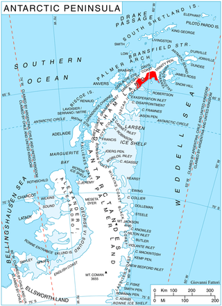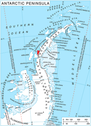
The Prince Charles Mountains are a major group of mountains in Mac. Robertson Land in Antarctica, including the Athos Range, the Porthos Range, and the Aramis Range. The highest peak is Mount Menzies, with a height of 3,228 m (10,591 ft). Other prominent peaks are Mount Izabelle and Mount Stinear. These mountains, together with other scattered peaks, form an arc about 420 km (260 mi) long, extending from the vicinity of Mount Starlight in the north to Goodspeed Nunataks in the south.

Isbrecht Glacier is a small glacier flowing south from Thurston Island in Antarctica between Cox Glacier and Hale Glacier. It was named by the Advisory Committee on Antarctic Names after JoAnn Isbrecht of the United States Geological Survey (USGS), Flagstaff, Arizona, a satellite image processing specialist who was part of the USGS team that compiled the 1:5,000,000-scale Advanced Very High Resolution Radiometer maps of Antarctica and the 1:250,000-scale Landsat image maps of the Siple Coast area in the 1990s.
Explorers Range is a large mountain range in the Bowers Mountains of Victoria Land, Antarctica, extending from Mount Bruce in the north to Carryer Glacier and McLin Glacier in the south. Named by the New Zealand Antarctic Place-Names Committee (NZ-APC) for the northern party of New Zealand Geological Survey Antarctic Expedition (NZGSAE), 1963–64, whose members carried out a topographical and geological survey of the area. The names of several party members are assigned to features in and about this range. All of the geographical features listed below lie situated on the Pennell Coast, a portion of Antarctica lying between Cape Williams and Cape Adare.
Arthur Glacier is a valley glacier in Antarctica. It is about 25 nautical miles (50 km) long, and flows west to Sulzberger Ice Shelf between the Swanson Mountains on the north and Mount Rea and Mount Cooper on the south, in the Ford Ranges of Marie Byrd Land. It was discovered by members of West Base of the United States Antarctic Service, in aerial flights and from ground surveys in November–December 1940. It was named by the Advisory Committee on Antarctic Names for Rear Admiral Arthur C. Davis, a leader in aviation in the U.S. Navy.

Blanchard Ridge is a rocky ridge, 520 metres (1,700 ft) high, at the north side of the mouth of Wiggins Glacier on Kyiv Peninsula on the west coast of Graham Land. It was mapped by the French Antarctic Expedition, 1908–10, and named by Jean-Baptiste Charcot for a Monsieur Blanchard, then French Consul at Punta Arenas.

Bussey Glacier is a glacier flowing west from Mount Peary to the head of Waddington Bay on Kyiv Peninsula on the west coast of Graham Land. It was first charted by the French Antarctic Expedition under Jean-Baptiste Charcot, 1908–10, and named by the UK Antarctic Place-Names Committee in 1959 for Group Captain John Bussey of the Directorate of Overseas Surveys.
Carlson Glacier is a glacier, 9 nautical miles (17 km) long, flowing northward from between Mount Edgell and the Relay Hills into Wordie Ice Shelf, Fallières Coast. It was photographed from the air by the U.S. Navy in 1966, and surveyed by the British Antarctic Survey between 1970 and 1973. It was named by the Advisory Committee on Antarctic Names after Captain Burford A. Carlson, U.S. Navy, Staff Meteorologist, Naval Support Force, Antarctica, Operation Deep Freeze, 1970 and 1971.

Jorum Glacier is a glacier draining the southeast slopes of Forbidden Plateau, and lowing east into Exasperation Inlet, just north of Caution Point, on the east coast of Graham Land, Antarctica. It was surveyed by the Falkland Islands Dependencies Survey in 1947 and 1955. The UK Antarctic Place-Names Committee name alludes to the punchbowl shape of the head of the glacier, a "jorum" being a large drinking bowl used for punch.

Depot Glacier is a well-defined valley glacier, flanked by lateral moraines, which terminates in a high vertical ice cliff at the head of Hope Bay, in the northeast end of the Antarctic Peninsula. It was discovered by the Swedish Antarctic Expedition, 1901–04, under Otto Nordenskiöld, and so named by him because, as seen from Antarctic Sound, it appeared to be a possible site for a depot.
Mount Tranchant is a small mountain or hill directly on the west coast of Graham Land. The feature marks the south side of the terminus of Wiggins Glacier. First charted by the French Antarctic Expedition, 1908–10, under J.B. Charcot who gave the descriptive name "Mont Tranchant".

Polaris Glacier is a distinctive glacier, 4 nautical miles (7 km) long, flowing southward from Detroit Plateau, between Pyke and Eliason Glaciers on Nordenskjöld Coast in northern Graham Land, Antarctica. Mapped from surveys by Falkland Islands Dependencies Survey (FIDS) (1960–61). Named by United Kingdom Antarctic Place-Names Committee (UK-APC) after the "Polaris" motor sledge made by Polaris Industries, Roseau, Minnesota, and used in Antarctica since 1960.
Fricker Glacier is a glacier, 10 nautical miles (19 km) long, which lies close north of Tindal Bluff and Monnier Point and flows in a northeasterly direction into the southwest side of Mill Inlet, on the east coast of Graham Land, Antarctica. It was charted by the Falkland Islands Dependencies Survey (FIDS) and photographed from the air by the Ronne Antarctic Research Expedition in 1947, and was named by the FIDS for Karl Fricker, a German Antarctic historian.

Goff Glacier is a broad glacier flowing from Parker Peak into the head of Koether Inlet on the north side of Thurston Island, Antarctica. It was named by the Advisory Committee on Antarctic Names after Lieutenant Robert G. Goff, co-pilot of PBM Mariner aircraft in the Eastern Group of U.S. Navy Operation Highjump, which obtained aerial photographs of Thurston Island and adjacent coastal areas, 1946–47.
Metchnikoff Point is a point forming the western extremity of Pasteur Peninsula in northern Brabant Island, in the Palmer Archipelago, Antarctica. It was first charted by the Third French Antarctic Expedition, 1903–05, and named by Jean-Baptiste Charcot for Russian-born zoologist and bacteriologist Élie Metchnikoff, who succeeded Louis Pasteur as the director of the Pasteur Institute in Paris.

Mount Howell is a mountain 3 nautical miles (6 km) south-southwest of Mount Borgeson in the Walker Mountains of Thurston Island, Antarctica. It was named by the Advisory Committee on Antarctic Names after Lieutenant Commander John D. Howell, a pilot and airplane commander in the Eastern Group of U.S. Navy Operation Highjump, which obtained aerial photographs of this mountain and coastal areas adjacent to Thurston Island in 1946–47. Commander Howell landed a PBM Mariner seaplane in the open water of eastern Glacier Bight on January 11, 1947 to rescue six survivors of a December 30 Mariner crash on Noville Peninsula.

Hoek Glacier is a glacier flowing into Dimitrov Cove northeast of Veshka Point on the northwest coast of Velingrad Peninsula on Graham Coast in Graham Land, Antarctica, southward of the Llanquihue Islands. It was charted by the British Graham Land Expedition under John Rymill, 1934–37, and was named by the UK Antarctic Place-Names Committee in 1959 for Henry W. Hoek (1878–1951), a pioneer Swiss ski-mountaineer and author of one of the earliest skiing manuals.

McCance Glacier is the 30-km long and 5 km wide glacier draining the Hutchison Hill area on the west slopes of Avery Plateau on Loubet Coast in Graham Land, Antarctica. It flows north-northwestwards along the west side of Osikovo Ridge, Kladnitsa Peak and Rubner Peak and enters Darbel Bay.
Spartan Glacier is a short valley glacier lying between Callisto Cliffs and Tombaugh Cliffs on the east side of Alexander Island, Antarctica. The glacier was first mapped by the Overseas Surveys Directorate from satellite imagery supplied by U.S. National Aeronautics and Space Administration in cooperation with U.S. Geological Survey. Named by United Kingdom Antarctic Place-Names Committee after the British dog team known as "The Spartans," used in ascending this glacier, 1969. This is one of the few glaciers in Antarctica to be named after a dog team.

Lind Glacier is a glacier flowing west from Alencar Peak into the southern part of Collins Bay, on the west coast of Kyiv Peninsula in Graham Land, Antarctica. It was first charted by the Fourth French Antarctic Expedition under Jean-Baptiste Charcot, 1908–10, and was named by the UK Antarctic Place-Names Committee in 1959 for James Lind, the Scottish "founder of modern naval hygiene," who was the first to publish a convincing account of experimental work establishing the dietary cause and cure of scurvy, in 1755.

Della Pia Glacier is a glacier that descends the east slope of Craddock Massif and flows between Mount Mohl and Elfring Peak into Thomas Glacier in the Sentinel Range, Ellsworth Mountains in Antarctica.


