Related Research Articles

Graham Land is the portion of the Antarctic Peninsula that lies north of a line joining Cape Jeremy and Cape Agassiz. This description of Graham Land is consistent with the 1964 agreement between the British Antarctic Place-names Committee and the US Advisory Committee on Antarctic Names, in which the name "Antarctic Peninsula" was approved for the major peninsula of Antarctica, and the names Graham Land and Palmer Land for the northern and southern portions, respectively. The line dividing them is roughly 69 degrees south.

Aagaard Glacier, also known as Glaciar Alderete, is an 8-mile (13 km) long Antarctic glacier which lies close to the east of Gould Glacier and flows in a southerly direction into Mill Inlet, on the east coast of Graham Land. It was charted by the Falkland Islands Dependencies Survey (FIDS) and photographed from the air by the Ronne Antarctic Research Expedition during December 1947; it was named by the FIDS for Bjarne Aagaard, a Norwegian authority on Antarctic whaling and exploration.

Drygalski Glacier is a broad glacier, 18 nautical miles long and 15 miles (24 km) wide at its head, which flows from Herbert Plateau southeast between Ruth Ridge and Kyustendil Ridge, and enters Solari Bay immediately north of Sentinel Nunatak on Nordenskjöld Coast, the east coast of Graham Land, Antarctica. It was discovered in 1902 by the Swedish Antarctic Expedition, under Otto Nordenskiöld, and named "Drygalski Bay" after Professor Erich von Drygalski. The feature was determined to be a glacier by the Falkland Islands Dependencies Survey in 1947.
Detroit Plateau is a major interior plateau of Graham Land on the Antarctic Peninsula, with heights between 1,500 and 1,800 metres. Its northeast limit is marked by the south wall of Russell West Glacier, from which it extends some 90 miles (140 km) in a general southwest direction to Herbert Plateau. The plateau was observed from the air by Sir Hubert Wilkins on a flight of December 20, 1928. Wilkins named it Detroit Aviation Society Plateau after the society which aided in the organizing of his expedition, but the shortened form of the original name is approved. The north and east sides of the plateau were charted by the Falkland Islands Dependencies Survey in 1946–47.
Attlee Glacier is a glacier 8 miles (13 km) long, which flows east-southeast from the plateau escarpment on the east side of Graham Land to the head of Cabinet Inlet to the north of Bevin Glacier.
Alberts Glacier is a heavily crevassed glacier in Antarctica. It is about 8 miles (13 km) long, and flows east from Avery Plateau, Graham Land, until entering Mill Inlet between Balch Glacier and Southard Promontory.

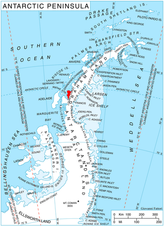
Lawrie Glacier is a glacier flowing between Mount Genecand and Mezzo Buttress, and entering the head of Barilari Bay between Cherkovna Point and Prestoy Point on the west coast of Graham Land, Antarctica. It was charted by the British Graham Land Expedition under Rymill, 1934–37, and was named by the UK Antarctic Place-Names Committee in 1959 for Robert Lawrie, an English alpine and polar equipment specialist.

Flask Glacier, is a gently-sloping glacier, 25 nautical miles long, flowing east from Bruce Plateau to enter Scar Inlet between Daggoo Peak and Spouter Peak in Graham Land, Antarctica. The lower reaches of this glacier were surveyed and photographed by the Falklands Islands Dependencies Survey (FIDS) in 1947. The entire glacier was photographed by the Falkland Islands and Dependencies Aerial Survey Expedition in 1955–56, and mapped by the FIDS in 1957. It was named by the UK Antarctic Place-names Committee after the third mate on the Pequod in Herman Melville's Moby-Dick; or, The White Whale.
Bevin Glacier is a glacier 5 nautical miles (9 km) long, which flows east from the plateau escarpment on the east side of Graham Land into the northwest end of Cabinet Inlet between Attlee Glacier and Anderson Glacier. During December 1947 it was charted by the Falkland Islands Dependencies Survey (FIDS) and photographed from the air by the Ronne Antarctic Research Expedition. It was named by the FIDS for Rt. Hon. Ernest Bevin, M.P., British Minister of Labour and National Service and member of the War Cabinet.

Breitfuss Glacier is a glacier 10 nautical miles (19 km) long, which flows southeast from Avery Plateau into Mill Inlet to the west of Cape Chavanne, on the east coast of Graham Land. It was charted by the Falkland Islands Dependencies Survey (FIDS) and photographed from the air by the Ronne Antarctic Research Expedition in 1947. It was named by the FIDS for Leonid Breitfuss, a German polar explorer, historian, and author of many polar bibliographies.
Wyatt Glacier is a steep, narrow glacier 6 nautical miles (11 km) long in southern Graham Land. It flows south from the central plateau near Beehive Hill to join the upper part of Gibbs Glacier. Photographed from the air by Ronne Antarctic Research Expedition (RARE), November 1947. Surveyed from the ground by Falkland Islands Dependencies Survey (FIDS), May 1958. Named by United Kingdom Antarctic Place-Names Committee (UK-APC) for Henry T. Wyatt of FIDS, Medical Officer at Detaille Island, 1957, and at Stonington Island, 1958.

Wiggins Glacier is a 10 nautical miles (18 km) long glacier on Kyiv Peninsula in Antarctica, flowing from Bruce Plateau to the west coast of Graham Land just south of Blanchard Ridge. Charted by the French Antarctic Expedition, 1908–10, under Charcot, and named Glacier du Milieu. Feeling that a more distinctive name was needed, the United Kingdom Antarctic Place-Names Committee (UK-APC) in 1959 renamed the glacier for W.D.C. Wiggins, then Deputy Director of Overseas Surveys.
The Playfair Mountains are a group of mountains between Swann Glacier and Squires Glacier in southeast Palmer Land, Antarctica.
Foster Plateau is a plateau, about 80 square miles (210 km2) in area, lying between Drygalski Glacier and Hektoria Glacier in northern Graham Land, Antarctica. It borders Forbidden Plateau on the south and Herbert Plateau on the north. The feature was photographed by the Falkland Islands and Dependencies Aerial Survey Expedition in 1956–57 and mapped from these photos by the Falkland Islands Dependencies Survey (FIDS). It was named by the UK Antarctic Place-Names Committee in 1960 for Richard A. Foster, FIDS leader of the Danco Island station in 1956 and 1957.
Friederichsen Glacier is a glacier 7 nautical miles (13 km) long, which flows in an easterly direction into Cabinet Inlet, close north of Mount Hulth, on the east coast of Graham Land, Antarctica. It was charted by the Falkland Islands Dependencies Survey (FIDS) and photographed from the air by the Ronne Antarctic Research Expedition in 1947. It was named by the FIDS for Ludwig Friederichsen, a German cartographer who in 1895 published a chart based upon all existing explorations of the Antarctic Peninsula and the South Shetland Islands.

Hoek Glacier is a glacier flowing into Dimitrov Cove northeast of Veshka Point on the northwest coast of Velingrad Peninsula on Graham Coast in Graham Land, Antarctica, southward of the Llanquihue Islands. It was charted by the British Graham Land Expedition under John Rymill, 1934–37, and was named by the UK Antarctic Place-Names Committee in 1959 for Henry W. Hoek (1878–1951), a pioneer Swiss ski-mountaineer and author of one of the earliest skiing manuals.
Herbert Plateau is a portion of the central plateau of Graham Land, Antarctica, lying between Blériot Glacier and Drygalski Glacier. It borders Foster Plateau on the south and Detroit Plateau on the north. The feature was photographed by the Falkland Islands and Dependencies Aerial Survey Expedition in 1956–57 and mapped from these photos by the Falkland Islands Dependencies Survey (FIDS). It was named by the UK Antarctic Place-Names Committee in 1960 for Walter W. Herbert, a FIDS assistant surveyor at the Hope Bay station in 1956 and 1957.

McCance Glacier is the 30-km long and 5 km wide glacier draining the Hutchison Hill area on the west slopes of Avery Plateau on Loubet Coast in Graham Land, Antarctica. It flows north-northwestwards along the west side of Osikovo Ridge, Kladnitsa Peak and Rubner Peak and enters Darbel Bay.

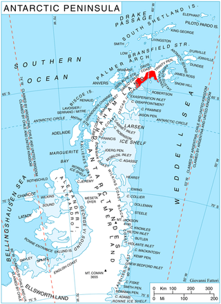
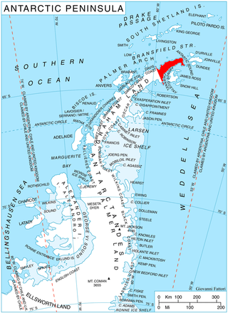
Sjogren Glacier is a glacier 12.5 miles (20 km) long in the south part of Trinity Peninsula, flowing southeast from Detroit Plateau in between Aldomir Ridge and Hazarbasanov Ridge to enter Prince Gustav Channel at the head of Sjögren Inlet, west of Royak Point. Discovered in 1903 by the Swedish Antarctic Expedition under Nordenskjold. He named it Sjogren Fiord after a patron of the expedition. The true nature of the feature was determined by the Falkland Islands Dependencies Survey (FIDS) in 1945.

Lind Glacier is a glacier flowing west from Alencar Peak into the southern part of Collins Bay, on the west coast of Kyiv Peninsula in Graham Land, Antarctica. It was first charted by the Fourth French Antarctic Expedition under Jean-Baptiste Charcot, 1908–10, and was named by the UK Antarctic Place-Names Committee in 1959 for James Lind, the Scottish "founder of modern naval hygiene," who was the first to publish a convincing account of experimental work establishing the dietary cause and cure of scurvy, in 1755.
References
- ↑ "Bruce Plateau". Geographic Names Information System . United States Geological Survey, United States Department of the Interior . Retrieved 2011-09-22.
![]() This article incorporates public domain material from "Bruce Plateau". Geographic Names Information System . United States Geological Survey.
This article incorporates public domain material from "Bruce Plateau". Geographic Names Information System . United States Geological Survey.
