
Anvers Island or Antwerp Island or Antwerpen Island or Isla Amberes is a high, mountainous island 61 km long, the largest in the Palmer Archipelago of Antarctica. It was discovered by John Biscoe in 1832 and named in 1898 by the Belgian Antarctic Expedition under Adrien de Gerlache after the province of Antwerp in Belgium. It lies south-west of Brabant Island at the south-western end of the group. The south-western coastline of the island forms part of the Southwest Anvers Island and Palmer Basin Antarctic Specially Managed Area. Cormorant Island, an Important Bird Area, lies 1 km off the south coast.

Hughes Bay is a bay lying between Cape Sterneck and Cape Murray along the west coast of the Antarctic Peninsula. It is 42 kilometres (26 mi) wide and lies south of Chavdar Peninsula and north of Pefaur (Ventimiglia) Peninsula, indenting the Danco Coast on the west side of Graham Land for 20 kilometres (12 mi).

The French Antarctic Expedition is any of several French expeditions in Antarctica.

Drygalski Glacier is a broad glacier, 18 nautical miles long and 15 miles (24 km) wide at its head, which flows from Herbert Plateau southeast between Ruth Ridge and Kyustendil Ridge, and enters Solari Bay immediately north of Sentinel Nunatak on Nordenskjöld Coast, the east coast of Graham Land, Antarctica. It was discovered in 1902 by the Swedish Antarctic Expedition, under Otto Nordenskiöld, and named "Drygalski Bay" after Professor Erich von Drygalski. The feature was determined to be a glacier by the Falkland Islands Dependencies Survey in 1947.
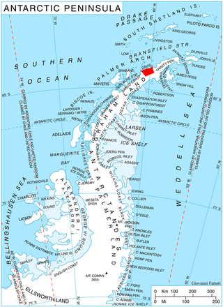
The Danco Coast is the portion of the west coast of the Antarctic Peninsula between Cape Sterneck and Cape Renard. This coast was explored in January and February 1898 by the Belgian Antarctic Expedition under Adrien de Gerlache, who named it for Lieutenant Emile Danco who died on the expedition.

Chavdar Peninsula is a 10-km wide peninsula projecting 13 km in northwest direction from Graham Land on the Antarctic Peninsula in Antarctica. It is bounded by Curtiss Bay to the northeast, Hughes Bay to the southwest and Gerlache Strait to the northwest. Its west extremity Cape Sterneck separates Danco Coast to the southwest and Davis Coast to the northeast. The interior of the peninsula is partly occupied by the westerly portion of Kaliva Range.
Pirin Glacier is the 5.7 km long and 6 km wide glacier situated next east of Chavdar Peninsula on Davis Coast on the Antarctic Peninsula. Situated west of Wright Ice Piedmont, north of Gregory Glacier and east of Samodiva Glacier. Draining north-northwestwards from Boulton Peak to enter Curtiss Bay east of Seaplane Point.
Papiya Nunatak is the rocky hill rising to 666 m in the south foothills of Detroit Plateau on Nordenskjöld Coast in Graham Land, Antarctica, north of the terminus of Drygalski Glacier. It is surmounting Kladorub Glacier to the northeast and Vrachesh Glacier to the southwest.

Agalina Glacier is a 4.8 km (3.0 mi) long and 2.9 km (1.8 mi) wide glacier on Pefaur (Ventimiglia) Peninsula, Danco Coast on the west side of Antarctic Peninsula, situated east of Poduene Glacier and west of Krapets Glacier. It drains northwards, and flows into both Graham Passage and the west arm of Salvesen Cove.

Cierva Cove is a cove lying 6 nautical miles (11 km) southeast of Cape Sterneck in Hughes Bay, just south of Chavdar Peninsula along the west coast of Graham Land, Antarctica. Shown on an Argentine government chart of 1950, it was named by the UK Antarctic Place-Names Committee in 1960 for Juan de la Cierva, the Spanish designer of the autogiro, which was the first successful rotating wing aircraft in 1923.
Cape Sterneck is a bold, black cliff on a projecting point forming the west extremity of Chavdar Peninsula on the west coast of Graham Land, Antarctica. It is situated on the north side of the entrance to Hughes Bay and the west side of the entrance to Curtiss Bay, and separating Davis Coast to the northeast from Danco Coast to the southwest.
Darzalas Peak is the rocky, mostly ice-free peak rising to 934 m in the south foothills of Detroit Plateau on Nordenskjöld Coast in Graham Land, Antarctica. The peak is situated between Bombardier and Dinsmoor Glaciers, and surmounting Mundraga Bay to the southeast.
Mount Pénaud is a mountain rising to ca. 1050 m in the east part of Chavdar Peninsula, Danco Coast on the west side of Graham Land, Antarctica, 8.55 km east-southeast of Cape Herschel. It surmounts Tumba Ice Cap to the northwest and Samodiva Glacier to the northeast.
Cape Murray is a cape forming the western end of Murray Island just off the west coast of Pefaur (Ventimiglia) Peninsula in Graham Land, Antarctica, separating Hughes Bay to the northeast from Charlotte Bay to the south. First charted by the 1897-99 Belgian Antarctic Expedition under Lt. Adrien de Gerlache, and considered at the time as joined to the mainland. Named by Gerlache, presumably for Sir John Murray, British marine zoologist and oceanographer, an ardent advocate of Antarctic research.
Lale Buttress (Bulgarian: рид Лале, ‘Rid Lale’ \'rid la-'le\ is the ice-covered buttress rising to 2069 m on the northwest side of Detroit Plateau on Davis Coast in Graham Land, Antarctica. It is situated between tributaries to Wright Ice Piedmont, and has steep and partly ice-free southwest, northwest and northeast slopes.
Sinitovo Gap is the ice-covered pass of elevation 1170 m extending 1.6 km in the northwest foothills of Detroit Plateau on Danco Coast in Graham Land, Antarctica. It separates Lale Buttress on the southeast from Kaliva Range on the northwest, with a branch of upper Breguet Glacier flowing northwards through the pass to join Wright Ice Piedmont.
Kaliva Range (Bulgarian: хребет Калива, ‘Hrebet Kaliva’ \'hre-bet ka-'li-va\ is the mostly ice-covered range extending 24.7 km in southeast-northwest direction and 10 km wide, rising to 1771 m in the northwest foothills of Detroit Plateau and partly on Chavdar Peninsula, on the border between Davis Coast and Danco Coast in Graham Land, Antarctica. It is separated from Lale Buttress on the southeast by Sinitovo Gap, and surmounts Breguet Glacier to the south, Gregory Glacier to the southwest, Tumba, Samodiva and Pirin Glaciers to the north, and Wright Ice Piedmont to the northeast.
Trepetlika Glacier is the 8 km long and 3.5 km wide glacier on the south side of Sonketa Ridge in the west foothills of Detroit Plateau on Danco Coast in Graham Land, Antarctica. It drains the northwest slopes of Razhana Buttress, flows westwards and enters Brialmont Cove north of the terminus of Mouillard Glacier.
Vinitsa Cove is the 3.75 km wide cove indenting for 1.9 km Davis Coast in Graham Land, Antarctica east of Cape Page and west of Havilland Point. The cove is named after the settlement of Vinitsa in Southern Bulgaria.
Sursuvul Point is the rocky point on Davis Coast in Graham Land, Antarctica projecting 300 m northwards into Orléans Strait. The point is named after Georgi Sursuvul, first minister and regent of Bulgaria during the reigns of Czar Simeon the Great and Czar Peter I.

