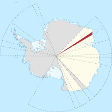
Following is a list of glaciers of Kemp Land in Antarctica. This list may not reflect recently named glaciers in Kemp Land.
Following is a list of glaciers of Kemp Land in Antarctica. This list may not reflect recently named glaciers in Kemp Land.
67°29′S59°10′E / 67.483°S 59.167°E . Small glacier entering the south part of Stefansson Bay just west of Mulebreen. Seen from an Australian National Antarctic Research Expeditions (ANARE) aircraft in 1956 and later mapped. Named by Antarctic Names Committee of Australia (ANCA) for M. Cosgrove, radio supervisor at Mawson Station, 1959. [1]
67°06′S58°07′E / 67.100°S 58.117°E . Glacier 12 nautical miles (22 km; 14 mi) long, flowing north into the sea between West Stack and East Stack, 15 nautical miles (28 km; 17 mi) east of Edward VIII Bay. Roughly mapped by Norwegian cartographers from aerial photos taken by the Lars Christensen Expedition, 1936-37. Visited in 1954 by an ANARE sledging party and named by ANCA for Richard Hoseason of ANARE, who perished on a field trip at Heard Island in 1952. [2]
67°28′S59°21′E / 67.467°S 59.350°E . Glacier 6 nautical miles (11 km; 6.9 mi) wide, flowing west-north-west into the southeast side of Stefansson Bay. First mapped by Norwegian cartographers from air photos taken by the Lars Christensen Expedition 1936-37, and named Mulebreen (the snout glacier). Between 1980 and 2023 the glacier advanced by 13.5km. [3]
Not: Dovers Glacier. [4] [lower-alpha 1]
66°40′S56°29′E / 66.667°S 56.483°E . Small glacier, close east of Seaton Glacier, flowing southward into Edward VIII Ice Shelf. Mapped from aerial photos taken by ANARE in 1956, and named for Sgt. R. Rippon, RAAF, airframe fitter at Mawson in 1959. [5]
67°12′S56°00′E / 67.200°S 56.000°E . The western of two glaciers entering the southern part of Edward VIII Bay. Seen by an ANARE party led by Robert Dovers in November 1954. Named by ANCA for the wife of Robert Dovers, officer in charge and surveyor at Mawson Station in 1954. [6]
66°46′S56°25′E / 66.767°S 56.417°E . Glacier 9 nautical miles (17 km; 10 mi) long, flowing northeast into Edward VIII Ice Shelf just south of Seaton Glacier. Photographed from ANARE aircraft in 1956. Named by ANCA for Flight Lt. H.O. Wilson, RAAF pilot at Mawson Station, 1959, who was killed in an aircraft accident shortly after his return to Australia. [6]
The Dennistoun Glacier is a glacier, 50 nautical miles long, draining the northern slopes of Mount Black Prince, Mount Royalist and Mount Adam in the Admiralty Mountains of Victoria Land, Antarctica. It flows northwest between the Lyttelton Range and Dunedin Range, turning east on rounding the latter range to enter the sea south of Cape Scott.
Concord Mountains is a group name applied to a complex system of ranges in northwest Victoria Land, Antarctica. They comprise the Everett Range, Mirabito Range, King Range, Leitch Massif, East Quartzite Range and West Quartzite Range. They are north of the Admiralty Mountains, northeast of the Victory Mountains, southeast of the Bowers Mountains and south of the Anare Mountains.

Lambert Glacier is a major glacier in East Antarctica. At about 80 km (50 mi) wide, over 400 km (250 mi) long, and about 2,500 m (8,200 ft) deep, it is the world's largest glacier. It drains 8% of the Antarctic ice sheet to the east and south of the Prince Charles Mountains and flows northward to the Amery Ice Shelf. It flows in part of Lambert Graben and exits the continent at Prydz Bay.
Fisher Glacier is a glacier in Mac. Robertson Land, Antarctica. It is a major tributary of the Lambert Glacier. The glacier is unusual in periodically surging.

The Prince Charles Mountains are a major group of mountains in Mac. Robertson Land in Antarctica, including the Athos Range, the Porthos Range, and the Aramis Range. The highest peak is Mount Menzies, with a height of 3,228 m (10,591 ft). Other prominent peaks are Mount Izabelle and Mount Stinear. These mountains, together with other scattered peaks, form an arc about 420 km (260 mi) long, extending from the vicinity of Mount Starlight in the north to Goodspeed Nunataks in the south.
Scott Glacier is a glacier, 7 miles (11.3 km) wide and over 20 miles (32 km) long, flowing north-northwest to the Antarctic coast between Denman Glacier and Mill Island. It was discovered by the Western Base Party of the Australasian Antarctic Expedition (1911–1914) under Mawson and named for Capt. Robert F. Scott.
Seaton Glacier is a glacier 17 miles (27 km) long, flowing southeast into Edward VIII Ice Shelf at the northwest part of Edward VIII Bay. It was mapped by Norwegian cartographers from aerial photos taken by the Lars Christensen Expedition, 1936–37, remapped, 1954–58, by ANARE and named by ANCA in 1958 for Flight Lt. John Seaton, RAAF, pilot with ANARE at Mawson in 1956.

The David Range (67°54′S62°30′E is a mountain range that extends for 26 kilometres in the Framnes Mountains of Mac.Robertson Land in Antarctica. The range is surrounded by, and largely covered by, an ice sheet. Only the peaks are visible.
Kirkby Glacier is a glacier, 20 nautical miles in length, that drains the central Anare Mountains of Antarctica and flows northwest to the sea just north of Arthurson Bluff, northern Victoria Land.
The Porthos Range is the second range south in the Prince Charles Mountains of Antarctica, extending for about 30 miles in an east-to-west direction between Scylla Glacier and Charybdis Glacier. First visited in December 1956 by the Australian National Antarctic Research Expeditions (ANARE) southern party under W.G. Bewsher (1956-57) and named after Porthos, a character in Alexandre Dumas, père's novel The Three Musketeers, the most popular book read on the southern journey.
On the continent of Antarctica, the Aramis Range is the third range south in the Prince Charles Mountains, situated 11 miles southeast of the Porthos Range and extending for about 30 miles in a southwest–northeast direction. It was first visited in January 1957 by Australian National Antarctic Research Expeditions (ANARE) southern party led by W.G. Bewsher, who named it for a character in Alexandre Dumas' novel The Three Musketeers, the most popular book read on the southern journey.
Casey Range is a jagged, razor-backed ridge and a few nunataks in a line extending north–south, standing 8 miles (13 km) west of David Range, in the Framnes Mountains. It was discovered by the British Australian and New Zealand Antarctic Research Expedition (BANZARE), 1929–31, under Douglas Mawson, who named it for Rt. Hon. Richard G. Casey.
Barnett Glacier is a large glacier in the Anare Mountains that flows east along the south side of Tapsell Foreland into Smith Inlet, northern Victoria Land, Antarctica.
Buell Peninsula is an ice-covered peninsula terminating in Cape Williams, located between the lower ends of Lillie Glacier, George Glacier and Zykov Glacier, at the northwest end of the Anare Mountains in Antarctica. The peninsula is 15 nautical miles long and 8 nautical miles at its greatest width.
The Gustav Bull Mountains are a small group of bare, rugged mountain peaks and nunataks, lying 4 miles (6 km) inland from the coast and 10 nautical miles (19 km) southwest of Scullin Monolith in Mac. Robertson Land, Antarctica.
The Playfair Mountains are a group of mountains between Swann Glacier and Squires Glacier in southeast Palmer Land, Antarctica.
Smith Peaks is a group of peaks standing close south of Mount Hordern in the David Range of the Framnes Mountains. Mapped by Norwegian cartographers from aerial photographs taken by the Lars Christensen Expedition, 1936–37. Remapped by ANARE, 1957–60, and named by Antarctic Names Committee of Australia (ANCA) for F.A. Smith, diesel mechanic at Mawson Station, 1957.
McMahon Glacier is a glacier about 18 nautical miles long in the Anare Mountains of Victoria Land, Antarctica. It drains north between the Buskirk Bluffs and Gregory Bluffs into Nielsen Fjord.