| Mount Turner | |
|---|---|
| Highest point | |
| Elevation | 1,267 m (4,157 ft) [1] |
| Listing | Mountains of Yukon |
| Coordinates | 65°23′43″N136°12′53″W / 65.3952778°N 136.2147222°W [2] |
| Geography | |
| Country | Canada |
| Territory | Yukon |
| Topo map | NTS 116H8 Mount Turner [2] |
| Mount Turner | |
|---|---|
| Highest point | |
| Elevation | 1,267 m (4,157 ft) [1] |
| Listing | Mountains of Yukon |
| Coordinates | 65°23′43″N136°12′53″W / 65.3952778°N 136.2147222°W [2] |
| Geography | |
| Country | Canada |
| Territory | Yukon |
| Topo map | NTS 116H8 Mount Turner [2] |

Mount Columbia is a mountain located in the Winston Churchill Range of the Rocky Mountains. It is the highest point in Alberta, Canada, and is second only to Mount Robson for height and topographical prominence in the Canadian Rockies. It is located on the border between Alberta and British Columbia on the northern edge of the Columbia Icefield. Its highest point, however, lies within Jasper National Park in Alberta.

Mount Temple is a mountain in Banff National Park of the Canadian Rockies of Alberta, Canada.

Mount Bryce is a mountain at the southwestern corner of the Columbia Icefield, in British Columbia, Canada, near the border with Alberta. It can be seen from the Icefields Parkway.

The Blue Range is a mountain range of the Canadian Rockies, located on the Continental Divide in Banff National Park, Canada. The range was so named on account of its blueish colour when viewed from afar. Mount Alcantara is the highest point in the range.
Mount Queen Bess is one of the principal summits of the Pacific Ranges of the Coast Mountains of southern British Columbia. It stands west of Chilko Lake and to the south of Tatlayoko Lake, and crowns a peak-studded ridge to the north of the Homathko Icefield.

The Fairweather Range is the unofficial name for a mountain range located in the U.S. state of Alaska and the Canadian province of British Columbia. It is the southernmost range of the Saint Elias Mountains. The northernmost section of the range is situated in Tatshenshini-Alsek Provincial Park while the southernmost section resides in Glacier Bay National Park, in the Hoonah-Angoon Census Area. In between it goes through the southeastern corner of Yakutat Borough. Peaks of this range include Mount Fairweather and Mount Quincy Adams 4,150 m (13,615 ft).

Abbot Pass lies between Mount Lefroy and Mount Victoria, in the divide between the valleys of Lake O'Hara and Lake Louise. It was named for Philip Stanley Abbot who died in 1896 in an attempt to climb Mount Lefroy with Charles Fay, Charles Thompson, and George T. Little.
Mount Oxford is located on Ellesmere Island, Nunavut, Canada and was named for the University of Oxford. The first known ascent was in 1935 by A. W. Moore and Nukapinguaq, a Greenland Inuit, during the Oxford University Ellesmere Land Expedition, when Moore estimated the height as 9,000 ft (2,743 m).

Mount Baker National Recreation Area is a United States national recreation area in northern Washington about 15 miles (24 km) south of the Canada–US border within the Mount Baker-Snoqualmie National Forest.

Mount Callaghan is a volcanic peak located east of the headwaters of the Squamish River, just northeast of the Powder Mountain Icefield and just south of the Pemberton Icefield in the Sea to Sky Country of southwestern British Columbia, Canada, about 20 km directly west of the Resort Municipality of Whistler. A crack was observed across Callaghan's summit in the spring of 1999. In 2000, a section of the summit collapsed. Callaghan Lake lies below the south face of the mountain.

Nahta Cone is a small cinder cone in Cassiar Land District of northwestern British Columbia, Canada. It has an elevation of 1,670 metres and lies near the northern edge of the Arctic Lake Plateau, a glacially scored plateau of the Tahltan Highland which in turn extends along the western side of the Stikine Plateau. The cone is about 70 kilometres south-southeast of the community of Telegraph Creek and lies in the southwestern corner of Mount Edziza Provincial Park, one of the largest provincial parks in British Columbia.

Mount Tantalus is a 2,608-metre (8,556-foot) mountain in southwestern British Columbia, Canada, located 24 km (15 mi) southeast of Falk Lake and 134 km (83 mi) south of Monmouth Mountain. It is the highest mountain in the Tantalus Range of the Pacific Ranges and is famous for its snow-covered face.
Mount Ulysses, is the highest mountain in the Muskwa Ranges of the Northern Canadian Rockies in British Columbia. It and neighbouring peaks are part of a group of names drawing on the epic poem The Odyssey, in which here Ulysses wanders for 10 years before being able to return home to Ithaca.

Mount Worthington is located on the eastern side of Mount McHarg, in Height of the Rockies Provincial Park, and straddles the Continental Divide marking the Alberta-British Columbia border. It was named in 1956 after Lt. Col. Don Worthington who was killed in action in 1944 during the Second World War while commanding the 7th Battalion, The British Columbia Regiment.

Turner Glacier is a glacier on the east side of Mount Liotard flowing northeast into Ryder Bay, Adelaide Island. The glacier was surveyed by Falkland Islands Dependencies Survey (FIDS), 1948, and photographed from the air by Falkland Islands and Dependencies Aerial Survey Expedition (FIDASE), 1956–57. Named by the United Kingdom Antarctic Place-Names Committee (UK-APC) in 1977 after Andrew John Turner, British Antarctic Survey (BAS) builder, Halley Station, 1973–74; Signy Island, 1974–75; Rothera Station, 1976–77, 1978–80; and Faraday Station, 1982–83.

Mount Turner is a 2,806-metre (9,206-foot) mountain summit located in the upper Spray River Valley of southern Banff National Park, in the Canadian Rockies of Alberta, Canada. Mount Turner in not visible from any road in Banff Park, however, it can be seen from Alberta Highway 742, also known as the Smith-Dorrien/Spray Trail in Kananaskis Country. Mount Turner's nearest higher peak is Cone Mountain, 2.91 km (1.81 mi) to the north.

Mount Morrison is a 2,765-metre (9,072-foot) mountain summit located in the upper Spray River Valley of southern Banff National Park, in the Canadian Rockies of Alberta, Canada. Mount Morrison in not visible from any road in Banff Park, however, it can be seen from Alberta Highway 742, also known as the Smith-Dorrien/Spray Trail in Kananaskis Country. Mount Morrison's nearest higher peak is Mount Turner, 1.8 km (1.1 mi) to the north.

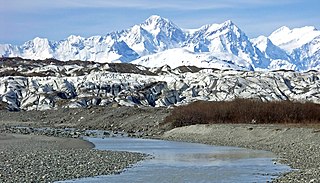
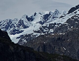
Mount Turner, also known as Boundary Peak 162, is an 8,661+ foot glaciated mountain summit located in the Fairweather Range of the Saint Elias Mountains, on the Canada–United States border between southeast Alaska and British Columbia. The peak is situated on the shared boundary of Glacier Bay National Park with Tatshenshini-Alsek Provincial Park, 8 mi (13 km) west of Tarr Inlet, and 4.4 mi (7 km) southwest of Mount Forde, which is the nearest peak. Turner is the highest point on the divide which separates Ferris Glacier from Margerie Glacier. The mountain's name was officially adopted by the Geographical Names Board of Canada on March 31, 1924. The mountain was named for George Turner (1850–1932), one of the US members of the 1903 Alaska Boundary Tribunal.
This is a list of nominated candidates for the Green Party of Canada in the 2019 Canadian federal election.
Sydney Leslie Turner is a Canadian artistic gymnast. She won team bronze at the 2022 World Artistic Gymnastics Championships which was Canada's historic first team medal.