
Lilongwe is the capital and largest city of Malawi. It has a population of 989,318 as of the 2018 Census, up from a population of 674,448 in 2008. In 2020 that figure was 1,122,000. The city is located in the central region of Malawi, in the district of the same name, near the borders with Mozambique and Zambia, and it is an important economic and transportation hub for central Malawi. It is named after the Lilongwe River.
Zomba is a city in southern Malawi, in the Shire Highlands. It is the former capital city of Malawi.

Blantyre is Malawi's centre of finance and commerce, and its second largest city, with a population of 800,264 as of 2018. It is sometimes referred to as the commercial and industrial capital of Malawi as opposed to the political capital, Lilongwe. It is the capital of the country's Southern Region as well as the Blantyre District.

Karonga is a township in the Karonga District in Northern Region of Malawi. Located on the western shore of Lake Nyasa, it was established as a slaving centre sometime before 1877. As of 2018 estimates, Karonga has a population of 61,609. The common and major language spoken in this district is the Tumbuka language, which is also a regional language of Northern Malawi.

Mulanje, formerly called Mlanje, is a town in the Southern Region of Malawi, close to the border with Mozambique, to the east. It is near the Mulanje Massif.

The Central Region of Malawi, population 7,523,340 (2018), covers an area of 35,592 km2. Its capital city is Lilongwe, which is also the national capital. The region has an outlet on Lake Malawi and borders neighbouring countries Zambia and Mozambique. The Chewa people make up the majority of the population today.

The Shire is the largest river in Malawi. It is the only outlet of Lake Malawi and flows into the Zambezi River in Mozambique. Its length is 402 kilometres (250 mi). The upper Shire River issues from Lake Malawi and runs approximately 19 km (12 mi) before it enters shallow Lake Malombe. It then drains Lake Malombe and flows south through Liwonde National Park where large concentrations of hippopotamus are common along its shores. Between the towns of Matope and Chikwawa, the middle river drops approximately 400 m (1,300 ft) through a series of falls and gorges, including Kapachira Falls. Two hydroelectric dams have been built along the Shire northwest of Blantyre.

Chipata is a city and administrative centre of the Eastern Province of Zambia and Chipata District. It was declared the 5th city of the country, after Lusaka, Ndola, Kitwe and Livingstone, by President Edgar Lungu on 24 February 2017. The city has undergone rapid economic and infrastructure growth in the years, leading up to city status.
Blantyre is a district in the Southern Region of Malawi. The capital is Blantyre, a commercial city where most Malawian industrial and business offices are. The district covers an area of 2,012 km² and has a population of 809,397. It was named after Blantyre, the birth village of David Livingstone in Scotland, one of the first missionary explorers who came to Nyasaland, as Malawi was called before independence in 1964. It is also a main trading point besides the other large cities in Malawi. The other large cities are Lilongwe, which is located in the central region, and Mzuzu, which is in the northern part of Malawi.
Chitipa District is the northernmost district in the Northern Region of Malawi. The capital is Chitipa. The district covers an area of 4,288 km2, and has a population of 234,927. Chitipa borders fellow districts Karonga and Rumphi, as well as neighboring countries Tanzania and Zambia. The district is divided into five main areas known as Misuku to the east, Kameme to the north, Bulambia right at the centre while Wenya and Nthalire areas are situated to the south.
Karonga is a district in the Northern Region of Malawi. The district covers an area of 3,355 km.² and has a population of 365,028. It is a border district between Malawi and Tanzania's Mbeya Region's Kyela District and is mainly occupied by the Tumbuka and Nkhonde tribes.
Phalombe is a town in Malawi. It is the district capital of Phalombe District.
Ndali, or Chindali, is a Bantu language spoken by an increasing population in southern Tanzania of 150,000 (1987) and in northern Malawi by 70,000 (2003).

The Mafinga Hills are a plateau covered by hills, situated on the border between Zambia and Malawi, in Southern Africa. These hills are composed of quartzites, phyllites and feldspathic sandstones of sedimentary origin.
Nyakyusa, or Nyakyusa-Ngonde, is a Bantu language of Tanzania and Malawi spoken by the Nyakyusa people around the northern end of Lake Malawi. There is no single name for the language as a whole; its dialects are Nyakyusa, Ngonde (Konde), Kukwe, Mwamba (Lungulu), and Selya of Tanzania. Disregarding the Bantu language prefixes Iki- and Ki-, the language is also known as Konde ~ Nkhonde, Mombe, Nyekyosa ~ Nyikyusa, and Sochile ~ Sokili.
Chilumba is a town in Malawi. It is an urban centre in Karonga District.
Lambya (Rambia) is a Bantu language of Tanzania and Malawi. In Northern Malawi it is spoken particularly in the Chitipa District.
Mwanza is a town in Malawi on the border with Mozambique. It is the administrative headquarters for Mwanza District.
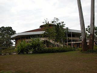
King Ceasor University is a private university previously known as St. Augustine International University.
The M14 is a road in the Muchinga Province of Zambia that connects Nakonde with the Malawian Border at Katumbi via Chitipa, Thendere and Muyombe.
