Silverton is a statutory town that is the county seat, the most populous community, and the only incorporated municipality in San Juan County, Colorado, United States. The town is located in a remote part of the western San Juan Mountains, a range of the Rocky Mountains. The first mining claims were made in mountains above the Silverton in 1860, near the end of the Colorado Gold Rush and when the land was still controlled by the Utes. Silverton was established shortly after the Utes ceded the region in the 1873 Brunot Agreement, and the town boomed from silver mining until the Panic of 1893 led to a collapse of the silver market, and boomed again from gold mining until the recession caused by the Panic of 1907. The entire town is included as a federally designated National Historic Landmark District, the Silverton Historic District.

The Madison River is a headwater tributary of the Missouri River, approximately 183 miles (295 km) long, in Wyoming and Montana. Its confluence with the Jefferson and Gallatin rivers near Three Forks, Montana forms the Missouri River.

The National Trails System is a series of trails in the United States designated "to promote the preservation of, public access to, travel within, and enjoyment and appreciation of the open-air, outdoor areas and historic resources of the Nation". There are four types of trails: the national scenic trails, national historic trails, national recreation trails, and connecting or side trails. The national trails provide opportunities for hiking and historic education, as well as horseback riding, biking, camping, scenic driving, water sports, and other activities. The National Trails System consists of 11 national scenic trails, 21 national historic trails, over 1,300 national recreation trails, and seven connecting and side trails, as well as one national geologic trail, with a total length of more than 91,000 mi (150,000 km). The scenic and historic trails are in every state, and Virginia and Wyoming have the most running through them, with six.
Enbridge Inc. is a Canadian multinational pipeline and energy company headquartered in Calgary, Alberta, Canada. Enbridge owns and operates pipelines throughout Canada and the United States, transporting crude oil, natural gas, and natural gas liquids, and also generates renewable energy. Enbridge's pipeline system is the longest in North America and the largest oil export pipeline network in the world. Its crude oil system consists of 28,661 kilometres of pipelines. Its 38,300 kilometre natural gas pipeline system connects multiple Canadian provinces, several US states, and the Gulf of Mexico. The company was formed by Imperial Oil in 1949 as the Interprovincial Pipe Line Company Limited to transport Alberta oil to refineries. Over time, it has grown through acquisition of other existing pipeline companies and the expansion of their projects.

Mount Cotton is a rural locality in the City of Redland, Queensland, Australia. In the 2016 census, Mount Cotton had a population of 6,835 people.

Frontenac Provincial Park is a provincial park located near the town of Sydenham, north of Kingston, Ontario, Canada. This 5,350-hectare park is classified as a natural environment park, and lies on the Frontenac Axis, a topographic extension of the Canadian Shield connecting to the Adirondack Mountains. It features 22 lakes, over 700 species, and extensive areas of mixed forest, wetlands, and granite outcrops.

Penrith North Lakes is a railway station on the West Coast Main Line, which runs between London Euston and Edinburgh Waverley or Glasgow Central. The station, situated 17 miles 69 chains (28.7 km) south of Carlisle, serves the market town of Penrith, Westmorland and Furness in Cumbria, England. It is owned by Network Rail and managed by Avanti West Coast.

Lady Evelyn-Smoothwater Provincial Park is a remote wilderness park in northeastern Ontario, Canada, north of Lake Temagami. It is one of five provincial parks located in the Temagami area.

Canberra railway station is located on the NSW TrainLink Regional Southern Line in the Australian Capital Territory, Australia. It is located in the Canberra suburb of Kingston.

The Moehau Range is the northernmost range on the Coromandel Peninsula, extending from the settlement of Colville, New Zealand northwards to the tip of the peninsula. Mount Moehau is the highest point of the range, at 892m above sea level.

Mount Rose Ski Tahoe is a ski resort in the western United States, in the Sierra Nevada mountains near Reno, Nevada. The closest resort to the city, it is located about thirty miles (50 km) south-southwest of Reno, in the Carson Range. It has the highest base elevation of a Tahoe-region ski area, at about 8,260 ft (2,520 m) and the summit is 9,700 ft (2,955 m). The resort area is 1,200 acres (4.9 km2) and is located in Toiyabe National Forest.
The McGregor Range is a mountain range in the Central Interior of British Columbia, located between the main spine of the Rocky Mountains and the Fraser River on the northeast and southwest, and between the Torpy River on its southeast and the McGregor River on its northwest. Though adjacent to the Rockies and very mountainous, the McGregor Range is part of the McGregor Plateau, a subdivision of the Fraser Plateau.

The Rotorua Branch is a railway line from Putāruru to Rotorua, in the Waikato and Bay of Plenty regions of the North Island of New Zealand. Construction of the line was commenced by the Thames Valley and Rotorua Railway Company and finished by the Public Works Department (PWD). The complete line, 50.5 kilometres (31.4 mi) in length, opened in two sections; on 24 November 1893 to Tārukenga and the final 8 mi 43 ch (13.7 km) to Rotorua on 8 December 1894.

Linton railway station was a flag station at Linton in Palmerston North on the North Island Main Trunk in New Zealand.
Lavitah Mountain, is a 1,699-metre (5,574 ft) mountain in the Miscinchinka Ranges of the Hart Ranges in the Northern Rocky Mountains.

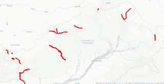
India–China Border Roads is a Government of India project for developing infrastructure along the Sino-Indian border by constructing strategic roads, including bridges and tunnels. The ICBR project is largely in response to Chinese infrastructure development along the borderlands with India.

Rangiwahia is a small, elevated, farming settlement in the North Island, New Zealand, 26 km (16 mi) northeast of Kimbolton in the Manawatū-Whanganui region. It is in the Kiwitea valley, near the Whanahuia Range of the Ruahines. Due to its height and the nearby ranges, Rangiwahia has a mean annual rainfall of 1267mm; 309mm more than Feilding's.
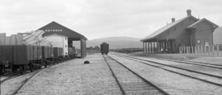
Hatuma is 7 km (4.3 mi) south of Waipukurau, in Central Hawke's Bay in the east of the North Island of New Zealand. Meshblock 7016748, which covers 19.3 km2 (7.5 sq mi) from the edge of Waipukurau to Marakeke, had a population of 153 in 2018.
Hakone Onsen, or Hakone Hot Springs, is a general term for numerous thermal spas located in the town of Hakone, Ashigarashimo District, Kanagawa Prefecture, Japan, an area formerly known as Sagami Province. Situated about 90 km southwest of Tokyo and 60 kilometers east-southeast of Mt. Fuji, it is one of the most popular hot spring resorts in central Japan. At least twenty hot spring spring resorts exist around Mt. Hakone, an area that is designated as part of the Fuji Hakone Izu National Park.


