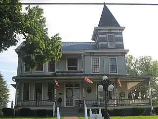
Wayne County is the westernmost county in the U.S. state of West Virginia. As of the 2020 census, the population was 38,982. Its county seat is Wayne. The county was founded in 1842 and named for General "Mad" Anthony Wayne. Wayne County is part of the Huntington–Ashland, WV–KY–OH Metropolitan Statistical Area.

Lincoln County is a county in the U.S. state of West Virginia. As of the 2020 census, the population was 20,463. Its county seat is Hamlin. The county was created in 1867 and named for Abraham Lincoln. Lincoln County is part of the Huntington-Ashland, WV-KY-OH Metropolitan Statistical Area.
Cabell County is a county located in the U.S. state of West Virginia. As of the 2020 census, the population was 94,350, making it West Virginia's fourth most-populous county. Its county seat is Huntington. The county was organized in 1809 and named for William H. Cabell, the Governor of Virginia from 1805 to 1808. Cabell County is part of the Huntington–Ashland, WV–KY–OH Metropolitan Statistical Area.

Huntington is a city in Cabell and Wayne counties in the U.S. state of West Virginia. The seat of Cabell County, the city is located at the confluence of the Ohio and Guyandotte rivers in the state's southwestern region. The population was 46,842 at the 2020 census, and was estimated to be 45,325 in 2023. Huntington is the second-most populous city in West Virginia. The Huntington–Ashland metropolitan area, spanning seven counties across West Virginia, Kentucky and Ohio, had an estimated population of 368,262 in 2023.

Barboursville is a village in Cabell County, West Virginia, United States. The population was 4,456 at the 2020 census. It is part of the Huntington–Ashland metropolitan area.

Harts is a census-designated place (CDP) at the mouth of Big Harts Creek in Lincoln County, West Virginia, United States, situated along the Guyandotte River. As of the 2010 census, its population was 656. Harts is a part of the Huntington-Ashland, WV-KY-OH, Metropolitan Statistical Area (MSA). The Harts CDP includes the unincorporated communities of Harts, Atenville, Ferrellsburg, and Sand Creek.

West Hamlin is a town in Lincoln County, West Virginia, United States, along the Guyandotte River. The population was 519 at the 2020 census, and is now down to 509, according to the 2021 census. West Hamlin is a part of the Huntington-Ashland, WV-KY-OH, Metropolitan Statistical Area (MSA). West Hamlin is west of the county seat at Hamlin, hence the name.

Chapmanville is a town in Logan County, West Virginia, United States. The population was 1,025 at the 2020 census. Chapmanville is named for Ned Chapman, an early settler who operated a store and post office. It was incorporated in 1947.

West Logan is a town along the Guyandotte River in Logan County, West Virginia, United States. The population was 400 at the 2020 census. For unknown reasons, some sources report West Logan to lay west of the county seat at Logan, attributing to this fact the name.

The Guyandotte River is a tributary of the Ohio River, approximately 166 mi (267 km) long, in southwestern West Virginia in the United States. It was named after the French term for the Wendat Native Americans. It drains an area of the unglaciated Allegheny Plateau south of the Ohio between the watersheds of the Kanawha River to the northeast and Twelvepole Creek and the Big Sandy River to the southwest. Via the Ohio River, it is part of the Mississippi River watershed.
Big Ugly Creek is a major tributary of the Guyandotte River in the Harts Creek District of Lincoln County, West Virginia, United States. The creek was named as such because of an early settler at the mouth of the creek who was unpleasing to the eye and the crooked shape of the creek itself. Big Ugly Creek is a meandering stream stretching nearly 20 miles from U.S. Route 119 northeast of Chapmanville in Boone County to where it meets the Guyandotte River at Gill, an extinct railroad town north of Harts in Lincoln County. Big Ugly Creek is also at the southern end of the state's largest mountaintop removal mine, Arch Coal's Hobet 21. The mine stretches nearly 15 miles from near Julian, north of Madison in Boone County to right above the end of Fawn Hollow, which joins Big Ugly, not far from the Big Ugly Community Center.
Guyandotte is a historic neighborhood in the city of Huntington, West Virginia, that previously existed as a separate town before annexation was completed by the latter. The neighborhood is home to many historic properties, and was first settled by natives of France at the end of the eighteenth century. Guyandotte was already a thriving town when the state of West Virginia was formed from part of Virginia. Located at the confluence of the Guyandotte River and the Ohio River, it was already a regional trade center with several industries of its own when the Chesapeake and Ohio Railway (C&O) reached its western terminus nearby just across the Guyandotte River in 1873. This event was soon followed by the formation and quick development of the present city of Huntington which was named in honor of the C&O Railway's founder and then principal owner Collis P. Huntington.
Ferrellsburg is an unincorporated community in southern Lincoln County, West Virginia, United States. It is located in Harts Creek District and is part of the Harts census-designated place.
The Guyandotte River train wreck occurred on the morning of January 1, 1913, when the Chesapeake and Ohio Railway's (C&O) train No. 99, scheduled to run from Hinton, West Virginia, to Russell, Kentucky, and headed by Mikado locomotive 820, fell through a bridge over the Guyandotte River near Huntington, West Virginia while attempting to cross it. The accident killed seven people.

Gill is an unincorporated community and former railroad town in Lincoln County, West Virginia, United States.

Eden Park is a former coal town situated along the Guyandotte River between Atenville and Harts in Lincoln County, West Virginia, United States. It appears in state business directories as early as 1908.

Big Harts Creek, often shortened to "Harts Creek" or "Big Hart," is a major tributary of the Guyandotte River in Lincoln and Logan counties, West Virginia.
Fred Bussey Lambert was a West Virginia educator and regional historian. He is best known for his role in establishing Guyan Valley High School, his production of The Llorrac, and the Fred B. Lambert Collection, an assemblage of regional history housed at Marshall University.
Joes Creek is a 5.5-mile-long (8.9 km) secondary tributary of the Mud River, in Lincoln County in the U.S. state of West Virginia. The stream is located in eastern Lincoln County and lies 4.4 miles from Tornado. Through Trace Fork, the Mud River, the Guyandotte River, and finally the Ohio River, it is part of the watershed of the Mississippi.
Davis Creek is a stream in the U.S. state of West Virginia. It is a tributary of the Guyandotte River.

