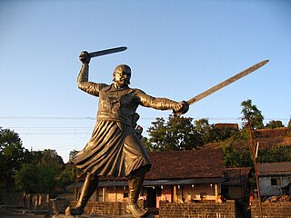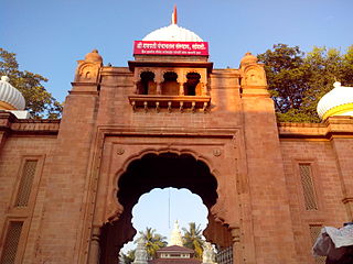
Kolhapur district is a district in the Maharashtra state of India. The city of Kolhapur is its district headquarter. It is situated near Panchaganga river.

Sangli district is a district of Maharashtra state in India. Sangli city is the district headquarters. It is bordered by Satara district, Solapur district to the North, Karnataka state to South-East, by Kolhapur district to South-West and by narrow portion in East side to Ratnagiri district. It is present on the southern tip of Maharashtra.
Kagal is a town in Kolhapur district of the Indian state of Maharashtra.
Ajara is a census town and the taluka headquarters of Ajara taluka in Kolhapur district in the state of Maharashtra, India.
Kodoli is a census town in Kolhapur district in the Indian state of Maharashtra. It is situated between the foothills of Panhala fort (Ranges) and Warana River. Kodoli is well developed town as per all point of view. Kodoli is home to many and variety of industries. This is one of the unique towns in the Maharashtra where you can get glimpse of modernity and heritage at one place e.g. town still inherits open air theaters. Kodoli is the biggest city in Panhala tehsil.
Benadi is a village in the North-Western region of Karnataka state near Maharashtra Border in India. It is located in the Chikodi taluka of Belgaum district in Karnataka. Before it was a part of Bombay State and Princely state of Kolhapur. It is a part of Twin Village Aadi-Benadi. People who has origin from this village are known as Benadikar.
Kurli is a village in Sindhudurg District, the south-easternmost district of Konkan Division, Maharashtra, India. Kurli is located 7.9 km from its Taluk Main Town Vaibhavwadi. Kurli is 33.6 km from its District main city, Oras. It is 307 km from its State Main City Mumbai. This is a culturally and historically important village. Kurli consists of wadis like Temb Wadi, Khadakwadi, Bajarpeth. Also it is famous because of the newly made Kurli Dam.
Madabhavi is a large village located in Athani taaluk of Belagavi district, Karnataka state of India. The village is famous for the production of leather chappals, which have main market in Kolhapur. The village name comes from "Madya" meaning central and "Bhavi" meaning an open well. The open well is situated near panchayat of the village. Kalbhairava and Madhukeshwar are two ancient temples in this village.
Nandikurali is a village in the southern state of Karnataka, India. It is located in the Raybag taluk of Belgaum district in Karnataka.
Shegunashi is a village in the southern state of Karnataka, India. It is located in the Athani taluk of Belagavi district in Karnataka.
Jat is a town and taluka headquarters in Miraj subdivision of Sangli district in southern Maharashtra.
Diggewadi is a village in Raybag taluk in Belgaum Panchayat in the southern state of Karnataka, India. The official language of Diggewadi is Kannada.

Honnihalli is a village in Belagavi district in the southern state of Karnataka, India.
Bhood is a village in Khanapur tehsil of Sangli district in Maharashtra, India. It is located near the city Vita.
Atigre is a village in Kolhapur district in the Indian state of Maharashtra, in western India. It is situated on Kolhapur-Sangli Highway about 410 kilometres (250 mi) from Mumbai, 17 km from Kolhapur, 8 km from Hatkanangle, 35 km from Sangli, and 12 km from Ichalkaranji.
Bhadole is a large village situated along the Warana River basin in the Hatkanangale Taluka of Kolhapur District in the state of Maharashtra, India.
Kadgaon is a town situated Gadhinglaj Taluka of Kolhapur district situated in the southwest corner of the state of Maharashtra, India. Kadgaon is about 4 km from Gadhinglaj, 79 km from Kolhapur. Kadgaon is situated on MH SH 134 and is about 15 km from National Highway 48 (NH48). It is managed by Town Council. It is in the phase of transforming from a small town to a bustling city. It is the second-largest city after Gadhinglaj in Gadhinglaj Taluka also second largest city in Gadhinglaj sub division which Include talukas of Gadhinglaj, Ajra, Bhudargad, Chandgad. As of 2012 it has a population of about 20,851. Kadgaon has amenities that are of the level of Municipal Council in India. Kadgaon has developed as an industrial hub in recent years. It has a strong agricultural sector and is known for its sugarcane, jaggery and red chili production. It is well connected to all of Kolhapur and Maharashtra. It has a very excellent civic amenities. Like in most of the case in the Maharashtra the primary Language spoken is Marathi with 20,851 speaking as their primary Language.
Mahagaon is a town in Gadhinglaj Taluka, Kolhapur district, situated in the southwest corner of the state of Maharashtra, India, on the banks of the Hiranyakeshi river. It is about 10 kilometres (6.2 mi) south of Gadhinglaj and 14 kilometres (8.7 mi) from the city of Kadgaon. It is managed by a town council. In 2011, it had a population of about 20,108.
Mungurwadi is a town in Gadhinglaj Taluka of Kolhapur district in Maharashtra, India. In 2001 it had a population of 3,271, but as of 2011, it has a population of 12,199. It is a major market place and the tenth largest settlement in Gadhinglaj taluka. Mungurwadi is about 24 km from Gadhinglaj, 29 km from second-largest settlement Kadgaon and 12 km from National Highway 48 (NH48).
Haladi is a Town in Gadhinglaj Taluka Kolhapur district situated in the southwest corner of state Maharashtra, India. Harali is situated on banks of Hiranyakeshi river originated from the Great Amboli Ghats is about 7 km from Gadhinglaj towards south and 12 km from the second largest city Kadgaon in Gadhinglaj Taluka and just 2 km from Mahagaon,Gadhinglaj. It is managed by Town Council.In 2011 it has a population of about 9,856. Harali is the eight largest city and town in Gadhinglaj Taluka. Shri Appasaheb Nalawade Gadhinglaj Taluka Sahakari Sakhar Karkhana is situated in the town.


