Anantnag district is an administrative district of Indian-administered Jammu and Kashmir in the disputed Kashmir region. It is one of ten districts which make up the Kashmir Valley. The district headquarters is Anantnag city. As of 2011, it was the third most populous district of Jammu and Kashmir, after Jammu and Srinagar.

Doda district is an administrative district of the Jammu division of Indian-administered Jammu and Kashmir in the disputed Kashmir region. Doda covers 2,625 square kilometers.

Doda is a town and a notified area committee in Doda district in the Indian union territory of Jammu and Kashmir. Doda has an average elevation of 1,107 metres (3,632 ft).

Banihal is a town and a notified area committee, near Ramban town in Ramban district in the Indian union territory of Jammu and Kashmir. It is a rural and hilly area with Kamirwah being one of the most prominent hills. It is located about 35 km (22 mi) away from Qazigund of Anantnag district on NH 44. However, the distance between Banihal and Qazigund is only 18 km by train on the new railway line which is much shorter than the road. The most common language spoken in the region is Kashmiri; Urdu, Hindi, Gujjari, Pahari and English are other familiar languages.

Sonamarg or Sonmarg, known as Sonamarag in Kashmiri, is a hill station located in the Ganderbal District of Jammu and Kashmir, India. It is located about 62 kilometers from Ganderbal Town and 80 kilometres (50 mi) northeast of the capital city, Srinagar.

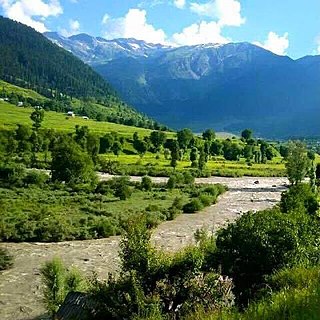
Jammu and Kashmir is home to several valleys such as the Kashmir Valley, Chenab Valley, Sindh Valley and Lidder Valley. Some major tourist attractions in Jammu and Kashmir are Srinagar, with its renowned Dal Lake and Mughal Gardens, Gulmarg, Pahalgam, Bhaderwah, Patnitop and Jammu. Every year, thousands of Hindu pilgrims visit holy shrines of Vaishno Devi and Amarnath which has had a significant impact on the state's economy.

Kishtwar district is an administrative district of the Jammu division of Indian-administered Jammu and Kashmir of the disputed Kashmir region. As of 2011, it is the largest and the least populous district of the Union Territory of Jammu and Kashmir.

Paddar, also spelled Padar, is a Sub-District and remote valley in the Kishtwar district of the union territory of Jammu and Kashmir, India. It falls in the Jammu division. It consists of two tehsils namely Machail and Atholi Paddar The valley covers the entire southeastern portion of the Kishtwar district. It borders Zanskar (Ladakh) in the north and east, Pangi in the south and the rest of Jammu and Kashmir in the west. The valley is known for its Sapphire mines. It lies along the Chandrabhaga river (Chenab) in the Great Himalayas. Paddar is one of the most remote regions of Jammu and Kashmir. There are a number of small valleys within Paddar, such as Machail, Gandhari, Kabban, Ongai, Bhuzunu, Barnaj, Bhuzas, Kijai Nallah, Ishtiyari, Tiyari and Dharlang, among others.

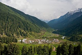
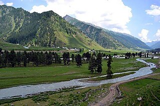
Aru known as Adav in Kashmiri, is a village, tourist spot in the Anantnag District of Jammu and Kashmir, India. It lies 53km from Anantnag city, the district headquarter. It is located around 12 km from Pahalgam, 11 km upstream from the Lidder River. Noted for its scenic meadows, lakes and mountains, it is a base camp for trekking to the Kolhoi Glacier, Tarsar Lake, Marsar and Herbaghwan Lake. The village lies on the left bank of the Aru river, which is a tributary of the Lidder river. Jammu & Kashmir’s biggest Fodder Seed Product Station is also located in the Aru village.

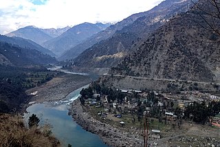
Chenab Valley is a term refers to present-day districts of Doda, Kishtwar, Ramban in Jammu and Kashmir. These three districts used to be part of a single former district called Doda, which was created in 1948 out of the eastern parts of Udhampur district of the princely state of Jammu and Kashmir, and are sometimes collectively referred to as the Doda belt.

Sinthan Top is a mountain pass, a popular tourist destination located in Kishtwar district and borders with South Kashmir's Breng Valley of Anantnag district in the Indian union territory of Jammu and Kashmir. Majority of the area lies on the Kishtwar side. The top acts as a sort of base camp to several alpine lakes in the region.
Srigufwara is a town and administrative sub-division, or tehsil, in the Anantnag district of the India-administered union territory of Jammu and Kashmir. It was given tehsil status by the government of Jammu and Kashmir on 1 February 2014.

The Warwan Valley is a Himalayan sub-valley and a tehsil in Kishtwar District in the Jammu division in union territory of Jammu and Kashmir in India. The Valley lies 68 kilometres (42 mi) northeast of Kishtwar and 150 kilometres (93 mi) from Srinagar, the summer capital of Jammu and Kashmir.
Margan Top or Margan Pass is a mountain pass, connecting Warwan Valley in Kishtwar District with the main Kashmir Valley. It is located south of Anantnag district in the Indian state of Jammu and Kashmir.

Jammu and Kashmir is a region administered by India as a union territory and consists of the southern portion of the larger Kashmir region, which has been the subject of a dispute between India and Pakistan since 1947 and between India and China since 1959. The Line of Control separates Jammu and Kashmir from the Pakistani-administered territories of Azad Kashmir and Gilgit-Baltistan in the west and north. It lies to the north of the Indian states of Himachal Pradesh and Punjab and to the west of Ladakh which is administered by India as a union territory.
Ababeel (ابابیل), also known as Ababeel NGO, is a charitable trust that provides emergency assistance, disaster relief, food kits, and blood donations for the needy, poor, orphans, widows, and also in emergencies in the Chenab Valley's Doda, Kishtwar, Thathri, Bhaderwah, Bhalessa, Chatroo, Dhadpeth and Jammu. The organization assists people irrespective of caste and religion. It is registered with the Sub Registrar Court Doda.
Saraz or Siraj is a hilly region in the eastern part of the Jammu division of Jammu and Kashmir in northern India. Historically a pargana within the erstwhile state of Kishtwar, the region currently takes up the northern half of Doda district and parts of neighbouring Ramban and Kishtwar districts. Its population in 2011 stood at 180,000 people. The region is defined mainly on the basis of linguistics where the majority of people speak Sarazi as their mother tongue.

Marwah is a valley and sub-division in the Kishtwar district of Jammu and Kashmir in India. Marwah is surrounded by the Warwan valley to the northwest, Ladakh and Zanskar to the east, Chatroo and Kishtwar to the south, and Anantnag in the west. The area is drained by river Marusudar, which is the largest tributary of Chenab.
The Mulwarwan Fire was a destructive fire that occurred on October 14, 2024, in Mulwarwan village, located in Warwan tehsil of Kishtwar district, Jammu and Kashmir, India. The fire devastated a large portion of the village, destroying 70 houses and displacing 95 families. Approximately 500 people were affected by the incident, which razed most homes to the ground. The cause of the fire remains unknown.
Chatroo is a small village and an administrative subdivision located in the Kishtwar district of the Indian Union Territory of Jammu and Kashmir.


