Municipal Okrug 78

Last updated
Municipal Okrug #78 on the 2006 map of St. Petersburg Spb tsentr 78th.svg
Municipal Okrug #78 on the 2006 map of St. Petersburg

Municipal Okrug 78 (Russian : муниципа́льный о́круг № 78) is a municipal okrug of Tsentralny District of the federal city of St. Petersburg, Russia. Population: 11,186(2010 Census); [1] 13,508(2002 Census). [2]

Russian language East Slavic language

Russian is an East Slavic language, which is official in the Russian Federation, Belarus, Kazakhstan and Kyrgyzstan, as well as being widely used throughout Eastern Europe, the Baltic states, the Caucasus and Central Asia. It was the de facto language of the Soviet Union until its dissolution on 25 December 1991. Although nearly three decades have passed since the breakup of the Soviet Union, Russian is used in official capacity or in public life in all the post-Soviet nation-states, as well as in Israel and Mongolia.

Administrative divisions of Saint Petersburg

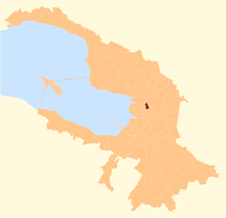
The federal city of Saint Petersburg, Russia, is divided into eighteen districts, which are in turn subdivided into municipal okrugs, municipal towns, and municipal settlements.

Tsentralny District, Saint Petersburg District in federal city of St. Petersburg, Russia

Tsentralny District is a district of the federal city of St. Petersburg, Russia. As of the 2010 Census, its population was 214,625; down from 236,856 recorded in the 2002 Census.

The okrug borders Nevsky Avenue in the northeast, the Fontanka River in the south, and Gorokhovaya Street in the west.

Fontanka River left branch of the river Neva in Saint Petersburg, Russia

Fontanka is a left branch of the river Neva, which flows through the whole of Central Saint Petersburg, Russia. It is 6.7 kilometres (4.2 mi) long; its width is up to 70 metres (230 ft), and its depth is up to 3.5 metres (11 ft). The Fontanka Embankment is lined with the former private residences of Russian nobility.

Gorokhovaya Street street in Tsentralny District, Russia

Gorokhovaya Street is a north-south thoroughfare in the Central Business District of Saint Petersburg.

Places of interest include the Kazan Cathedral, the Merchant Court, the Apraksin Dvor, the Alexandrinsky Theatre, and the Saint Petersburg City Duma.

Apraksin Dvor

Apraksin Yard is a 14 hectares market and retail block in Saint Petersburg, Russia, currently under a massive long-term renovation project. The buildings of Apraksin Dvor nestle between Sadovaya Street and the Fontanka River, just southwest of the Alexandrinsky Theatre.

Alexandrinsky Theatre theater in Saint Petersburg, Russia

The Alexandrinsky Theatre or Russian State Pushkin Academy Drama Theater is a theatre in Saint Petersburg, Russia.

Saint Petersburg City Duma city hall

Saint Petersburg City Duma was established in 1785 in the course of Catherine the Great's municipal reform. Emperor Paul replaced it by the so-called Ratusha, but his son, Alexander I, had the Duma restored four years later. The next emperor, Nicholas I, expanded the institution from six to twelve members in 1846. Alexander II of Russia reorganized it once again during the Zemstvo reform of the 1870s. In September 1918 the Duma was abolished and its functions devolved on the Petrograd Soviet.

Related Research Articles

Admiralteysky Municipal Okrug human settlement in Russia

Admiralteysky Municipal Okrug is a municipal okrug of Admiralteysky District of the federal city of St. Petersburg, Russia. Population: 22,634 (2010 Census); 30,533 (2002 Census).

Sennoy Municipal Okrug human settlement in Russia

Sennoy Municipal Okrug is a municipal okrug of Admiralteysky District of the federal city of St. Petersburg, Russia. Population: 22,384 (2010 Census); 28,105 (2002 Census).

Semyonovsky Municipal Okrug municipal okrug of Saint Petersburg

Semyonovsky Municipal Okrug, formerly Municipal Okrug #4, is a municipal okrug of Admiralteysky District of the federal city of St. Petersburg, Russia. Population: 23,322 (2010 Census); 29,572 (2002 Census).

Izmaylovskoye Municipal Okrug human settlement in Russia

Izmaylovskoye Municipal Okrug is a municipal okrug of Admiralteysky District of the federal city of St. Petersburg, Russia. Population: 26,355 (2010 Census); 30,415 (2002 Census).

Yekateringofsky Municipal Okrug human settlement in Russia

Yekateringofsky Municipal Okrug (Russian: Екатеринго́фский муниципа́льный о́круг, known as Municipal Okrug #6 until 2011, is a municipal okrug of Admiralteysky District of the federal city of St. Petersburg, Russia. Population: 24,038  ; 31,570  .

Dvortsovy Municipal Okrug human settlement in Russia

Dvortsovy Municipal Okrug is a municipal okrug of Tsentralny District of the federal city of St. Petersburg, Russia. Population: 6,426 (2010 Census); 10,491 (2002 Census).

Liteyny Municipal Okrug human settlement in Russia

Liteyny Municipal Okrug is a municipal okrug of Tsentralny District of the federal city of St. Petersburg, Russia. Population: 44,864 (2010 Census); 50,567 (2002 Census).

Smolninskoye Municipal Okrug human settlement in Russia

Smolninskoye Municipal Okrug is a municipal okrug of Tsentralny District of the federal city of St. Petersburg, Russia. Population: 76,259 (2010 Census); 90,337 (2002 Census).

Vladimirsky Municipal Okrug Municipal okrug in St. Petersburg, Russia

Vladimirsky Municipal Okrug is a municipal okrug in Tsentralny District, one of the eighty-one low-level municipal divisions of the federal city of St. Petersburg, Russia. As of the 2010 Census, its population was 59,065, up from 57,213 recorded during the 2002 Census.

Vvedensky Municipal Okrug human settlement in Russia

Vvedensky Municipal Okrug, formerly Municipal Okrug #58, is a municipal okrug of Petrogradsky District of the federal city of St. Petersburg, Russia. Population: 19,778 (2010 Census); 21,374 (2002 Census).

Kronverkskoye Municipal Okrug human settlement in Russia

Kronverkskoye Municipal Okrug is a municipal okrug of Petrogradsky District of the federal city of St. Petersburg, Russia. Population: 20,513 (2010 Census); 21,256 (2002 Census).

Municipal Okrug 7 human settlement in Russia

Municipal Okrug #7 is a municipal okrug of Vasileostrovsky District of the federal city of St. Petersburg, Russia. Population: 39,168 (2010 Census); 45,696 (2002 Census).

Rybatskoye Municipal Okrug human settlement in Russia

Rybatskoye Municipal Okrug, formerly Municipal Okrug 52, is a municipal okrug of Nevsky District of the federal city of St. Petersburg, Russia, located in the far southeastern area of the city along the banks of the Neva River. Population: 55,076 (2010 Census); 49,537 (2002 Census).

Petro-Slavyanka

Petro-Slavyanka is a municipal settlement in Kolpinsky District of the federal city of St. Petersburg, Russia. Population: 1,085 (2010 Census); 1,337 (2002 Census); 1,312 (1989 Census).

Metallostroy

Metallostroy is a municipal settlement in Kolpinsky District of the federal city of St. Petersburg, Russia. Population: 26,361 (2010 Census); 25,675 (2002 Census); 22,940 (1989 Census).

Yugo-Zapad Municipal Okrug municipal okrug in Krasnoselsky District of Saint Petersburg

Yugo-Zapad Municipal Okrug or South-West Municipal Okrug, formerly called Municipal Okrug #37, is a municipal okrug of Krasnoselsky District of the federal city of St. Petersburg, Russia. Population: 66,746 (2010 Census); 64,261 (2002 Census).

Alexandrovskaya is a municipal settlement in Pushkinsky District of the federal city of St. Petersburg, Russia. Population: 2,491 (2010 Census); 1,184 (2002 Census); 2,960 (1989 Census).

Tyarlevo is a municipal settlement in Pushkinsky District of the federal city of St. Petersburg, Russia. Population: 1,854 (2010 Census); 1,556 (2002 Census);

Sapyorny is a municipal settlement in Kolpinsky District of the federal city of St. Petersburg, Russia. Population: 1,378 (2010 Census); 1,401 (2002 Census);

Pontonny is a municipal settlement in Kolpinsky District of the federal city of St. Petersburg, Russia. Population: 8,291 (2010 Census); 9,199 (2002 Census); 10,895 (1989 Census).

References

  1. Russian Federal State Statistics Service (2011). "Всероссийская перепись населения 2010 года. Том 1" [2010 All-Russian Population Census, vol. 1]. Всероссийская перепись населения 2010 года (2010 All-Russia Population Census) (in Russian). Federal State Statistics Service . Retrieved June 29, 2012.
  2. Russian Federal State Statistics Service (May 21, 2004). "Численность населения России, субъектов Российской Федерации в составе федеральных округов, районов, городских поселений, сельских населённых пунктов – районных центров и сельских населённых пунктов с населением 3 тысячи и более человек" [Population of Russia, Its Federal Districts, Federal Subjects, Districts, Urban Localities, Rural Localities—Administrative Centers, and Rural Localities with Population of Over 3,000](XLS). Всероссийская перепись населения 2002 года [All-Russia Population Census of 2002] (in Russian). Retrieved August 9, 2014.

Coordinates: 59°56′00″N30°20′00″E / 59.9333°N 30.3333°E / 59.9333; 30.3333

Geographic coordinate system Coordinate system

A geographic coordinate system is a coordinate system that enables every location on Earth to be specified by a set of numbers, letters or symbols. The coordinates are often chosen such that one of the numbers represents a vertical position and two or three of the numbers represent a horizontal position; alternatively, a geographic position may be expressed in a combined three-dimensional Cartesian vector. A common choice of coordinates is latitude, longitude and elevation. To specify a location on a plane requires a map projection.