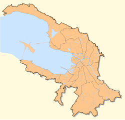
Zelenogorsk, officially known as Terijoki prior to 1948, is a municipal town in Kurortny District of the federal city of St. Petersburg, Russia, located in part of the Karelian Isthmus on the shore of the Gulf of Finland. Population: 14,958 (2010 Census); 12,074 (2002 Census); 13,032 (1989 Census).

Beloostrov, from 1922 to World War II—Krasnoostrov, is a municipal settlement in Kurortny District of the federal city of St. Petersburg, Russia, located on the Sestra River, Karelian Isthmus. Population: 2,080 (2010 Census); 1,690 (2002 Census); 1,405 (1989 Census).

Solnechnoye is a municipal settlement in Kurortny District of the federal city of St. Petersburg, Russia, located on the Karelian Isthmus, on the northern shore of the Gulf of Finland. Population: 1,370 (2010 Census); 1,161 (2002 Census); 1,574 (1989 Census).

Ushkovo is a municipal settlement in Kurortny District of the federal city of St. Petersburg, Russia, located on the Karelian Isthmus, on the northern shore of the Gulf of Finland. Population: 618 (2010 Census); 482 (2002 Census); 6,031 (1989 Census).

Shushary is a municipal settlement in Pushkinsky District of the federal city of St. Petersburg, Russia, located on the slopes of the Pulkovo Heights. Population: 22,652 (2010 Census); 15,843 (2002 Census); 4,789 (1989 Census).

Mikhaylovka is an urban locality in Cheremkhovsky District of Irkutsk Oblast, Russia. Population: 7,827 (2010 Census); 8,148 (2002 Census); 9,381 (1989 Census).

Povarovo is an urban locality in Solnechnogorsky District of Moscow Oblast, Russia, located 30 kilometers (19 mi) from the federal city of Moscow. Population: 7,985 (2010 Census); 7,602 (2002 Census); 9,066 (1989 Census).

Danilovka is an urban locality and the administrative center of Danilovsky District of Volgograd Oblast, Russia. Population: 5,317 (2010 Census); 5,943 (2002 Census); 5,518 (1989 Census).
Rudnogorsk is an urban locality in Nizhneilimsky District of Irkutsk Oblast, Russia. Population: 3,620 (2010 Census); 4,559 (2002 Census); 3,029 (1989 Census).

Sredny is an urban locality in Usolsky District of Irkutsk Oblast, Russia. Population: 5,352 (2010 Census); 5,268 (2002 Census); 6,820 (1989 Census).
Markova is an urban locality in Irkutsky District of Irkutsk Oblast, Russia. Population: 9,894 (2010 Census); 6,509 (2002 Census); 2,569 (1989 Census).
Yuganets is an urban locality in Volodarsky District of Nizhny Novgorod Oblast, Russia. Population: 2,923 (2010 Census); 3,042 (2002 Census); 3,494 (1989 Census).
Podosinovets is an urban locality in Podosinovsky District of Kirov Oblast, Russia. Population: 4,029 (2010 Census); 4,235 (2002 Census); 4,378 (1989 Census).
Svobodny is an urban locality in Bazarno-Karabulaksky District of Saratov Oblast, Russia. Population: 2,160 (2010 Census); 2,292 (2002 Census); 2,309 (1989 Census).
Samoylovka is an urban locality in Samoylovsky District of Saratov Oblast, Russia. Population: 7,580 (2010 Census); 8,648 (2002 Census); 8,460 (1989 Census).
Balyaga is an urban locality in Petrovsk-Zabaykalsky District of Zabaykalsky Krai, Russia. Population: 3,322 (2010 Census); 3,720 (2002 Census); 5,068 (1989 Census).

Novoorlovsk is an urban locality in Aginsky District of Zabaykalsky Krai, Russia. Population: 3,110 (2010 Census); 2,859 (2002 Census); 5,298 (1989 Census).
Orlovsky is an urban locality in Aginsky District of Zabaykalsky Krai, Russia. Population: 2,194 (2010 Census); 2,348 (2002 Census); 3,366 (1989 Census).
Sapozhok is an urban locality in Sapozhkovsky District of Ryazan Oblast, Russia. Population: 3,878 (2010 Census); 4,392 (2002 Census); 5,313 (1989 Census).

Sosva is an urban locality in Serovsky District of Sverdlovsk Oblast, Russia. Population: 9,634 (2010 Census); 10,341 (2002 Census); 10,412 (1989 Census).
 On the bank of the Sestroretsky flood in the Sestroretsky Swamp nature Reserve
 Eco-trail on the Sestroretsk swamp
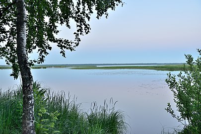 On the shore of the Sestroretsky flood on a White night