Munshi Aziz Bhat Museum of Central Asian and Kargil Trade Artefacts

Last updated

Munshi Aziz Bhat Museum of Central Asian And Kargil Trade Artefacts
Munshi Aziz Bhat Museum of Central Asian and Kargil Trade Artefacts
Established2004
Location Kargil
Coordinates 34°33′43″N76°07′23″E / 34.562°N 76.123°E / 34.562; 76.123
TypePublic Museum
Key holdingsHandwritten Quran, Old Tibetan manuscripts
Collections Hukkah, Silk rugs,Coins Ammunitions
Collection size3500
DirectorGulzar Hussain
CuratorAjaz Hussain
Website kargilmuseum.org

The Munshi Aziz Bhat Museum of Central Asian And Kargil Trade Artefacts [1] [2] [3] [4] is a family-operated, public museum located in the town of Kargil, in the union territory of Ladakh, India. The museum has on display objects that circulated along the trade routes between Ladakh and Yarkand, as well as other are material relics.

Contents

History

The museum has been operational since 2004, owned and maintained by two brothers – Gulzar Hussain Munshi (director) and Ajaz Hussain Munshi (curator) – with assistance from their family members and founding partners International Association for Ladakh Studies. The museum is named after the ancient silk route trader Munshi Aziz Bhat. Objects on display include a variety of artefacts: horse-saddles, tapestries, utensils, coins, old manuscripts and photographs, costumes and jewellery. Though not stated as such, the museum implicitly contributes to the recognition sought for Kargil beyond its current Kashmiri or "Islamic" image in the eye of the common traveler and situates the region in the longue durée of history. The first and only initiative of its kind in the Ladakh region, it is primarily a repository of artifacts associated with the Silk route trade dating back to the 19th century, when Kargil served as a principal trading centre along this passage. Most artefacts displayed in the museum were discovered and retrieved from a rest house Ek Sarai (currently dysfunctional) built in Kargil for traders in 1920 by Munshi Aziz Bhat.

Even though local and international interest in the museum's establishment has grown substantially since its conception, the owners claim to face considerable financial difficulties related to its upkeep and expansion. The brothers intend to eventually relinquish personal ownership of the museum and establish a trust fund. This, they hope, will go a long way in insuring the museum against chronic financial difficulties and generating greater interest amongst academicians and tourists.[ citation needed ]

For the time being, they continue to invest in the project in the hope of developing a comprehensive repository of their cultural heritage, the memory of which they claim has faded quickly in the wake of a markedly altered geo-political scenario that consumes Kargil.

Artefacts

Embroidered Silk from Khotan Period: 17th century Embroided Silk.jpg
Embroidered Silk from Khotan Period: 17th century
Traditional Ladakhi, Mongolian, Tibetan shoes - Local Name: Papu. Period: 17th century Papu mangolia ladakh.jpg
Traditional Ladakhi, Mongolian, Tibetan shoes - Local Name: Papu. Period: 17th century
Jade and Serpentine Crockery - Local Name: Zaharmora from Khotan Period: 17th Century Jade and serpentine.jpg
Jade and Serpentine Crockery - Local Name: Zaharmora from Khotan Period: 17th Century

The museum's collection consists primarily of artefacts unearthed at the rest house (Sarai) built by Munshi Aziz Bhat, as also donations by townsfolk and heirs of erstwhile merchants and royalty. Even though the number of artefacts in the museum's possession has grown steadily over the past eight years – it currently houses over 3500 artefacts including a range of mercantile items associated with trade along the Silk Route – only 1000 are on display due to lack of space.

Some of the choicest artefacts picked for exhibition in Delhi included hookah pipes from Yarkand, rugs from Kashgar, fabrics (dyed and raw silk from Khotan in China), natural dyes, costumes, jewelry, coins, shoes, utensils and ammunition. Apart from these, the museum incorporates mercantile items from the late 19th and early 18th centuries like leather skins, coarse cotton cloth, carpets from Central Asia, British horse seats and saddles, buttons from Italy and items from the factory of the Nizam of Hyderabad.

Recently, the museum has acquired handwritten Qurans and Tibetan manuscripts which the owners claim to be around 600–700 years old. The museum has also gathered important documents and artefacts of the Purkis tribe, a major tribe of the Ladakh region. Kacho Ahmad Khan, the great-grandson of the king of ‘Sot’ Kargil and Kacho Sikander Khan, the descendants of the King of Shar Chiktan recently contributed to the list of artefacts by donating old guns, a small cannon, a sword, wooden bowls, a granite stone pot as well as warrior armor. The owners have also obtained their consent to excavate and explore their ancestral fort in Chiktan to look for more artefacts. Currently, work is underway to comprehensively catalog artefacts in their possession.

Galleries in the museum

Munshi Aziz Bhat and Ek Sarai

Munshi Aziz Bhat Munshi Aziz Bhat.jpg
Munshi Aziz Bhat

Munshi Aziz Bhat was the Maharaja of Kashmir, Hari Singh's official petition writer as well as an affluent tradesman based out of Kargil. He joined the revenue department as a Patawari, but quit his job in 1915 in order to dabble in trading. In August 1915, he partnered with a Punjabi Sikh merchant Sardar Kanth Singh and established a retail cum whole sale shop. In 1920, his partnership with Sardar Kanth Singh ended and he established his own trading business with the help of two sons and a cousin. The enterprise was called "Munshi Aziz Bhat And Sons".

Munshi Aziz Bhat and Sons. Actual Sarai Site in Kargil, Ladakh Munshi Aziz Bhat Sarai.jpg
Munshi Aziz Bhat and Sons. Actual Sarai Site in Kargil, Ladakh

In 1920, he constructed the Ek Sarai, a 100 feet by 110 feet structure for traders traversing the Silk Route. A novel endeavor of its time, it was big enough to accommodate 400-500 caravans. The present owners, grandsons of Munshi Aziz Bhat, claim that the basement had a stable for horses, camels and yaks; the ground floor was meant for goods and the cattle; while the first floor had rooms and a kitchen hall. It served as a hub of trading activities and doubled up as a depot for goods going in all directions including Tibet, India and Baltistan. Owed to the prevalence of the barter system, Ek Sarai acquired some of the pieces currently on display in the museum as means of payment from traders availing its facilities. But in 1948, afflicted by the death of Munshi Aziz Bhat as well as the onset of independence from the British Raj and the subsequent partition of the Indian subcontinent (which effectively nullified trade along the Silk routes), Ek Sarai was closed down.

In 1998, while surveying the site with the intention of building a shopping center, the inheritors of this property chanced upon artifacts that lay forgotten inside for half a century. Collaboration with Dr. Jacqueline H. Fewkes, a researcher from the University of Pennsylvania, persuaded them to recognize the value of their discovery. Eventually, the brothers decided to curate the items discovered and establish a museum in Kargil dedicated to the memory of Ek Tajir, as Munshi Aziz Bhat is respectfully referred to.

Recognition

The museum has emerged as a valuable knowledge bank for historical research and several researchers from Kashmir University, Jammu University as well as the Berlin University have availed its resources. The owners also claim to have a tie-up with the Pitt Rivers Museum at University of Oxford in England. Gulzar, one of the owners, has been invited to international conferences where their work has been lauded. In 2006 he was invited to Rome for a conference hosted by La Spezia University in Italy and has also attended a conference at Aarhus University in Denmark. The founding of the museum is chronicled in a documentary film titled The Culture of Here: Preserving Local history in a Local Museum by Jacqueline H. Fewkes and Abdul Nasir Khan. [3]

Related Research Articles

<span class="mw-page-title-main">Ladakh</span> Region administered by India

Ladakh is a region administered by India as a union territory and constitutes an eastern portion of the larger Kashmir region that has been the subject of a dispute between India and Pakistan since 1947 and India and China since 1959. Ladakh is bordered by the Tibet Autonomous Region to the east, the Indian state of Himachal Pradesh to the south, both the Indian-administered union territory of Jammu and Kashmir and the Pakistan-administered Gilgit-Baltistan to the west, and the southwest corner of Xinjiang across the Karakoram Pass in the far north. It extends from the Siachen Glacier in the Karakoram range to the north to the main Great Himalayas to the south. The eastern end, consisting of the uninhabited Aksai Chin plains, is claimed by the Indian Government as part of Ladakh, and has been under Chinese control since 1962.

<span class="mw-page-title-main">Leh</span> City in Indian-administered Ladakh, Kashmir region

Leh is a city in Indian-administered Ladakh in the disputed Kashmir region. It is the largest city and the joint capital of Ladakh, which is an Indian-administered union territory. Leh, located in the Leh district, was also the historical capital of the Kingdom of Ladakh. The seat of the kingdom, Leh Palace, the former residence of the royal family of Ladakh, was built in the same style and about the same time as the Potala Palace in Tibet. Since they were both constructed in a similar style and at roughly the same time, the Potala Palace in Tibet and Leh Palace, the royal residence, are frequently contrasted. It's crucial to keep in mind, though, that Leh Palace lacks the same grandeur and historical significance as the Potala Palace. Although the assertion regarding the architectural period and timeline is frequently made. Leh is at an altitude of 3,524 m (11,562 ft), and is connected via National Highway 1 to Srinagar in the southwest and to Manali in the south via the Leh-Manali Highway.

<span class="mw-page-title-main">Kargil district</span> District of Indian-administered Ladakh, Kashmir region

Kargil district is a district in Indian-administered Ladakh in the disputed Kashmir-region. It is one of the two districts comprising the Indian-administered union territory of Ladakh. The district headquarters are in the city of Kargil. The district is bounded by the Indian-administered union territory of Jammu and Kashmir to the west, the Pakistani-administered administrative territory of Gilgit–Baltistan to the north, Ladakh's Leh district to the east, and the Indian state of Himachal Pradesh to the south. Encompassing three historical regions known as Purig, Dras and Zanskar, the district lies to the northeast of the Great Himalayas and encompasses the majority of the Zanskar Range. Its population inhabits the river valleys of the Dras, Suru, Wakha Rong, and Zanskar.

<span class="mw-page-title-main">Yarkand River</span> River in the East Turkistan

The Yarkand River is a river in the Xinjiang Uyghur Autonomous Region of western China. It originates in the Siachen Muztagh in a part of the Karakoram range and flows into the Tarim River or Neinejoung River, with which it is sometimes identified. However, in modern times, the Yarkand river drains into the Midstream Reservoir and exhausts its supply without reaching the Tarim river. The Yarkand River is approximately 1,332.25 km (827.82 mi) in length, with an average discharge of 210 m3/s (7,400 cu ft/s).

Khardung La or Khardung Pass is a mountain pass in the Leh district of the Indian union territory of Ladakh.

<span class="mw-page-title-main">Kargil</span> Town in Indian-administered Ladakh, Kashmir region

Kargil or Kargyil is a city in Indian-administered Ladakh in the Kashmir region. It is the joint capital of Ladakh, an Indian-administered union territory. It is also the headquarters of the Kargil district. It is the second-largest city in Ladakh after Leh. Kargil is located 204 kilometres (127 mi) east of Srinagar in Jammu and Kashmir, and 234 kilometres (145 mi) to the west of Leh. It is on the bank of the Suru River near its confluence with the Wakha Rong river, the latter providing the most accessible route to Leh.

<span class="mw-page-title-main">Suru River (Indus)</span> River in India and Pakistan

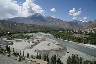
The Suru River is a tributary of the Indus River that flows largely through the Kargil district of Ladakh, India. The Suru Valley is coextensive with the Kargil tehsil, with the town of Kargil situated on its banks. The river enters the Kharmang District of Pakistani-administered Gilgit-Baltistan, coursing a brief length before joining the Indus near Marol.

<span class="mw-page-title-main">Suru Valley</span> Valley in Ladakh, India

The Suru Valley is a valley in the Kargil District in the Union Territory of Ladakh, India. It is drained by the Suru River, a tributary of the Indus River. The valley's most significant town is Sankoo.

<span class="mw-page-title-main">Ladakh Range</span>

The Ladakh Range is a mountain range in central Ladakh in India with its northern tip extending into Baltistan in Pakistan. It lies between the Indus and Shyok river valleys, stretching to 230 miles (370 km). Leh, the capital city of Ladakh, is on the foot of Ladakh Range in the Indus river valley.

<span class="mw-page-title-main">Tourism in Ladakh</span>

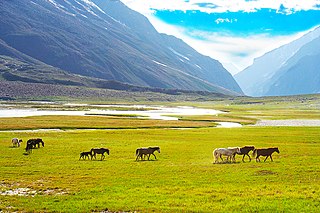
Tourism is one of an economic contributor to the union territory of Ladakh in Northern India. The union territory is sandwiched between the Karakoram mountain range to the north and the Himalayas to the south and is situated at the height of 11,400 ft. Ladakh is composed of the Leh and Kargil districts. The region contains prominent Buddhist sites and has an ecotourism industry.

<span class="mw-page-title-main">Ladakh Buddhist Association</span> 1933 Ladakh-based Indian organization

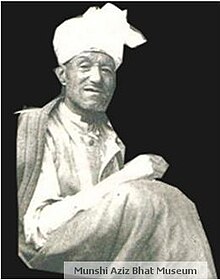
Ladakh Buddhist Association (LBA) is an organization in Ladakh, India concerned with interests of Buddhists in Ladakh. It was founded in 1933 by King Jigmet Dadul Namgyal, Kalon Tsewang Rigzin, lachumir Munshi Sonam Tsewang and Kalon Bankapa Morup Gyaltsan

<span class="mw-page-title-main">Daulat Beg Oldi</span> Military Base in Ladakh, India

Daulat Beg Oldi is a traditional campsite and current military base located in the midst of the Karakoram Range in northern Ladakh, India. It is on the historic trade route between Ladakh and the Tarim Basin, and is the last campsite before the Karakoram Pass. It is said to be named after Sultan Said Khan, who died here on his return journey from an invasion of Ladakh and Kashmir. Chip Chap River, the main headwater of the Shyok River, flows just to the south. The Line of Actual Control with Chinese-controlled Aksai Chin is five miles to the east.

The Mustagh Pass or Muztagh Pass is a mountain pass across the Baltoro Muztagh range in the Karakorams which includes K2, the world's second highest mountain. The crest of the Baltoro Muztagh marks the present border between Pakistani and Chinese territory. Sarpo Laggo Pass is a 6,013-meter (19,728 ft)-high mountain pass at 35.8234°N 76.16249°E near Mustagh Pass.

Shahidulla, also spelt Xaidulla from Mandarin Chinese,, was a nomad camping ground and historical caravan halting place in the Karakash River valley, close to Khotan, in the southwestern part of Xinjiang Autonomous Region, China. The site contains the ruins of a historical fort which was demolished by the Chinese administration of Xinjiang between 1890 and 1892. The site lies next to the Chinese National Highway G219 between Kashgar and Tibet, 25 km east of Mazar and 115 km west of Dahongliutan.

The Depsang Plains, a high-altitude gravelly plain in the northwest portion of the disputed Aksai Chin region of Kashmir, divided into Indian and Chinese administered portions by a Line of Actual Control. India controls the western portion of the plains as part of Ladakh, while the eastern portion is controlled by China and claimed by India. The Line of Control with Pakistan-administered Gilgit-Baltistan is 80 kilometres (50 mi) west of the Depsang Plains with the Siachen Glacier in-between. Ladakh's traditional trade route to Central Asia passed through the Depsang Plains, with the Karakoram Pass lying directly to its north.

<span class="mw-page-title-main">National Highway 1D (India, old numbering)</span> Old numbering of road in India

National Highway 1D, also known as Srinagar-Leh Highway, was a National Highway entirely within the union territory of Jammu and Kashmir and Ladakh in North India that connected Srinagar to Leh in Ladakh. It was one of the only two roads that connected Ladakh with the rest of India, the other being Leh-Manali Highway. The Srinagar-Leh Highway was declared as National Highway in 2006.

<span class="mw-page-title-main">Chorbat Valley</span> Valley in Gilgit-Baltistan & Ladakh, Pakistan & India

Chorbat Valley is a section of the Shyok river valley divided between Pakistan-administered Gilgit-Baltistan and Indian-administered Ladakh. The Pakistan-administered portion is in the Khaplu tehsil of Ghanche District in Gilgit–Baltistan, and the Indian-administered portion is in the Nubra tehsil, Leh district of Ladakh. Chorbat stretches from the edge of Khaplu to the Chalunka village of Nubra.

<span class="mw-page-title-main">National Highway 1 (India)</span> National highway in India

National Highway 1 in India runs between the union territories of Jammu & Kashmir and Ladakh. It comprises parts of old NH1A and NH1D. The number 1 indicates, under the new numbering system, that it is the northernmost East-West highway in India.

<span class="mw-page-title-main">Chang Chenmo River</span> River in China and India

Chang Chenmo River or Changchenmo River is a tributary of the Shyok River, part of the Indus River system. It is at the southern edge of the disputed Aksai Chin region and north of the Pangong Lake basin.

Hunderman or Hundarmaan or Hundurmaan is one of the northernmost hamlets in India and is situated in the Kargil district of Ladakh. Located on the banks of the Suru River 10 km from Kargil, it is a hamlet under Shilikchey village of Kargil district.] It was under Pakistan's control until 1971. Geographically, Hunderman lies in the Baltistan Region. There are two parts of Hunderman: Lower Hunderman Mal and Hunderman Broq.

References

  1. "Munshi Aziz Bhat Museum - Wlobalize". Wlobalize. Retrieved 12 September 2017.
  2. "Munshi Aziz Bhat Museum of Central Asian and Kargil Trade Artifac". waribu.com. Retrieved 12 September 2017.
  3. 1 2 "Munshi Aziz Bhat Museuma treasure trove of Silk Route memorabilia - Scoop News Jammu Kashmir". www.scoopnews.in. Retrieved 12 September 2017.
  4. thierrydamilano (14 August 2013), Munshi Aziz Bhat Museum of Central Asian and Kargil Trade Artifacts, film by Thierry Damilano , retrieved 12 September 2017
  5. "Gallery". Kargilmuseum.org. Retrieved 20 June 2015.