
Canada has a vast geography that occupies much of the continent of North America, sharing a land border with the contiguous United States to the south and the U.S. state of Alaska to the northwest. Canada stretches from the Atlantic Ocean in the east to the Pacific Ocean in the west; to the north lies the Arctic Ocean. Greenland is to the northeast with a shared border on Hans Island. To the southeast Canada shares a maritime boundary with France's overseas collectivity of Saint Pierre and Miquelon, the last vestige of New France. By total area, Canada is the second-largest country in the world, after Russia. By land area alone, however, Canada ranks fourth, the difference being due to it having the world's largest proportion of fresh water lakes. Of Canada's thirteen provinces and territories, only two are landlocked while the other eleven all directly border one of three oceans.

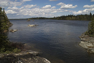
Lake Winnipeg is a very large, relatively shallow 24,514-square-kilometre (9,465 sq mi) lake in North America, in the province of Manitoba, Canada. Its southern end is about 55 kilometres (34 mi) north of the city of Winnipeg. Lake Winnipeg is Canada's sixth-largest freshwater lake and the third-largest freshwater lake contained entirely within Canada, but it is relatively shallow excluding a narrow 36 m (118 ft) deep channel between the northern and southern basins. It is the eleventh-largest freshwater lake on Earth. The lake's east side has pristine boreal forests and rivers that were in 2018 inscribed as Pimachiowin Aki, a UNESCO World Heritage Site. The lake is 416 km (258 mi) from north to south, with remote sandy beaches, large limestone cliffs, and many bat caves in some areas. Manitoba Hydro uses the lake as one of the largest reservoirs in the world. There are many islands, most of them undeveloped.
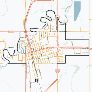
Swan River is a town in Manitoba, Canada. It is surrounded by the Municipality of Swan Valley West in the Swan River Valley region. According to the 2021 Canadian Census, Swan River had a population of 4,049, making it Manitoba's 18th largest in population.
Payuk Lake is a glacial lake located nine kilometres (5.6 mi) southeast of Bakers Narrows, Manitoba, Canada.

The Mistik Creek is a stream in the Hudson Bay drainage basin in the Northern Region of Manitoba, Canada, approximately 20 kilometres (12 mi) northeast of Bakers Narrows.

Holt Lake is a glacial lake that drains into the Kakat Lake, approximately 20 kilometres (12 mi) northeast of Bakers Narrows. As a tributary of Mistik Creek, it is part of the Nelson River watershed, in the Hudson Bay drainage basin in the Northern Region of Manitoba, Canada. The lake sits in Churchill River Upland portion of the Midwestern Canadian Shield forests and is surrounded by mixed forest with stands of black spruce, white spruce, jack pine, and trembling aspen. The shoreline is characterized by steeply sloping irregular rock ridges and poorly drained areas of muskeg.

Thompson Lake is a glacial lake approximately 12 kilometres (7.5 mi) northeast of Bakers Narrows which drains into Murray Lake. It is part of the Nelson River watershed, in the Hudson Bay drainage basin in the Northern Region of Manitoba, Canada. The lakes sits in Churchill River Upland portion of the Midwestern Canadian Shield forests and is surrounded by mixed forest with stands of black spruce, white spruce, jack pine, and trembling aspen. The shoreline is characterized by steeply sloping irregular rock ridges and poorly drained areas of muskeg. The lake contains northern pike, walleye, and yellow perch.
Bryan Lake is a glacial lake approximately 12 kilometres (7.5 mi) northeast of Bakers Narrows which drains into Thompson Lake. It is part of the Nelson River watershed, in the Hudson Bay drainage basin in the Northern Region of Manitoba, Canada. The lakes sits in Churchill River Upland portion of the Midwestern Canadian Shield forests and is surrounded by mixed forest with stands of black spruce, white spruce, jack pine, and trembling aspen. The shoreline is characterized by steeply sloping irregular rock ridges and poorly drained areas of muskeg. The lake contains yellow perch.
Alberts Lake is a glacial lake approximately 17 km (11 mi) north-east of Bakers Narrows which drains into Thompson Lake. It is part of the Nelson River watershed, in the Hudson Bay drainage basin in Northern Manitoba, Canada.
Lynx Lake is a glacial lake approximately 10 kilometres (6.2 mi) southeast of Bakers Narrows which drains into Lake Athapapuskow. It is part of the Nelson River watershed, in the Hudson Bay drainage basin in the Northern Region of Manitoba, Canada. The lakes sits in Churchill River Upland portion of the Midwestern Canadian Shield forests and is surrounded by mixed forest with stands of black spruce, white spruce, jack pine, and trembling aspen. The shoreline is characterized by steeply sloping irregular rock ridges and poorly drained areas of muskeg. The lake contains northern pike.

Vamp Creek is a river in the Hudson Bay drainage basin in the Northern Region of Manitoba, Canada, approximately 25 kilometres (16 mi) north-east of Bakers Narrows.

Leo Lake is a small glacial lake approximately 15 kilometres (9.3 mi) northeast of Bakers Narrows which drains into Thompson Lake. It is part of the Nelson River watershed, in the Hudson Bay drainage basin in the Northern Region of Manitoba, Canada.

Naosap Mud Lake is a small glacial lake approximately 22 kilometres (14 mi) northeast of Bakers Narrows which drains into Naosap Lake. It is part of the Nelson River watershed, in the Hudson Bay drainage basin in the Northern Region of Manitoba, Canada.
Goose River is a river in the Hudson Bay drainage basin in the Northern Region of Manitoba and Division No. 18 in Saskatchewan, Canada, approximately 19 kilometres (12 mi) south-east of Bakers Narrows.
The Pineroot River is a waterway in the Hudson Bay drainage basin in the Northern Region of Manitoba, Canada, approximately 3 km (1.9 mi) north of Bakers Narrows. The river begins at the south end of Mikanagan Lake, continues in a southerly direction over the Mikanagan Falls, to Whitefish Lake then drains in Lake Athapapuskow.

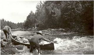
The Grass River is a historically important waterway in the Hudson Bay drainage basin in the Northern Region of Manitoba, Canada. It begins at the Cranberry Lakes approximately 27 kilometres (17 mi) east of Cranberry Portage and runs northeast 500 kilometres (310 mi) to its mouth on the Nelson River. The river was a critical route for earlier European explorers and was part of the "Upper Tract" of the fur trade into Canadian interior.
Birch Island Provincial Park is a remote provincial park located on Lake Winnipegosis in Manitoba, Canada. The park is bordered on its western boundary by the Swan-Pelican Provincial Forest and on its eastern side by Chitek Lake Anishinaabe Provincial Park.
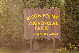
Birch Point Provincial Park is a provincial park located on Buffalo Bay, Lake of the Woods in Manitoba, Canada., about 160 kilometres (99 mi) southeast of Winnipeg. It is 13.1 hectares (0.051 sq mi) in size. It was designated as a Provincial Park in 1961.
Armit Meadows Ecological Reserve is an ecological reserve located in Porcupine Provincial Forest, Manitoba, Canada. It was established in 2015 under the Manitoba Ecological Reserves Act. It is 2.63 square kilometres (1.02 sq mi) in size.
Sturgeon Bay Provincial Park is a provincial park on the western shore of Lake Winnipeg in Manitoba, Canada. The park is considered to be a Class Ib protected area under the IUCN protected area management categories. It is 144.9 km2 (55.9 sq mi) in size.


