Museum Lane

Last updated

View west of Museum Lane from Exhibition Road. The Natural History Museum is on the left and the Science Museum is on the right, connected by a gateway. The lane continues through the gateway. Museum Lane, London.JPG
View west of Museum Lane from Exhibition Road. The Natural History Museum is on the left and the Science Museum is on the right, connected by a gateway. The lane continues through the gateway.
Looking north along Exhibition Road with the Natural History Museum and the Science Museum on the left. The junction with Museum Lane is between these two museums. Exhibition Road - geograph.org.uk - 777399.jpg
Looking north along Exhibition Road with the Natural History Museum and the Science Museum on the left. The junction with Museum Lane is between these two museums.

Museum Lane runs between two of London's leading museums in South Kensington, namely the Science Museum to the north and the Natural History Museum (formerly the Geological Museum) to the south. [1] It runs to the west off Exhibition Road through a gateway connecting the two museums and connects with Queen's Gate. Opposite on Exhibition Road is the Henry Cole Wing of the Victoria and Albert Museum. The Dana Centre is just to the north at the Queen's Gate end.

London Capital of the United Kingdom

London is the capital and largest city of England and the United Kingdom. Standing on the River Thames in the south-east of England, at the head of its 50-mile (80 km) estuary leading to the North Sea, London has been a major settlement for two millennia. Londinium was founded by the Romans. The City of London, London's ancient core − an area of just 1.12 square miles (2.9 km2) and colloquially known as the Square Mile − retains boundaries that follow closely its medieval limits. The City of Westminster is also an Inner London borough holding city status. Greater London is governed by the Mayor of London and the London Assembly.

South Kensington area in the Royal Borough of Kensington and Chelsea and partly in the City of Westminster, London, England

South Kensington is an affluent district of West London in the Royal Borough of Kensington and Chelsea. With some of its easterly areas shared with the City of Westminster, the district is known as a popular tourist destination due to its density of museums and cultural landmarks.

Natural History Museum, London Natural history museum in London

The Natural History Museum in London is a natural history museum that exhibits a vast range of specimens from various segments of natural history. It is one of three major museums on Exhibition Road in South Kensington, the others being the Science Museum and the Victoria and Albert Museum. The Natural History Museum's main frontage, however, is on Cromwell Road.

The lane provided access to the "Exhibition of Science" at the Science Museum in 1951, part of the Festival of Britain. [2] This included exhibits such as Ferranti's Nimrod, an early computer custom-built to play a computer game.

Festival of Britain national exhibition in the United Kingdom, 1951

The Festival of Britain was a national exhibition and fair that reached millions of visitors throughout the United Kingdom in the summer of 1951. Historian Kenneth O. Morgan says the Festival was a "triumphant success" as people:

flocked to the South Bank site, to wander around the Dome of Discovery, gaze at the Skylon, and generally enjoy a festival of national celebration. Up and down the land, lesser festivals enlisted much civic and voluntary enthusiasm. A people curbed by years of total war and half-crushed by austerity and gloom, showed that it had not lost the capacity for enjoying itself....Above all, the Festival made a spectacular setting as a showpiece for the inventiveness and genius of British scientists and technologists.

Ferranti British electrical engineering company

Ferranti or Ferranti International plc was a UK electrical engineering and equipment firm that operated for over a century from 1885 until it went bankrupt in 1993. The company was once a constituent of the FTSE 100 Index.

Nimrod (computer) special purpose computer that played the game of Nim

The Nimrod, built in the United Kingdom by Ferranti for the 1951 Festival of Britain, was an early computer custom-built to play a computer game, one of the first games developed in the early history of video games. The twelve-by-nine-by-five-foot (3.7-by-2.7-by-1.5-metre) computer, designed by John Makepeace Bennett and built by engineer Raymond Stuart-Williams, allowed exhibition attendees to play a game of Nim against an artificial intelligence. The player pressed buttons on a raised panel corresponding with lights on the machine to select their moves, and the Nimrod moved afterward, with its calculations represented by more lights. The speed of the Nimrod's calculations could be slowed down to allow the presenter to demonstrate exactly what the computer was doing, with more lights showing the state of the calculations. The Nimrod was intended to demonstrate Ferranti's computer design and programming skills rather than to entertain, though Festival attendees were more interested in playing the game than the logic behind it. After its initial exhibition in May, the Nimrod was shown for three weeks in October 1951 at the Berlin Industrial Show before being dismantled.

Museum Lane provides disabled access to the Natural History Museum. [3] During the Exhibition Road Music Day there has been a Museum Lane stage as part of the festivities. [4]

The postcode is London SW7 and the lane is within the Royal Borough of Kensington and Chelsea. [5] The nearest London Underground station is South Kensington tube station to the south along Exhibition Road.

Royal Borough of Kensington and Chelsea Royal borough in United Kingdom

The Royal Borough of Kensington and Chelsea (RBKC) is an inner London borough with royal status. It is the smallest borough in London and the second smallest district in England; it is one of the most densely populated administrative regions in the United Kingdom. It includes affluent areas such as Notting Hill, Central Kensington, South Kensington, Chelsea, and Knightsbridge.

London Underground rapid transit system in London, United Kingdom

The London Underground is a public rapid transit system serving London, England and some parts of the adjacent counties of Buckinghamshire, Essex and Hertfordshire in the United Kingdom.

South Kensington tube station London Underground station

South Kensington is a London Underground station in the district of Kensington, south west London. It is served by the District, Circle and Piccadilly lines. On the District and Circle lines, the station is between Gloucester Road and Sloane Square, and on the Piccadilly line, it is between Gloucester Road and Knightsbridge. It is in Travelcard Zone 1. The main station entrance is located at the junction of Old Brompton Road (A3218), Thurloe Place, Harrington Road, Onslow Place and Pelham Street. Subsidiary entrances are located in Exhibition Road giving access by pedestrian tunnel to the Natural History, Science and Victoria and Albert Museums. Also close by are the Royal Albert Hall, Imperial College London, the Royal College of Music, the London branch of the Goethe-Institut and the Ismaili Centre.

See also

Related Research Articles

Kensington District within the Royal Borough of Kensington and Chelsea in central London

Kensington is an affluent district in the Royal Borough of Kensington and Chelsea in the West End of central London.

Science Museum, London science museum in London

The Science Museum is a major museum on Exhibition Road in South Kensington, London. It was founded in 1857 and today is one of the city's major tourist attractions, attracting 3.3 million visitors annually.

Hyde Park, London Royal Park in London, United Kingdom

Hyde Park is a Grade I-listed major park in Central London. It is the largest of four Royal Parks that form a chain from the entrance of Kensington Palace through Kensington Gardens and Hyde Park, via Hyde Park Corner and Green Park past the main entrance to Buckingham Palace. The park is divided by the Serpentine and the Long Water lakes.

Portobello Road street in London

Portobello Road is a street in the Notting Hill district of the Royal Borough of Kensington and Chelsea in west London. It runs almost the length of Notting Hill from south to north, roughly parallel with Ladbroke Grove. On Saturdays it is home to Portobello Road Market, one of London's notable street markets, known for its second-hand clothes and antiques. Every August since 1996, the Portobello Film Festival has been held in locations around Portobello Road.

Cromwell Road road in the Royal Borough of Kensington and Chelsea, London, England

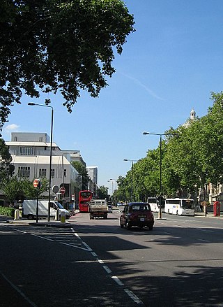
Cromwell Road is a major London road in the Royal Borough of Kensington and Chelsea, designated as part of the A4. It was created in the 19th century and is said to be named after Richard Cromwell, son of Oliver Cromwell, who once owned a house there.

Albertopolis human settlement in United Kingdom

Albertopolis is the nickname given to the area centred on Exhibition Road in London, named after Prince Albert, husband of Queen Victoria. It contains many educational and cultural sites. It is in South Kensington, split between the Royal Borough of Kensington and Chelsea and the City of Westminster, and the area bordered by Cromwell Road to the south and Kensington Road to the north.

Kensington Road section of road in the Royal Borough of Kensington and Chelsea and Westminster, London, England

Kensington Road is a section of road in the Royal Borough of Kensington and Chelsea and Westminster, London, England, forming part of the A315. It runs along the south edge of Kensington Gardens and Hyde Park. To the west it becomes Kensington High Street, to the east it becomes Knightsbridge, while Kensington Gore is the name applied to the middle section. To the north is Kensington Palace and to the south the road is joined by Palace Gate, Queen's Gate, Exhibition Road, and Rutland Gate.

Holland Road, London road in Kensington, London

Holland Road is a road in Kensington, London, England, which connects Kensington High Street with the Holland Park roundabout. The southernmost section is one-way and forms part of the Kensington/Earl's Court one-way system.

Kensington (UK Parliament constituency) Parliamentary constituency in the United Kingdom, 2010 onwards

Kensington is a constituency in Greater London which first existed between 1974 and 1997, and then was recreated in 2010. Since 2017, it has been represented in the House of Commons of the UK Parliament by Emma Dent Coad of the Labour Party.

Gloucester Road, London street in the Royal Borough of Kensington and Chelsea of London

Gloucester Road (B325) is a street in the Royal Borough of Kensington and Chelsea of London. It runs north-south between Kensington Gardens and the Old Brompton Road at the south end. At its intersection with Cromwell Road is Gloucester Road Underground station, close to which there are several pubs, restaurants, many hotels and St Stephen's Church.

Dana Library and Research Centre part of the Science Museum in London

The Dana Library and Research Centre on Queen's Gate, South Kensington, London is part of the Science Museum.

Brompton, London suburb of London, England

Brompton is a historic area of London, formerly in the county of Middlesex. It now lies within the boundaries of the Royal Borough of Kensington and Chelsea, and notionally fans out west and southward from the City of Westminster boundary in Knightsbridge. It encompasses Brompton Square, along Kensington Gore, down Queen's Gate, and along Brompton Road, into South Kensington, then from Walton Street, into the Fulham Road up to its boundary with the London Borough of Hammersmith and Fulham, then back along the Cromwell Road/Queen's Gate through Gloucester Road along the area adjacent to Old Brompton Road. To its north lies the district of Kensington, to its south the district of Chelsea and to the west are the districts of Earl's Court and West Brompton. Its fragmented existence is commemorated chiefly through the names of streets, buildings and a cemetery.

Geological Museum science museum in London, England

The Geological Museum is one of the oldest single science museums in the world and now part of the Natural History Museum in London. It transferred from Jermyn Street to Exhibition Road, South Kensington in 1935 in a building designed by Sir Richard Allison and John Hatton Markham of the Office of Works.

Exhibition Road street in South Kensington, London, England

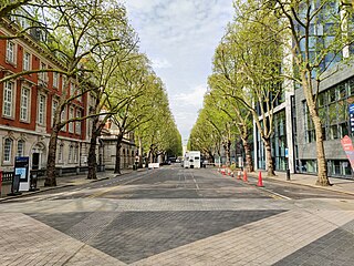
Exhibition Road is a street in South Kensington, London which is home to several major museums and academic establishments, including the Victoria and Albert Museum, the Science Museum and the Natural History Museum.

Queens Gate street in South Kensington, London, England

Queen's Gate is a street in South Kensington, London, England. It runs south from the Kensington Gardens Queen's Gate in Kensington Road, intersects with Cromwell Road, and then on to Old Brompton Road.

Prince Consort Road Street in the City of Westminster

Prince Consort Road is a street in London, United Kingdom. It is named after Prince Albert, consort to Queen Victoria. It is located between Queen's Gate to the west and Exhibition Road to the east, running parallel to Kensington Gore.

Imperial College Road Street in the City of Westminster and the Royal Borough of Kensington and Chelsea

Imperial College Road is a tree-lined road in South Kensington, London, England. It runs east–west with Queen's Gate to the west and Exhibition Road to the east.

Queens Gate Terrace Street in the Royal Borough of Kensington and Chelsea‎

Queen's Gate Terrace is a street in Kensington, London, in the Royal Borough of Kensington and Chelsea, home to several embassies. The street runs west to east from Gloucester Road to Queen's Gate.

Drayton Gardens residential street in South Kensington/Chelsea, London SW10

Drayton Gardens is a residential street in South Kensington/Chelsea, London SW10. It runs roughly north to south from Old Brompton Road to Fulham Road.

References

  1. MobileReference (2010). London Sights: A Travel Guide to the Top 60 Attractions in London, England, UK. MobileReference.com. p. 358. ISBN   978-1607789314.
  2. Rooney, David. "A visit in 1951: The 'Exhibition of Science' in the Centre Block". In Morris, Peter J. T. (ed.). Science for the Nation: Perspectives on the History of the Science Museum. Palgrave Macmillan. pp. 163–167. ISBN   978-1349311194.
  3. "Museum entrances". Natural History Museum, London . Retrieved 25 May 2014.
  4. "Museum Lane stage". exhibitionroadmusicday.org. Archive.org. Archived from the original on 13 June 2008. Retrieved 25 May 2014.
  5. "Museum Lane". www.streetlist.co.uk. UK: Streetlist. Retrieved 25 May 2014.

Coordinates: 51°29′50″N0°10′27″W / 51.4971°N 0.1743°W / 51.4971; -0.1743

Geographic coordinate system Coordinate system

A geographic coordinate system is a coordinate system that enables every location on Earth to be specified by a set of numbers, letters or symbols. The coordinates are often chosen such that one of the numbers represents a vertical position and two or three of the numbers represent a horizontal position; alternatively, a geographic position may be expressed in a combined three-dimensional Cartesian vector. A common choice of coordinates is latitude, longitude and elevation. To specify a location on a plane requires a map projection.