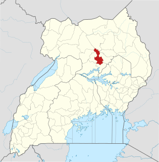
Pader District is a district in Northern Uganda. It is named after Pader, the chief municipal, administrative and commercial town in the district, where the district headquarters are located.
Lira District is a district in Northern Uganda. Like many other Ugandan districts, it is named after its 'chief town', Lira.

Apac is a town in Apac District, Northern Uganda. It is the 'chief town' of the district and the district headquarters are located there. The district is named after the town.

Kitgum is a municipality in Kitgum District in the Northern Region of Uganda. The town is administered by Kitgum Town Council, an urban local government. It is the largest metropolitan area in the district and the site of the district headquarters.

Amolatar District is a district in Northern Uganda. Like many other Ugandan districts, it is named after its main municipal and administrative centre, Amolatar Town.
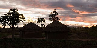
Pader is a town in Pader District in the Northern Region of Uganda. The town is administered by the Pader Town Council, an urban local government. It is the largest metropolitan area in the district and the site of the district headquarters.
Dokolo is a town in the Northern Region of Uganda. It is the main municipal, administrative, and commercial centre of Dokolo District.
Aduku is a town in, Kwinia District following the curving out of Kwania from Apac District in northern Uganda. It Head Quarter location of Kwania District.
Masindi Port is a town in Uganda.
Agago is a town in the Northern Region of Uganda. It is the chief political, administrative, and commercial center of the Agago District.

Otuke District is a district in Northern Uganda. Like most other Ugandan districts, it is named after its 'chief town', Otuke, where the district headquarters are located.
Kalongo is a town in the Northern Region of Uganda. It is one of the urban centers in Agago District.
The Acholibur–Gulu–Olwiyo Road is a road in the Northern Region of Uganda, connecting the town of Acholibur to the city of Gulu and the town of Olwiyo.
Rwekunye–Apac–Aduku–Lira–Kitgum–Musingo Road is a road in the Northern Region of Uganda, connecting the towns of Masindi Port in Kiryandongo District to Apac in Apac District, Lira in Lira District, Acholibur in Pader District, Kitgum in Kitgum District, and Musingo in Lamwo District at the international border with South Sudan.
Acholibur is a town in Pader District in the Northern Region of Uganda.
Rwekunye is a settlement in Kiryandongo District in the Western Region of Uganda.
Karuma is a settlement in the Western Region of Uganda.
Letshego Microfinance Uganda,, whose official name is Letshego Uganda Limited, is a Tier IV microfinance institution in Uganda.
Achwa 2 Hydroelectric Power Station is a 42 megawatts (56,000 hp) hydroelectric power plant, in Uganda.
The Kampala–Gulu Highway, also Kampala–Gulu Road, is a road connecting the capital city of Kampala, in the Buganda Region, with the city of Gulu, the largest urban centre in the Northern Region of Uganda.

