
Nellore is a city located on the banks of Penna River, in Nellore district of the Indian state of Andhra Pradesh. It serves as the headquarters of the district, as well as Nellore mandal and Nellore revenue division. It is the fourth most populous city in the state. It is at a distance of 279 kilometres (173 mi) from Vijayawada and about 170 km (110 mi) north of Chennai, Tamil Nadu and also about 380 km (240 mi) east-northeast of Bangalore, Karnataka.

Coastal Andhra or Kosta Andhra is a geographic region in the Indian state of Andhra Pradesh. Vijayawada is the largest city in this region. Region share borders with Uttarandhra, Rayalaseema and Telangana. It was part of Madras State before 1953 and Andhra State from 1953 to 1956. According to the 2011 census, it has an area of 91,915 square kilometres (35,489 sq mi) which is 57.99% of the total state area and a population of 34,193,868 which is 69.20% of Andhra Pradesh state population. This area includes the coastal districts of Andhra Pradesh on the Circar Coast between the Eastern Ghats and the Bay of Bengal, from the northern border with Odisha to Rayalaseema in the south.
Sullurupeta is a town in Tirupati district of Andhra Pradesh, India. It is a municipality and the headquarters of Sullurpeta mandal and Sullurupeta revenue division. It serves as a gateway to Satish Dhawan Space Centre(SDSC) at Sriharikota.

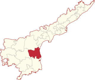
Nellore district, officially known as Sri Potti Sriramulu Nellore district in Coastal Andhra Region, is one of the 26 districts in the Indian state of Andhra Pradesh. According to the 2011 Census, the district's population was 2,469,712 of which 29.07% was urban. Its administrative headquarters are located in Nellore city. Located in the Coastal Andhra region, the district is bordered by the Bay of Bengal to the east, Kadapa district and Annamayya district to the west, Prakasam district to the north, and Tirupati district to the south.

Prakasamdistrict is one of the twelve districts in the coastal Andhra region of the Indian state of Andhra Pradesh. It was formed in 1970 and reorganised on 4 April 2022. The headquarters of the district is Ongole. It is located on the western shore of Bay of Bengal and is bounded by Bapatla district and Palnadu districts in the north, Nandyal district in the west, Kadapa and Nellore districts in the south. A part of north west region also borders with Nagarkurnool district of Telangana. It is the largest district in the state with an area of 14,322 km2 (5,530 sq mi) and had a population of 22,88,026 as per 2011 Census of India.

Kovur is a village in Nellore district of the Indian state of Andhra Pradesh. The village is also the headquarters of the Kovur Mandal and Assembly Constituency. It is located in Kovur mandal of Nellore revenue division. It forms a part of Nellore Urban Development Authority. The poet "Thikkanna" was born in this place.
Nellore Lok Sabha constituency is one of the twenty-five lok sabha constituencies of Andhra Pradesh in India. It comprises seven assembly segments and belongs to Nellore district.
Indukurupeta is a village and a mandal in Nellore district in the state of Andhra Pradesh in India. It is located in Kovur.

Andhra Pradesh is a state in India. Andhra Pradesh Tourism Development Corporation (APTDC) is a state government agency which promotes tourism in Andhra Pradesh, describing the state as the Koh-i-Noor of India. Andhra Pradesh has a variety of tourist attractions including beaches, hills, caves, wildlife, forests and temples.

Vikrama Simhapuri University (VSU) is a public state university in the Nellore district of the Indian state of Andhra Pradesh. It was established in 2008. It offers 17 post-graduate courses.

The Yuvajana Sramika Rythu Congress Party is an Indian regional political party based in the state of Andhra Pradesh. Its president, Y. S. Jagan Mohan Reddy, serves as the state's chief minister. It is currently the fifth largest party in the Lok Sabha with 22 seats.
Nellore Airport is a proposed greenfield airport project near Dagadarthi, India, intended to serve the Nellore district in Andhra Pradesh. The airport is to be developed on 1,352 acres (5.47 km2) of land with an estimated cost of ₹368 crore.

Mypadu Beach is located on the East coast of Bay of Bengal, at a distance of 25 km (16 mi) from SPSR Nellore district in Andhra Pradesh. The beach is maintained by the state tourism board, APTDC. The beach provides fishing opportunities for the local fishermen, and access to cruises for the tourists. The Andhra Pradesh Tourism Development Corporation (APTDC), is taking certain measures to promote Mypadu Beach as a tourist destination by setting up recreational activities such as water sports and development of resorts.

The state of Andhra Pradesh has a coastline of 970 km2 (370 sq mi) and hence, there exist many beaches. The seacoast extends along the Bay of Bengal from Srikakulam district to Nellore district.

The coastline of Andhra Pradesh is located on the southeastern coast of the Indian Peninsula in the Bay of Bengal and is part of the Northern Circars. With a length of 975 km, it has the second longest coastline in India after Gujarat. The coastal corridor boasts several ports, harbors, vast stretches of sandy beaches, wildlife and bird sanctuaries, as well as fresh water lakes and estuaries.
State Highway 57 (Andhra Pradesh) is a state highway in the Indian state of Andhra Pradesh. It starts at Nellore and ends at Mypadu. The route from Badvel to Nellore was upgraded to NH 67.
Chillakur mandal is one of the 34 mandals in Tirupati district in the Indian state of Andhra Pradesh. It is a part of Gudur revenue division and is headquartered at Chillakur.

