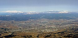
Fukushima is the capital city of Fukushima Prefecture, Japan. It is located in the northern part of the Nakadōri, central region of the prefecture. As of 1 April 2017, the city has an estimated population of 280,002 in 122,130 households and a population density of 390 persons per km². The total area of the city was 767.72 square kilometres (296.42 sq mi).

Ie is a village located in Kunigami District, Okinawa Prefecture, Japan. The village lies on the island of Iejima.

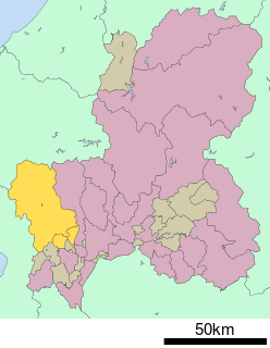
Hashima is a district located in Gifu Prefecture, Japan.

Yōrō is a district located in Gifu Prefecture, Japan.
Fuwa is a district located in Gifu Prefecture, Japan.
Anpachi District is a district located in Gifu Prefecture, Japan.
Ibi District is a district located in Gifu Prefecture, Japan. As of July 2011, the district has an estimated population of 72,109. The total area is 876.65 km².

Motosu District is a district located in Gifu Prefecture, Japan.

Kamo is a district located in Gifu Prefecture, Japan. As of July, 2011 the district has an estimated population of 52,536. The total area is 615.17 km².
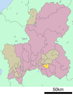
Kani is a district located in Gifu Prefecture, Japan. As of July 2011, the district has an estimated population of 18,709. The total area is 56.61 km².

Ōno is a district located in Gifu Prefecture, Japan.

Ōkuma is a town located in Fukushima Prefecture, Japan. In 2010, the town had a population of 11,515. However, the town was totally evacuated in the aftermath of the Fukushima Daiichi nuclear disaster and residents have been permitted return during daylight hours from May 2013. As of November 2016, the town had an official registered population of 10,700, however this number is due to the municipality continuing to keep track of its residents despite them having been evacuated elsewhere throughout the country. The total area is 78.71 square kilometres (30.39 sq mi).

Fukushima Prefectural Asaka High School, abbreviated as Anko, is the regionally prestigious prefectural high school in Koriyama city, Fukushima, Japan. It was founded on September 11, 1884, originally as Fukushima Junior High School. After being renamed Asaka Junior High School in 1948, it was changed into a high school due to the restructure of the Japanese education system on April 1, 1948.

Hamadōri (浜通り) is the easternmost of the three regions of Fukushima Prefecture, Japan, the other two being Nakadōri in the central area of the prefecture and Aizu in the west. Hamadōri is bordered by the Abukuma Highlands to the west and the Pacific Ocean to the east.

Fukushima Prefectural Museum of Art is a museum located in Fukushima City.

The Fukushima Prefectural Culture Center is a large multipurpose public cultural facility in the city of Fukushima, Japan, which opened in September 1970.
The Fukushima at-large district is a constituency that represents Fukushima Prefecture in the House of Councillors in the Diet of Japan. It currently has three Councillors in the 242-member house.