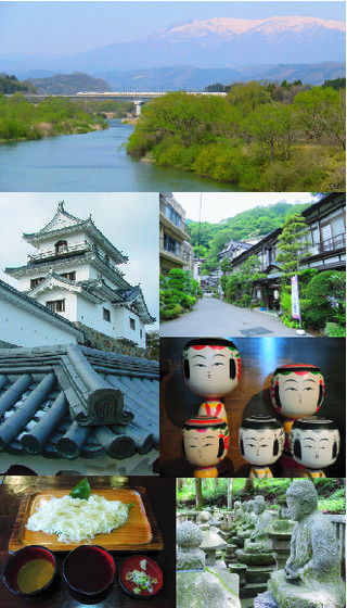
Shiroishi is a city in Miyagi Prefecture, Japan. As of 31 May 2020, the city had an estimated population of 33,330 and a population density of 120 persons per km2 in 14,242 households. The total area of the city is 286.48 square kilometres (110.61 sq mi).

Sukagawa is a city located in Fukushima Prefecture, Japan. As of 1 May 2018, the city had an estimated population of 76,251 in 38824 households, and a population density of 270 persons per km2. The total area of the city was 279.43 square kilometres (107.9 sq mi).

Sōma is a city located in Fukushima Prefecture, Japan. As of 29 February 2020, the city had an estimated population of 34,631, and a population density of 180 persons per km2 in 14,358 households. The total area of the city is 197.79 square kilometres (76.37 sq mi).

Koori is a town located in Fukushima Prefecture, Japan. As of 1 April 2020, the town had an estimated population of 11,679 in 4599 households, and a population density of 270 persons per km2. The total area the town was 42.97 square kilometres (16.59 sq mi).
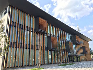
Kunimi is a town located in Fukushima Prefecture, Japan. As of 1 January 2020, the town had an estimated population of 8843 and a population density of 250 persons per km². The total area of the town was 37.90 square kilometres (14.63 sq mi).

Ten-ei is a village located in Fukushima Prefecture, Japan. As of 1 January 2020, the village had an estimated population of 5,258 in 1717 households, and a population density of 23 persons per km2. The total area of the village was 225.52 square kilometres (87.07 sq mi).

Inawashiro is a town located in Fukushima Prefecture, Japan. As of 1 March 2020, the town had an estimated population of 13,810 in 5309 households, and a population density of 35 persons per km2. The total area of the town was 394.85 square kilometres (152.45 sq mi). It is noted as the birthplace of the famous doctor Hideyo Noguchi, who contributed to knowledge in the fight against syphilis and yellow fever.

Nishigō is a village located in Fukushima Prefecture, Japan. As of 1 March 2020, the village had an estimated population of 20,351 in 7618 households and a population density of 110 persons per km2. The total area of the village was 192.06 square kilometres (74.15 sq mi)..

Izumizaki is a village located in Fukushima Prefecture, Japan. As of 1 March 2020, the village had an estimated population of 6,265 in 2179 households, and a population density of 180 persons per km². The total area of the village was 35.43 square kilometres (13.68 sq mi).

Yabuki is a town located in Fukushima Prefecture, Japan. As of 1 February 2020, the town had an estimated population of 16,955 in 6051 households, and a population density of 280 persons per km². The total area of the town was 60.4 square kilometres (23.3 sq mi).

Ishikawa is a town located in Fukushima Prefecture, Japan. As of 21 March 2018, the town had an estimated population of 15,511 in 5690 households, and a population density of 130 persons per km2. The total area of the town was 115.71 square kilometres (44.7 sq mi).

Tamakawa is a village located in Fukushima Prefecture, Japan. As of 1 March 2020, the village had an estimated population of 6,497 in 2143 households, and a population density of 140 per km². The total area of the village was 46.67 square kilometres (18.02 sq mi).

Asakawa is a town located in Fukushima Prefecture, Japan. As of 1 March 2020, the town had an estimated population of 6,036 across 2,070 households, and a population density of 170 persons per km2. The total area of the town was 37.43 square kilometres (14.45 sq mi).

Katsurao is a village located in Fukushima Prefecture, Japan. As of 1 April 2020, the village had an official registered population of 1,387 in 475 households, and a population density of 16 inhabitants per square kilometre (41/sq mi). The total area of the village is 84.37 square kilometres (32.58 sq mi). However, in March 2011, the entire population was evacuated as a result of the Fukushima Daiichi nuclear disaster. The evacuation order was lifted on June 12, 2016 for much of the village; however, the actual number of residents who returned is considerably less than the official population numbers.

Shinchi is a town located in Fukushima Prefecture, Japan. As of 1 February 2020, the town has an estimated population of 8,152, and a population density of 170 inhabitants per square kilometre (440/sq mi) in 2832 households. The total area is 46.70 square kilometres (18.03 sq mi).
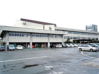
Takahata is a town located in Yamagata Prefecture, Japan. As of 1 April 2019, the town had an estimated population of 23,367, in 7629 households, and a population density of 130 persons per km2. The total area of the town is 180.26 square kilometres (70 sq mi).
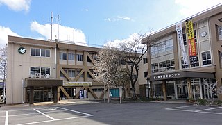
Shichikashuku is a town located in Katta District, Miyagi Prefecture, Japan. As of 1 June 2020, the town had an estimated population of 1,323, and a population density of 5.0 persons per km2 in 626 households. The total area of the town is 263.09 square kilometres (101.58 sq mi).
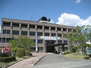
Marumori is a town located in Miyagi Prefecture, Japan. As of 1 June 2020, the town had an estimated population of 13,092, and a population density of 48 persons per km2 in 5,050 households. The total area of the town is 273.30 square kilometres (105.52 sq mi).

Yamamoto is a town located in Miyagi Prefecture, Japan. As of 31 May 2020, the town had an estimated population of 12,100, and a population density of 190 persons per km2 in 4794 households. The total area of the town is 64.58 square kilometres (24.93 sq mi).
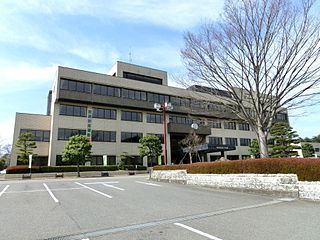
Nasushiobara is a city located in Tochigi Prefecture, Japan. As of 1 August 2020, the city had an estimated population of 115,794 in 48,437 households, and a population density of 67 persons per km². The total area of the city is 592.74 square kilometres (228.86 sq mi).


